A foray to North Somerset

30th December: with Tav and Alex.

Our first destination was to the location of Tickenham Rock Shelter, unfortunately this turned out to be more difficult than anticipated. Tav wanted to check the co-ords and description for the MCRA, Alex was interested in a possible glacial origin, and there was an archaeological interest for me, including Cadbury Camp.

The current MCRA grid ref. is wrong and we spent quite a bit of time wandering about. Eventually I googled ‘Rock Shelter’ and found a property of that name in the right location, unfortunately the owners were out, so this will have to wait for another day.

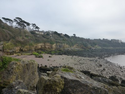
Next destination was the Clevedon estuary shoreline. First to Margarent’s Bay to look at the carvings in Babyface Cave, the cave is really a gap in amongst some large blocks of conglomerate.

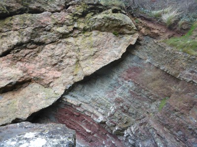
There is also some good geological features around here, including an unconformity between Triassic conglomerate and Devonian sandstones.

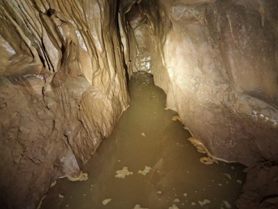
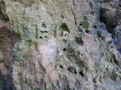
Then along to Ladye Bay to peer into the cave sites there, more great geology and we noted some more possible carvings of uncertain date close to a small cave.

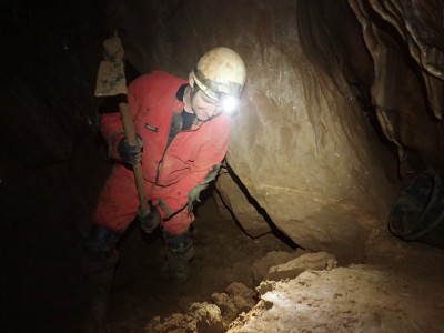
As time was running short Tav decided to give Swiss Valley a miss today and so, our final excursion was to check out a couple of sites on Strawberry Hill, Clevedon. We, quickly located the first target, recording was completed and we moved on to the next.

After a good deal of scrambling we located the second site, then proceeded to check out the rock exposures along the top of a steep and precarious hill slope. When this had been achieved we returned to the car.

An enjoyable day out in North Somerset done we returned home, and we didn’t go to the pub!

Wookey Hole, Mendip

29th December 2016: with Nick, Tav and Duncan.

A steady trip up through Chamber 20, stopping for a while to point out the entry to ‘Attila the Hun’s Sardine Cannery’ to DP so that he can add it to his survey at a later date.

At the dig, it was rather disappointing to find that it was full of water again. I can’t remember when it rained but Tav seemed sure it was around the 23rd. On the way out we noted that the pool in the chamber was deeper and a trickle of water was coming from the solutional slot in the roof, filling the small side tube that was overflowing and trickling into the pool.

Hopefully, the weather will remain dry and the water will drain away so that we can resume digging next week.

Wookey Hole, Mendip

15th December 2016: with Nick.

Just the two of us this evening.

A steady jaunt to the end of Chamber 20 where we continued the construction of the stepped wall. First lowering the sediment, then I collected rocks for Nick to build up the wall.

By the end of the session the retaining wall was just about completed, now we are ready to resume digging.

Wookey Hole, Mendip

13th December 2016: with Nick and Tav.

The dig at the end of Chamber 20 has dried up, it’s a bit claggy on the top but underneath it is relatively dry, at least it was where we reduced the level for the drystone wall. Nick decided to roll some rather large boulders down the slope for use in the next stepped wall and some of them took quite a lot of effort to position. It was very warm work indeed.

We plan to return on Thursday evening to continue the project.

Wookey Hole, Mendip

8th December: with Roz, Nick and Tav.

At the dig the water has all but receded, just a small puddle and some slop remain. We began the task of cleating spoil so that a retaining wall can be built to try and prevent any further slumping in should the dig flood in the future.

The plan is to build a series of stepped dry stone walls as we dig deeper, first of all though we will consolidate the depth we have already gained. A number of large rocks, and some medium sized ones, were moved into location and by the end of the session the first stage was almost completed.

As ever it was warm and thirsty work and soon time for some refreshment.

Wookey Hole, Mendip

1st December: with Tav and Nick.

The plan was to go up and check the water level in the dig at the top of Chamber 20 and then to search for Rob Harper’s passage.

The dig is still flooded, although the water has been much deeper it is at the level noted by Jake and myself a fortnight ago. There is not any sign of water flowing in so it may be receding slowly. There has been some slumping of material into the dig.

We went then, in search of Rob’s passage and after some rummaging around looking at, other potential leads we located the passage. A low, wide phreatic arch requiring some flat out crawling through puddles, strewn with boulders, plenty of calcification and some small formations, about 20m in length. We need to see a survey to see where it’s heading and then decide if it is a viable dig. A pleasant evenings stroll around though!

Pole photography

Roman building in Salisbury, Wiltshire. Image taken using Olympus TG_4 and Samsung Galaxy smartphone, Wi-Fi connection utilising Olympus Share App; camera mounted on a 12 metre telescopic pole. The building is north/south aligned through long axis, north is top left (image above) and bottom right (image below). Scales are 2m and 1m.

Wookey Hole, Mendip

17th November 2016: with Jake.

With hindsight, perhaps it shouldn’t have come with too much of a surprise to find the dig under a considerable depth of water. We didn’t really think there had been that much rain lately, but we knew that this area had flooded before.

There had been plenty of signs along the way to the dig, where there were drips before now was a trickle, it was noisier, the cascade was once again rippling with the flow of water, and a pool of water with a stream had appeared in the chamber just before the dig, the result of an overflow of water from a tiny flooded side passage.

As I approached the dig I could see the water, it’s probably 1.5m deep and there’s a small stream flowing in being fed, we suspect, by the tiny overflowing side passage previously mentioned.

We collected the tools together and stashed them up in the higher chamber. We will return when it dries up sometime in the future. Meanwhile we will have to find somewhere drier to dig!

Wookey Hole, Mendip

10th November 2016: with Nick, Tav and Jake.

The bears are back – Ursus fibra glassicus!

Putting our excitement aside we had a steady jaunt up to the dig. Arrived quite warm and straight into digging so no chance to cool down. Nick was clearing back the skips as I filled them, Tav and Jake hauling and dumping. When I had suitably overheated I swapped places with Nick until he too, overheated, we swapped places with Tav and Jake. Dug out lots of sediment and at 21:20 we left for the pub!

Wookey Hole, Mendip

3rd November 2016: with Jake, Tav and Nick. Duncan P. went to DW to check his dig there.

The ‘top of 20’ team had another warm trip up to the dig. Tav and Nick began the proceedings, Jake and Vince hauling and dumping the spoil. When Tav and Nick overheated we swapped roles.

It’s a big hole filled with silt and sand and it isn’t clear why there are no rocks as there are plenty on the approach and on both sides, perhaps they are lower down. There is some interesting banding ranging through yellow and red with alternating thinner bands of yellow and brown, probably signifying past flooding/filling events.

When we were all suitably warmed and thirsty we exited the cave and finished the evening at the usual local hostelry to discuss the dig and other plans ahead.

Wookey Hole, Mendip

25th October: with Jake, Nick, Tav and Duncan P.

All went in through the ‘adventure caving route’ near the main entrance where I stayed behind to take some photographs, the rest of the team went on up to the dig at the top of 20.

After taking the photographs I then headed into 20 to join up with the others. I was distracted along the way and stopped to take even more photographs.

Then I got sidetracked by a passage that I thought might by-pass the climb, it didn’t, and I was glad to get back out as it was rather too snug in places and I was not convinced it was entirely stable among the rocks.

Eventually arrived at the dig and joined in with the team shifting spoil back and dumping it in various gaps in the floor of the chamber.

All too soon it was time to depart the dig and we made our way out of the cave exiting by the more traditional route along the tunnel.

Brent Knoll, Somerset

Driving down the A38 to Burnham on Sea you can’t miss the prominent feature of Brent Knoll sitting atop a Lias inlier (c.139m AOD) standing out from the surrounding levels.

The Iron Age hill fort has produced evidence for Roman occupation to the 4th century. Enclosing an area c.1.6 hectares it has an inner bank with a second major bank just down the hillside. The original entrance was to the east, the west and south has been artificially shaped by terracing possibly during the Medieval period.

The interior has been damaged by extensive quarrying for the Lias limestone lowering the interior by at least 2 metres. The outer defences to the north have been used for military purposes in recent times.

From the top there are extensive views of the Mendip Hills, the Poldens, and across the Severn estuary to Wales and the Somerset Levels. There would also have been views of the now lost River Siger to the south.

Reference: Adkins, L and R. 1992. A Field Guide to Somerset Archaeology. The Dovecote Press Ltd. Wimborne, Dorset.