In the past, forestry operations in Harptree Woods, Mendip channelled surface water into naturally occurring sinkholes. The drainage for these sinks is localised and there are several springs along the flank of Garrow Bottom, including Garrowpipe Spring, where the water re-emerges to flow into Molly Brook.
I had a tentative poke into this sink several years ago but gave up due to the instability of the small chamber gained. It has since slumped and filled in with debris.
Some brief notes on the similarities of the rock-types of Pool Farm cist-slab, Hautville’s Quoit, Somerset, and Sarsen Stones at Fyfield Down, Wiltshire.
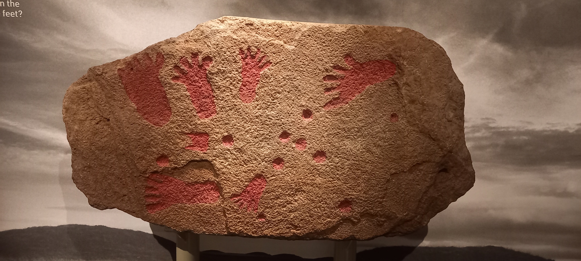
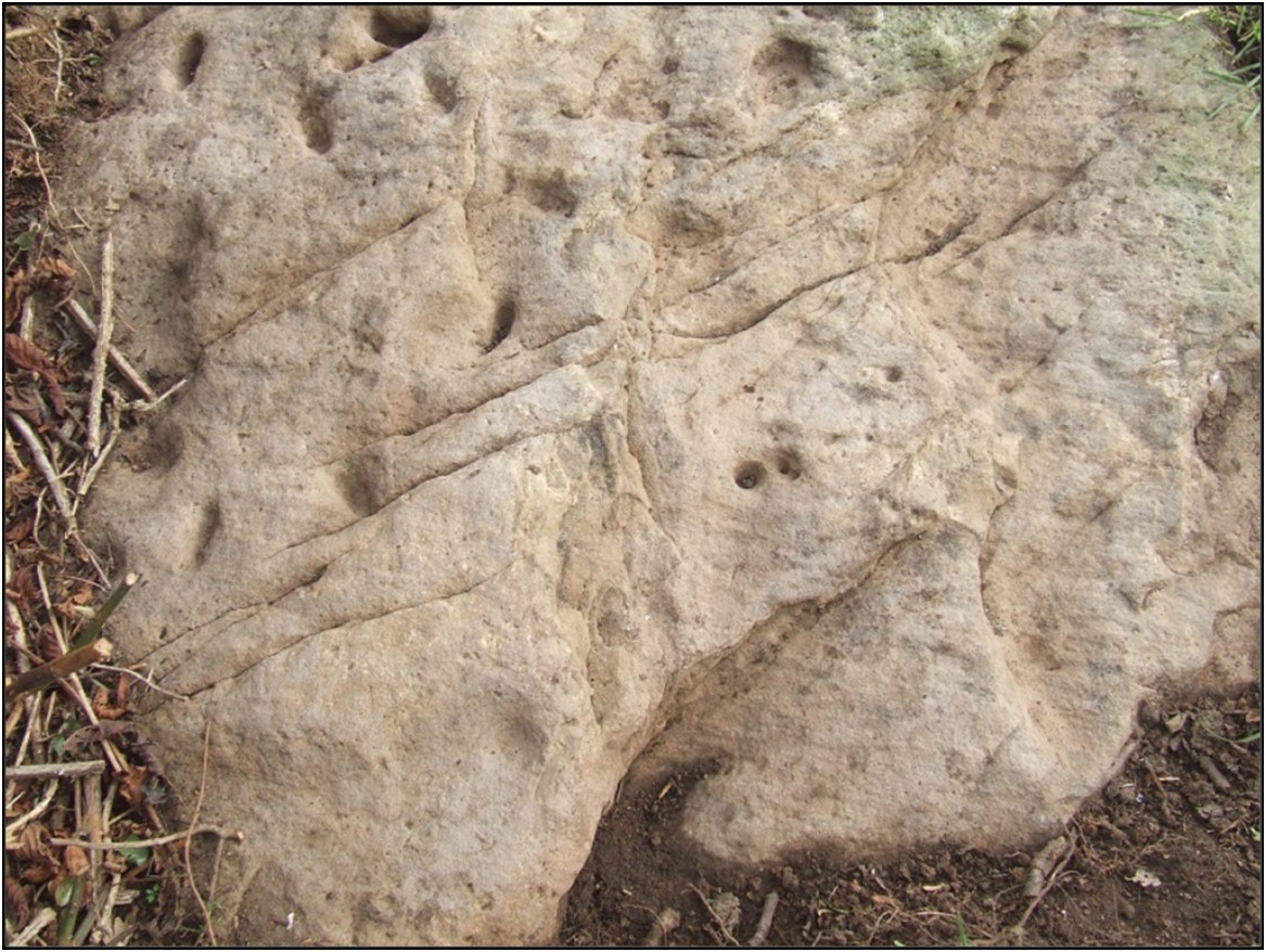
On a recent visit to Bristol Museum to view an exhibition – The Cave Art of Lascaux: A Virtual Reality Experience, I took some time to examine the Pool Farm cist-slab on display in the “Curiosities” section.
In 1930 a round barrow was excavated at Pool Farm, West Harptree, Somerset (NGR ST 5375, 5417). At the centre of the barrow a stone cist was discovered. The cist was constructed from several slabs comprising Dolomitic Conglomerate, Carboniferous Limestone, Liassic Chert, and sandstone. In 1931, the barrow was removed, and the material used for road-widening, the cist was left in-situ (Grinsell, 1958). The ‘carvings’ on the Pool Farm cist slab were recognised in May 1956 when the slab was removed to the City of Bristol Museum where it still remains. A replica of the slab is on display at Wells and Mendip Museum.
Pool Farm cist-slab on display at Bristol Museum
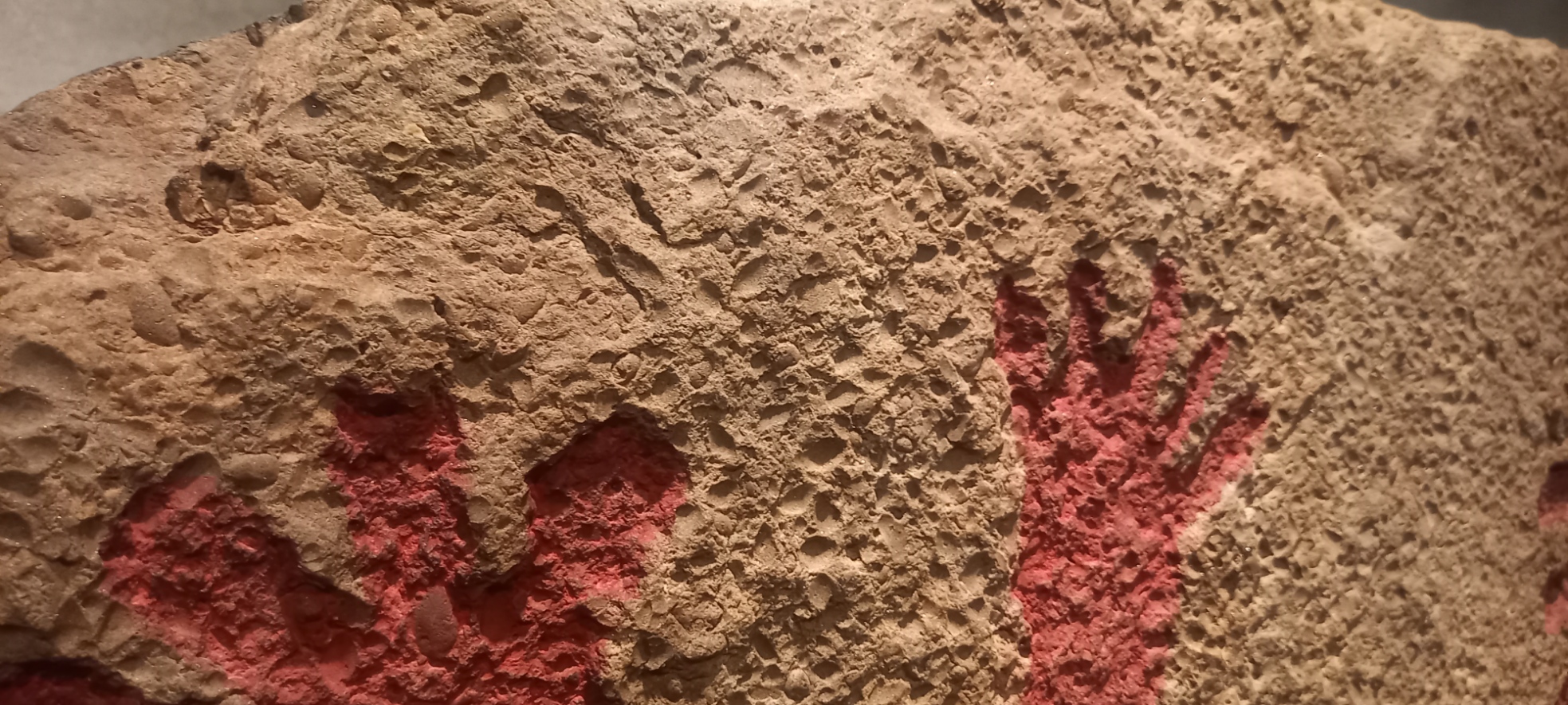
In Grinsell (1958) the cist slab rock type is described as “…a fine-grained pinkish sandstone containing numerous lamellibranchs”. Lamellibranchia (and Pelecypoda) are alternative names for Class Bivalvia, Phylum Mollusca. The bivalves are distinguished from other molluscs by their laterally compressed body enclosed between two bilaterally symmetrical, calcareous valves which are joined on the dorsal side by an elastic horny ligament. The bivalves are entirely aquatic, found in both marine and freshwater environments, the majority in shallow water. The fossil record of the Mollusca dates from the earliest Cambrian to Recent. Modern examples of bivalves include clams, cockles, mussels, and oysters (Black, 1988). A later description by Roger Clark, [then] Curator of Geology, at Bristol City Museum presented in Coles, et al (2000) reports “that thestone is almost certainly from the Harptree Beds, which consist of siliceous limestones and calcareous shelly limestones: these outcropon the northern slope of the Mendip Plateau between East Harptree and Oakhill. The slab has abundant traces of decalcified bivalve molluscs, mostly corbulids and/or nuculids. The stone is local, perhaps coming from within a kilometre or so of the barrow”.Nucula is a Mesozoic bivalve living an a richly organic substrate from offshore to abyssal depths. Date ranging from Cretaceous to Recent (Black, 1988).
Personally, I do not agree with Clark’s assignment of the rock-type as originating from the local Harptree Beds. The rock-type of the cist-slab bears some remarkable similarities to that of Hautville’s Quoit at Stanton Drew, where a detailed archaeological investigation of the scheduled ancient monument (Monument No.BA44) was undertaken by the author and members of the Bath and Camerton Archaeological Society (BACAS) and a report was later published in 2012 in collaboration with Bath & North East Somerset Council.
A closer look at Pool Farm cist-slab
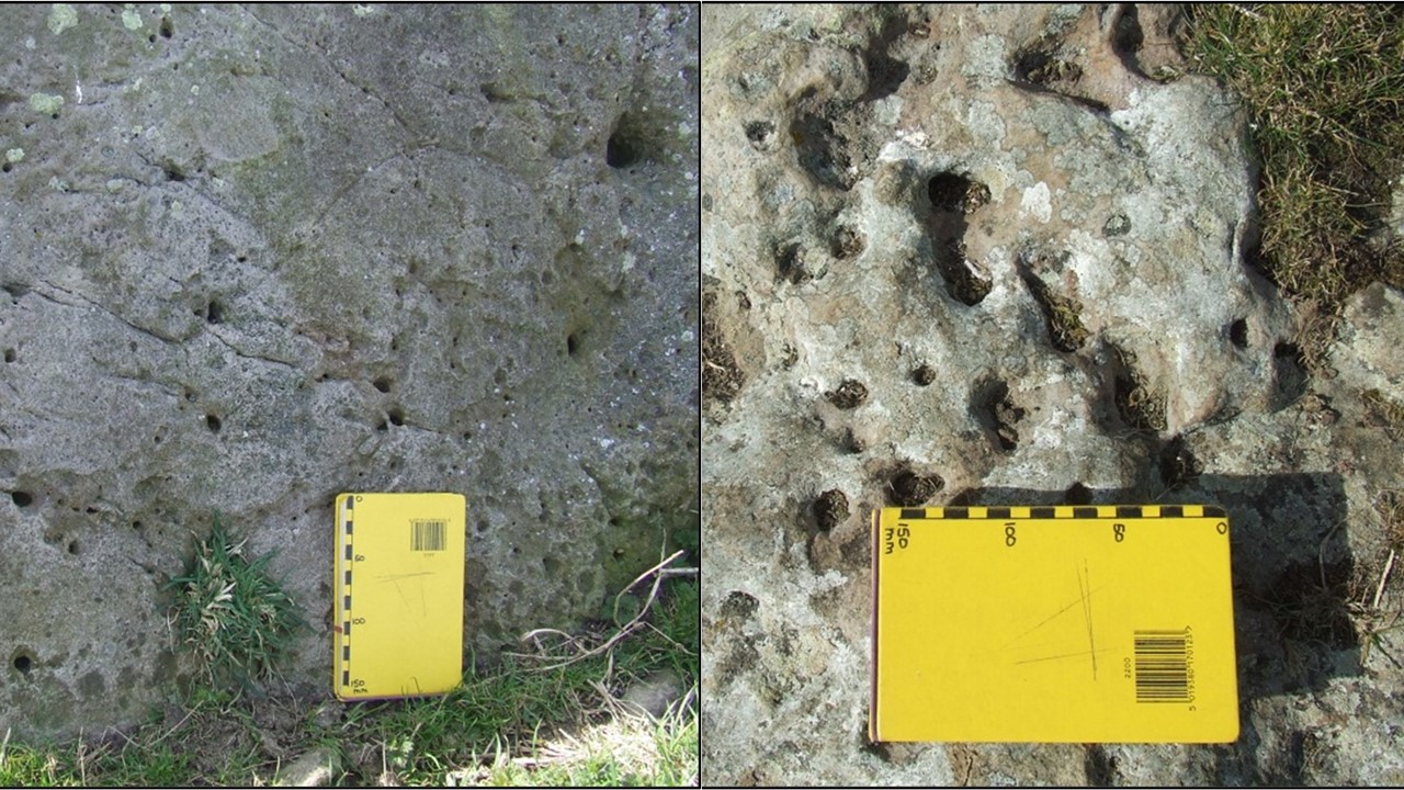
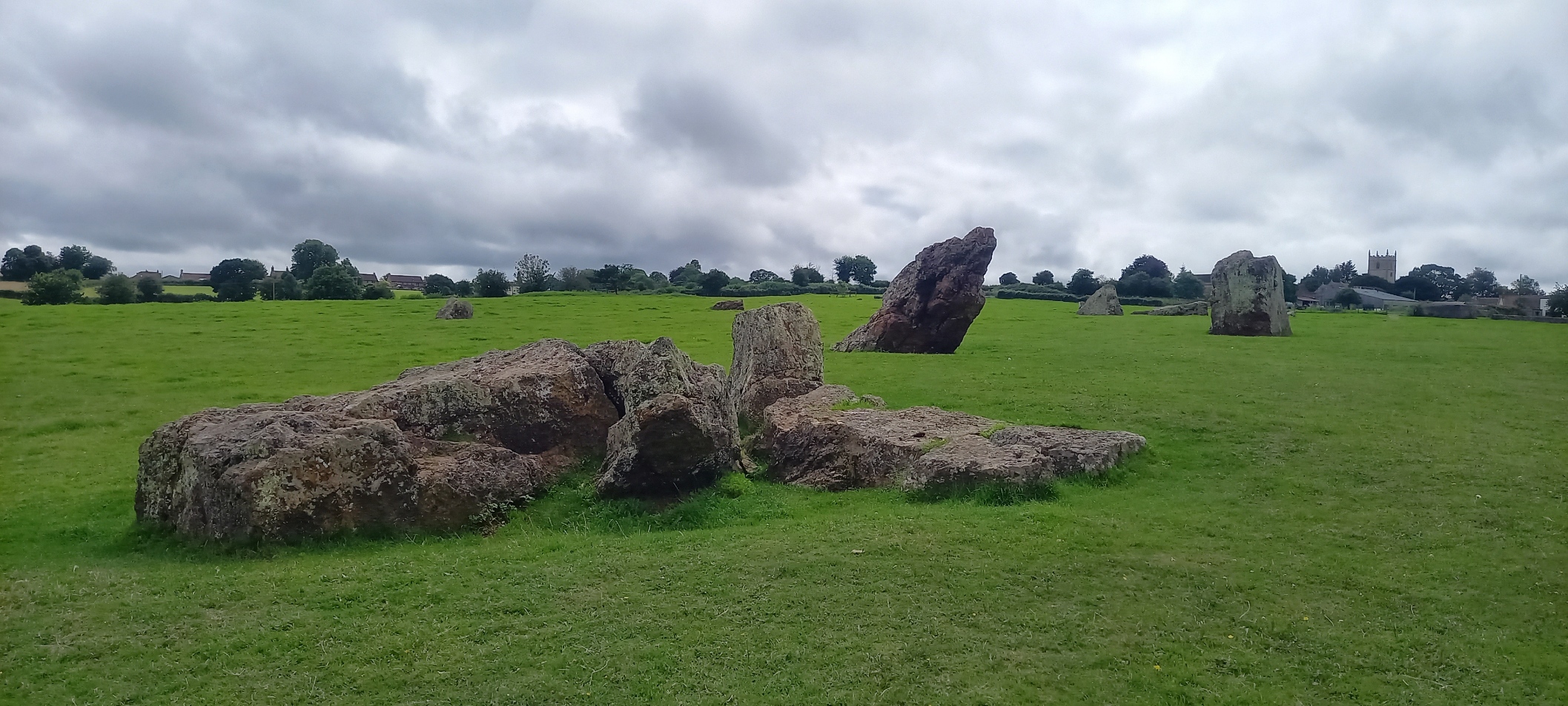
Hautville’s Quoit is located at Quoit Farm, near Stanton Drew (NGR ST 60173, 63811). According to the BGS 1:50 000 Map (Sheet 264) the underlying geology comprises Mercia Mudstone strata of Triassic age, this in turn overlies, unconformably, strata of Supra – Pennant Measures which form part of the Upper Coal Measures of Carboniferous age, below at an unspecified depth.
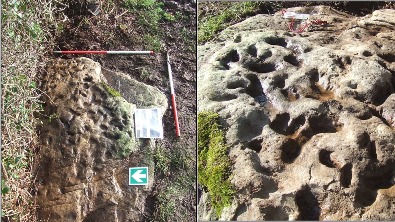
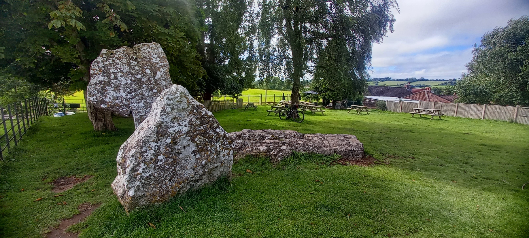
Hautville’s Quoit showing surface features
To the east and south of the site is alluvium of Pleistocene and Recent age; also, to the east of the site and below at unspecified depth is the Pensford No.2 Coal Seam. The soils found at Quoit Farm are likely to be derived from the erosion and subsequent transport of material from the Lias strata of Jurassic age that forms the high ground to the north of the site. In particular, from a layer consisting of mainly clay and shale, there is a substantial area of landslip on the slopes of Maes Knoll (East Dundry) and around the village of Norton Malreward. The strata that comprise the landslip are described as mainly clay with White and Blue Lias, mainly limestone, also of Jurassic age. The clay content of these soils is likely to retain a higher moisture content than the sandy soils of the stone circle site on the south side of the River Chew.
Hautville’s Quoit consists of a pale brown to grey sandstone. The sandstone can be described as comprising subrounded to rounded (high sphericity), fine to medium (250 – 375 microns), well to medium sorted, shiny, polished, mostly translucent grains of quartz, that appear matrix supported in a siliceous cement. There are noted numerous small clam-like (bivalve) fossil shells measuring up to 10mm x 6mm in an area of exposed bedding surfaces, these fossils are possibly a marker bed and might be useful in determining the origin of the rock type; these fossils have not yet been identified. A white scaly appearance on some parts of the stone was likely due to lichen growth or as a result of weathering. The pock-marked surface might be the consequence of a number of factors, including the effect of roots or solution. There are a number of lines of cleavage and other surface features visible on the stone. With regard to the Pool Farm cist-slab, Coles et al (2000) observe that “The whole surface of the slab appears to have been ground down to make some sort of uniform canvas for carving…”
Other surface features visible on Hautville’s Quoit
Discussionand follow-up fieldwork:
On a purely personal note, the rock type that comprises Hautville’s Quoit is not one that is recognised either locally, or in the broader surrounding area. There are a number of features of the stone that require further consideration. Some subsequent fieldwork in the Mendip area has been carried out in the Ebbor Gorge area to look at exposures of the Quartzitic Sandstone Group (QSG) associated with the Ebbor Thrust. However, it is thought unlikely that this particular exposure provided the source for Hautville’s Quoit.
Lloyd-Morgan (1887) described the rock type that comprises the quoit as fine-grained sandstone. Lloyd-Morgan hesitates to offer any opinion as to the source of sandstones found at Stanton Drew, either that of the quoit or the stones found in the stone circle close by and states, “of the source, geological and local I am doubtful”, he does, however go on to ask the question “Is it possible that one or more of the sandstone monoliths may be sarsen – but whence?”
Roger Mercer, Inspector of Ancient Monuments for the Ministry of Public Buildings and Works, carried out an excavation at the site in 1969 and also attributes the stone as of ‘Wiltshire sarsen stone’ origin.
Hardy (1999, p. 176, 181) in his book ‘The Geology of Somerset’ describes a ‘tough silica-cemented sandstone found as loose masses in the surface of softer rocks’. A number of these ‘sarsen’ stones were uncovered during the construction of the M5 motorway in the Blackdown Hills area close to Taunton but many of these appear to have been ‘lost’.
The references of Lloyd-Morgan and Mercer prompted a field trip to Fyfield Down in Wiltshire, an area that is renowned for the sarsen stones, also called ‘grey wethers’, that are found there, and many have been used in monument sites such as Avebury and Stonehenge. There are a number of similar features in the stones at Fyfield Down and Hautville’s Quoit.
Surface features on ‘sarsen’ stones observed at Fyfield Down.
Grey ‘wethers’ can generally be described as sandstone that comprises of grey, fine to medium (250 – 375 microns), sub-rounded to rounded (high sphericity), well sorted, shiny, polished, mostly translucent grains of quartz, the clasts are contained in a matrix comprising siliceous cement. Occasional stones were also noted to have variable colour from a pale grey-brown to more orange, possibly a result of iron content. Some of the stones contained rare flint nodules and very occasional fine to medium, sub-rounded to rounded gravel of quartz. The shape of the ‘grey wethers’ was also variable from rounded and spherical to more sub-angular blocks, with sizes ranging from <1m3 to several m3. It should be noted that no occurrences of fossils were noted in any of the stones observed at Fyfield Down.
Some further rock-types that might be considered:
The chert from the Upper Greensand that occurs in the Blackdown Hills near Taunton was formed as silica solution in the ground water filled the voids within the sandstone to convert it to quartzite or chert; this rock-type is of Cretaceous age. Fossils found in these sandy sediments are preserved in a similar process as silica replaced the calcium carbonate content of the shells (Hardy, 1999, pp. 176, 181). A field trip to this area to examine any outcrops or older buildings might provide further evidence.
Ganister is hard, fine-grained quartzose sandstone cemented with secondary silica and typically has a characteristic splintery fracture. Cornish miners originally coined this term for hard, chemically, and physically inert silica-cemented quartzose sandstones, commonly, but not always found as seatearths within English Carboniferous coal measures. Where a ganister underlies coal as a seatearth, it typically is penetrated by numerous root traces. These root traces typically consist of carbonaceous material. Ganisters that contain an abundance of fossil roots, which appear as fine carbonaceous, pencil-like streaks or markings, are called “pencil ganisters”. In other cases, the root traces consist of fine, branching nodules, called “rhizoliths”, which formed around the roots before they decayed (Wikipedia, online, accessed 30th April 2012). It is feasible that this rock-type was found within the Coal Measures in the Pensford area but no reference to it has, so far, been found in publications accessed.
X-ray fluorescence (XRF) is a non-destructive analytical technique used to determine the elemental composition of materials. Hand-held analyser units are widely available (although expensive) and might provide useful information regarding the relationships, or not, between these rock-types.
References:
Black, R.M. 1988. The Elements of Palaeontology, 2nd Edition. Cambridge University Press
British Geological Survey, Natural Environment Research Council, 1: 50 000 Series. Sheet 264, Bristol, Solid and Drift Edition. Ordnance Survey, Southampton.
Coles, J., Gestsdóttir, H., and Minnitt, S. 2000. A Bronze Age Decorated Cist from Pool Farm, West Harptree: New Analyses. Proceedings of the Somerset Archaeological and Natural History Society. Volume 144 (2000): pp 25-30
Grinsell, L.V. 1958. A Decorated Cist-slab from Mendip. Proceedings of the Prehistoric Society, Volume 23, January 1958, pp 231-232
Hardy, P. 1999. The Geology of Somerset. Ex Libris Press, Bradford on Avon.
Lloyd-Morgan, C. 1887. The Stones of Stanton Drew: their source and origin, Part II. Proceedings of the Somerset Archaeological and Natural History Society. Volume 33 (1887): pp. 37 – 50.
Mercer, R. 1969. Hautville’s Quoit Excavation Notes includes Clark, A.J. Geophysical Survey Report (Unpublished)
Richards, J., Oswin, J., and Simmonds, V. 2012. Hautville’s Quoit and other investigations at Stanton Drew. Bath and Camerton Archaeological Society in collaboration with Bath & North East Somerset Council.
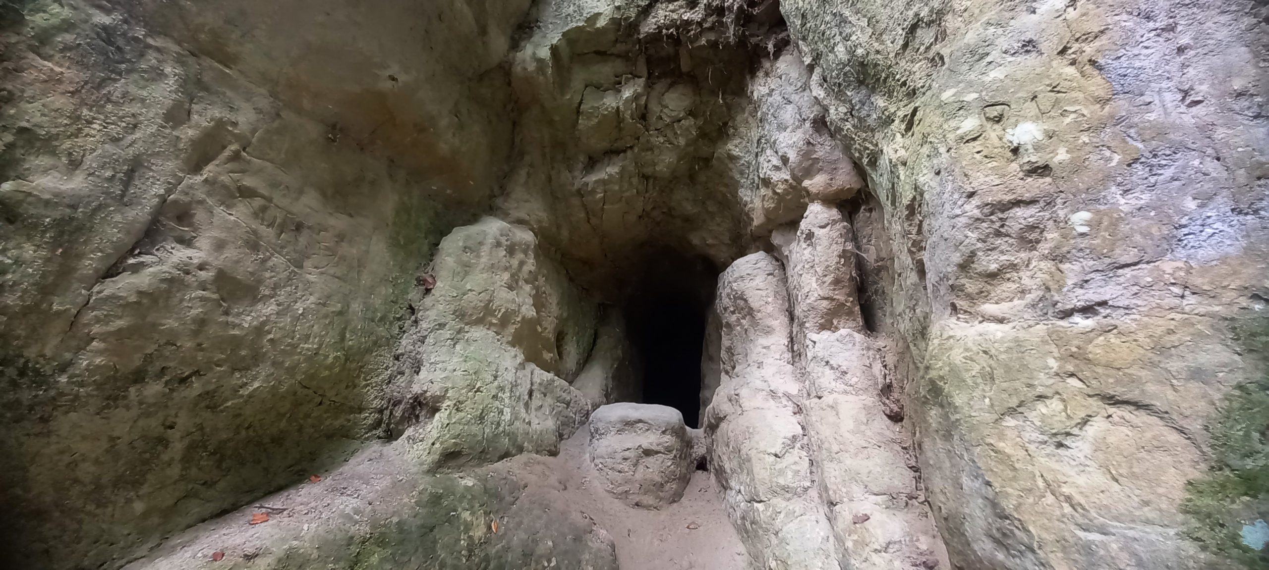
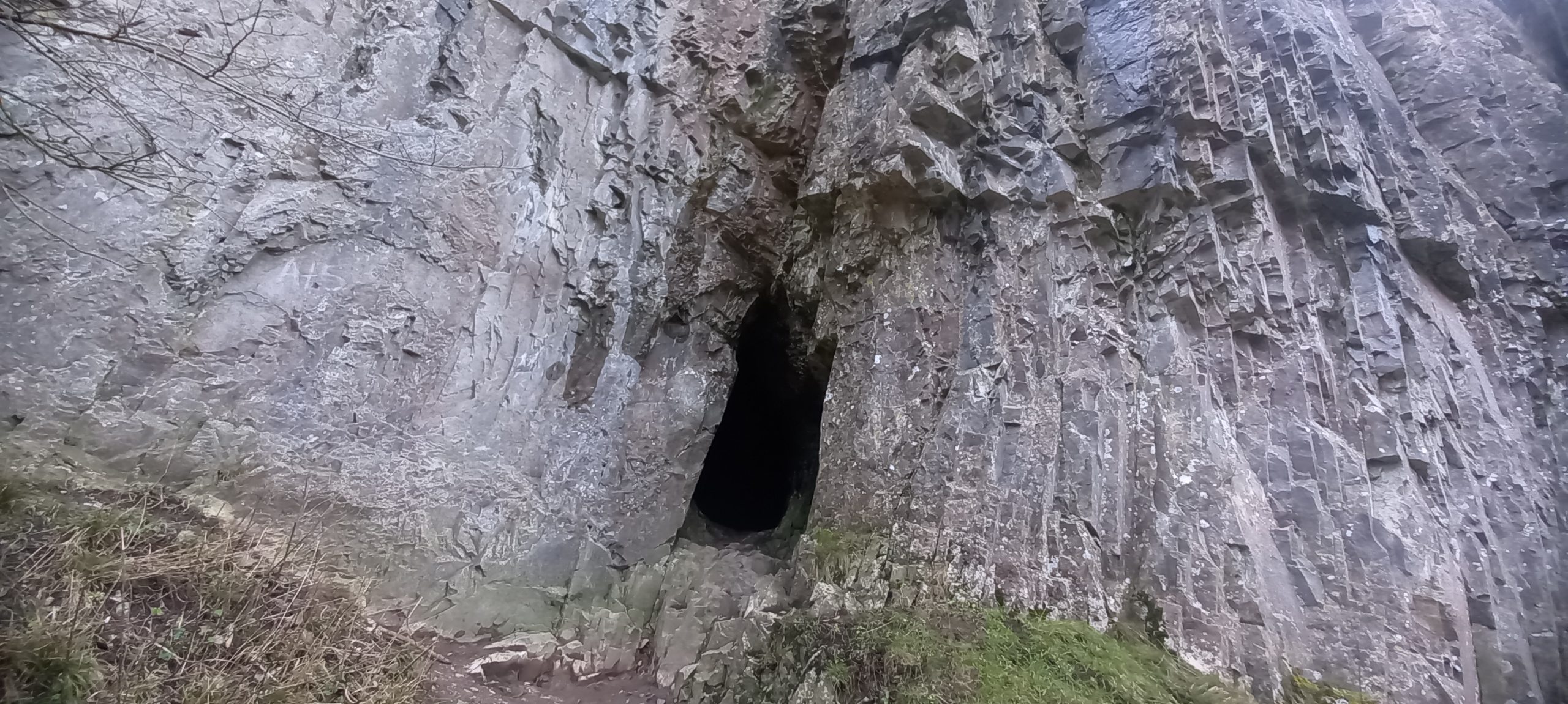
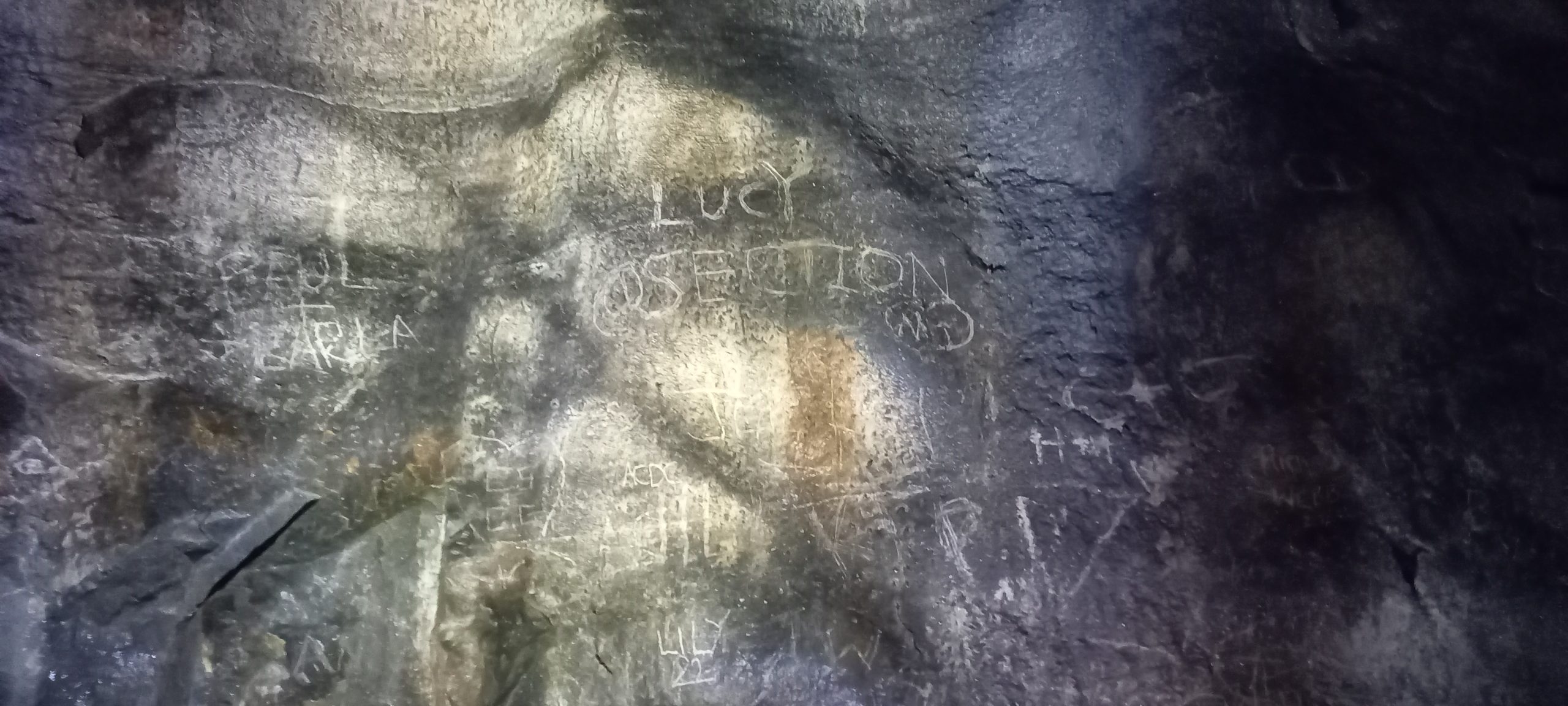
At Folly Wood, Easterton Sands, south of Devizes, a small ‘cave’ is located on the southwest side of a small gorge/ravine with sunken lane at its base. The ‘cave is found mid-section of an exposure of Upper Greensand, described as sand and sandstone, fine-grained silt, glauconitic, shelly, formed during the Cretaceous Period, 113 and 93.9 million years ago and very close to the geological boundary with Gault Formation – Mudstone formed between 113 and 100.5 million years ago during the Cretaceous period. (BGS, online). The entrance, ca 1-metre-high x 0.5-metre-wide, leads to a small chamber with abundant pick-marks evident on both sides and roof, the passage soon lowers and closes down, overall length <6 metres. There were etchings/inscriptions in the chamber and to the left side of the entrance, these were of modern date. The soft nature of the substrate makes it likely that potential inscriptions of older date have been eroded away.
Inscriptions can be seen on right side of entrance (and in the cave interior)
The anthropogenically altered ‘cave’ might have an alternative identity as described below:
“…Quabb’s Hole. This was a hole dug out of the sand, on the hill above Maggot Castle, separated from the Folly by a deep ravine, where the land slopes from Easterton to Crook’s farm. Quabb was a loner, a poacher and petty thief, whose exploits have been much embroidered. He stole sheep and hens and poached when and where he could, living alone in his cave where he died. When discovered, the cave was full of sheepskins and feathers. It was then filled in and forgotten. The story is never heard now but the events must have taken place about the beginning of the 19th century.”(Market Lavington Museum, online)
It is interesting to note that “quabb” is possibly derived from the Old English word cwabba “marsh”. A reflection on the ‘soft ground’ in the surrounding area perhaps.
Sources consulted:
British Geological Survey (BGS), https://geologyviewer.bgs.ac.uk Accessed 18/09/2023
May 28th to July 2nd 2023: Spent 36 days walking the 630 miles South West Coast Path National Trail from Minehead, Somerset to South Haven Point, Dorset. The coast path includes the Devon (north and south) and Cornwall coastlines. The walk was solo and self-supported using a variety of accommodation options, basically, whatever suited on the day!
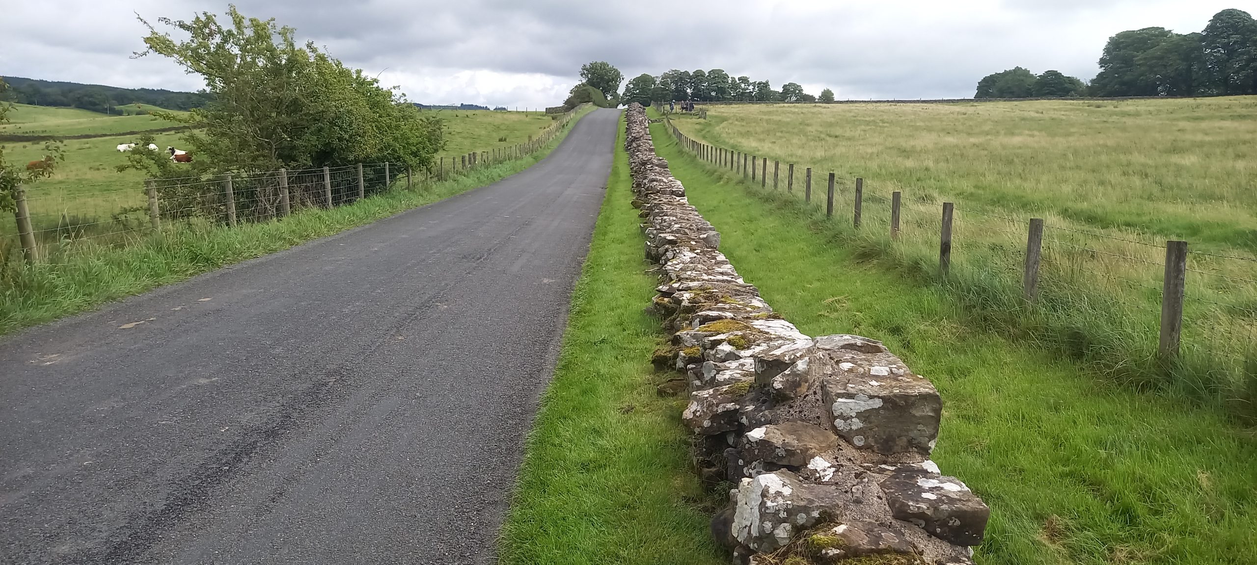
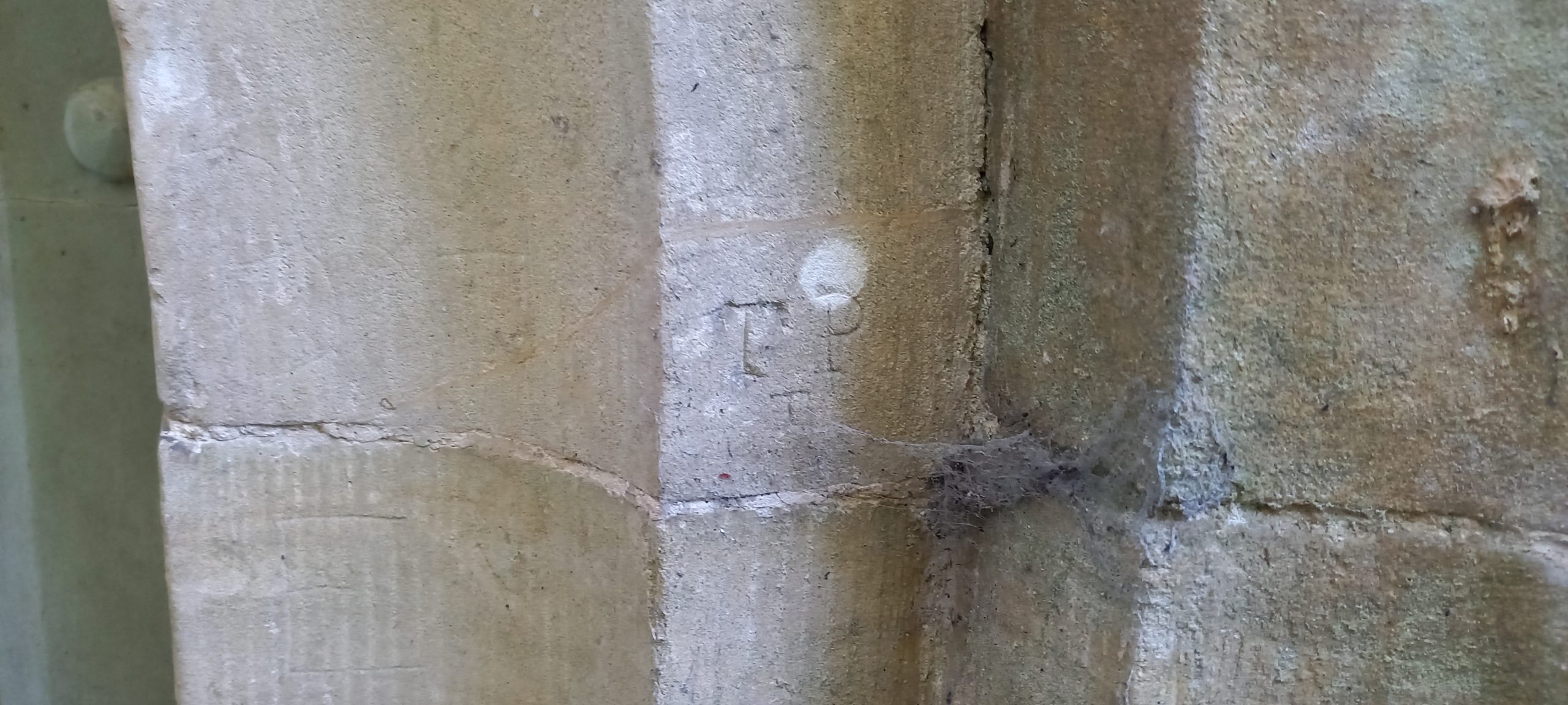
Recently cycled over to Stanton Drew to have a walk around the scheduled monuments. Several years ago I carried out some research on possible origins of the variety of rock-types used to construct the monuments.
Published in Cave and Karst Science, Volume 49, No.3, p136. December 2022
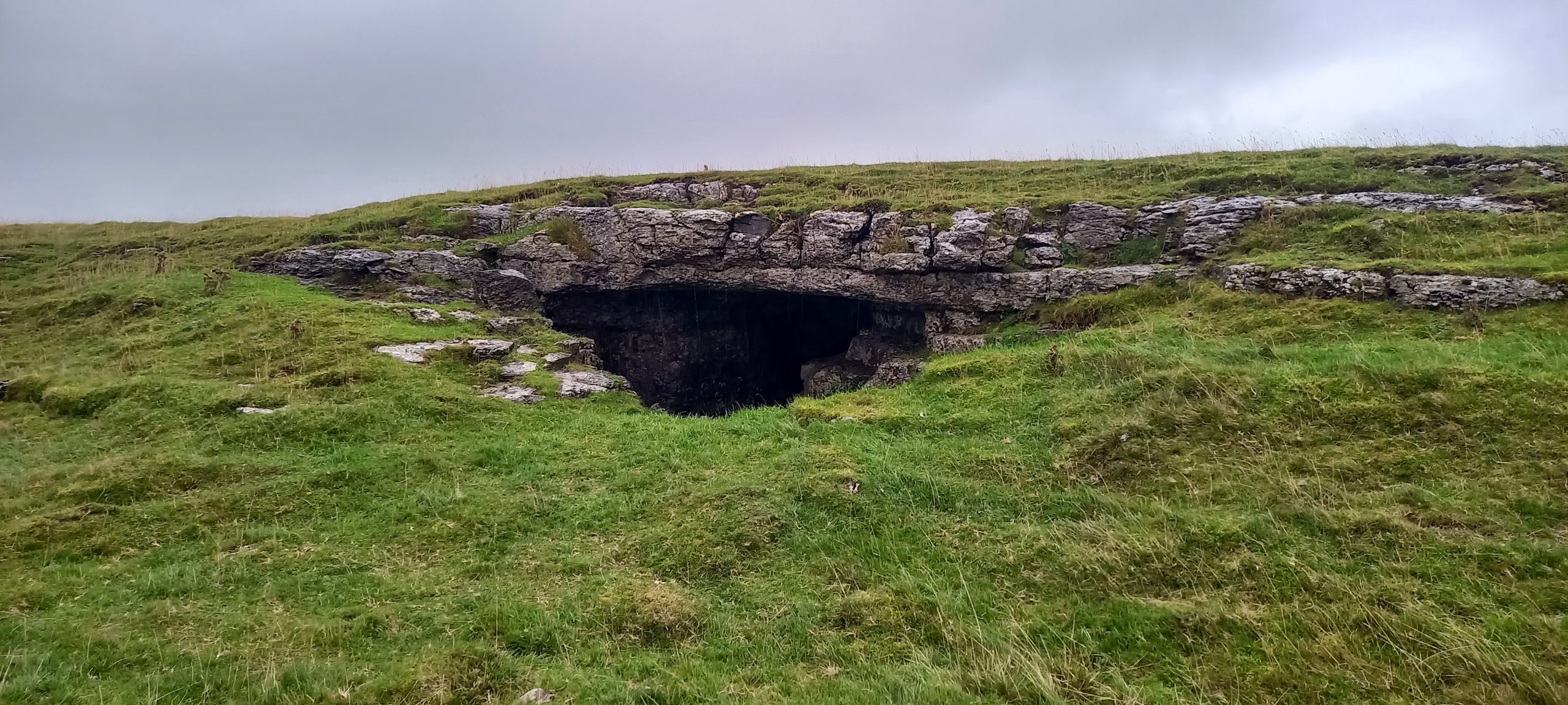
Dead Man’s Cave (NGR SD 800 670, Alt. 328m OD). The cave is situated within an area of ‘Access Land’ and is located above the scars to the northeast of a footpath between Feizor and Stackhouse. A wide entrance in the side of a grassy hollow leads to a roomy passage which closes down to a calcite and clay choke. The cave length is approximately 12m (Brook, et al., 1996).
Cave entrance
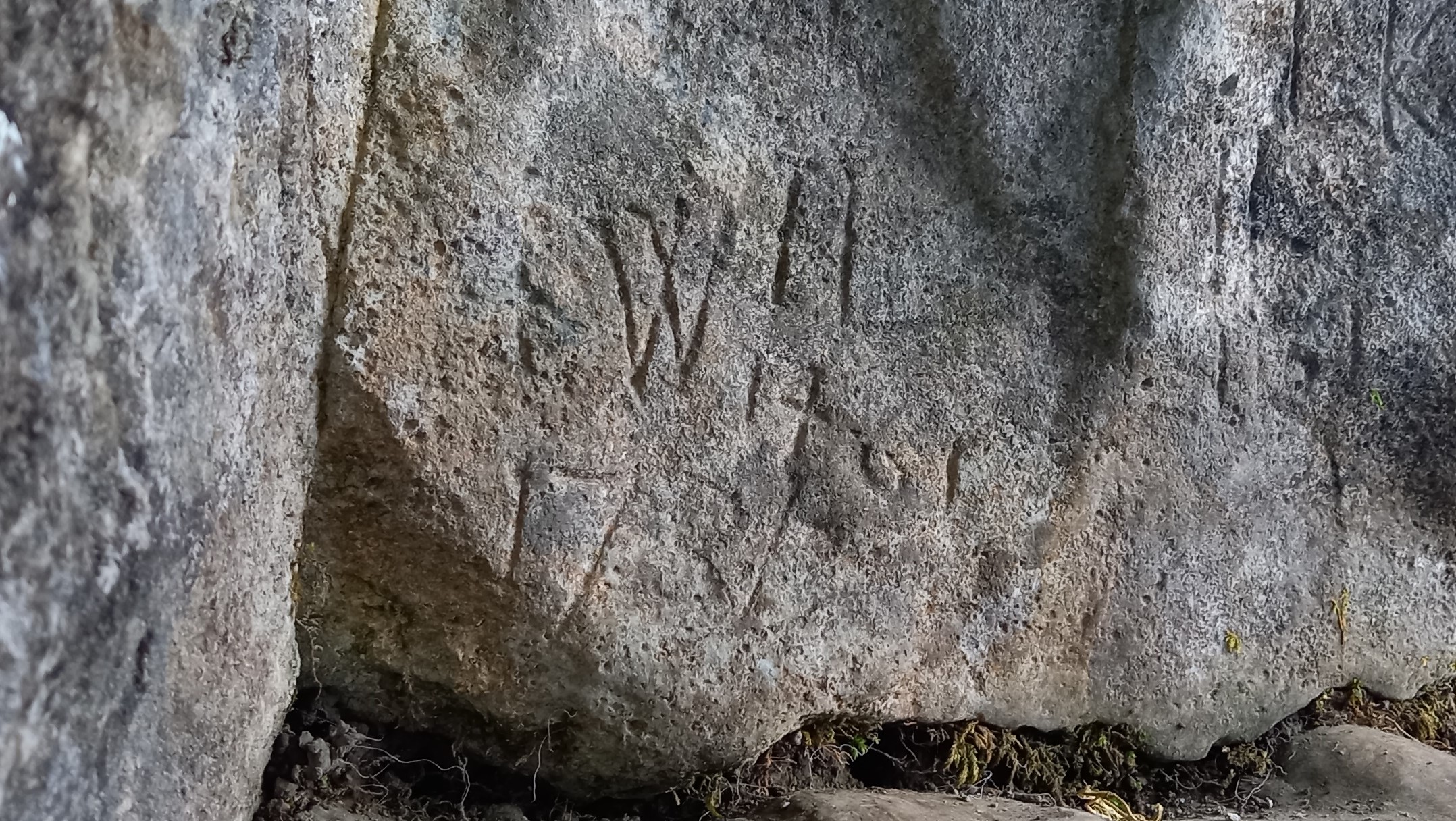
A visit to the site in June 2022, as part of a weekend field meeting organized by the British Cave Research Association (BCRA) Cave Archaeology (CA) Special Interest Group (SIG) had identified a wealth of historical markings at the site (Simmonds, Wilson, and Hall, 2022).
The cave entrance contains an abundance of incised markings on both of its side walls, the earliest inscription dates back to the 15th century – 1461. During the medieval period, the upland meadows that surround Dead Man’s Cave were used for summer grazing, when the cave would have offered a suitable place for shelter and storage, also providing a possible context for the medieval date and its associated initials (Simmonds et al., 2022).
Inscription “1461”
However, the date itself has enormous historical significance in that it corresponds to the year of the infamous ‘Battle of Towton’, the site of which is located some 50 miles to the southeast of Giggleswick (NGR SE 478 386). The political instability of the mid- to late-15th century led to a series of Civil Wars, now known as the Wars of the Roses (1455–1485), as rival factions of the House of Plantagenet fought for control of the English throne. The rival Kings in this period of English history were Henry VI of the House of Lancaster and Edward IV of the House of York.
According to English Heritage (1995) “…Although some historians have expressed doubt about the numbers that were eventually involved in the Battle of Towton, it is clear that the two armies were of an exceptional size for those times. There was a sharp fight at Ferrybridge on the River Aire on 28 March, which the Yorkists won, followed by the largest battle of the Wars of the Roses at Towton the next day. After ten hours of the severest fighting King Edward’s men emerged victorious. King Henry and Queen Margaret fled northwards to Newcastle and from there to Scotland, to continue the war as best they could. The presence of over 100,000 men and upwards of 28,000 deaths makes Towton the largest and bloodiest battle ever fought in England.”
References
Brook, A, Brook, D, Griffith, J and Long, M H, 1996 (Reprint: first published 1991). Northern Caves, Vol.2: The Three Peaks. [Burnley: Lords Printers.] p.42.
English Heritage, 1995. Battlefield Report: Battle of Towton 1461. Accessed 31 October 2022: https://historicengland.org.uk/content/docs/listing/battlefields/towton/
Simmonds, V, Wilson, L J and Hall, A, 2022. Meeting Report: British Cave Research Association (BCRA) Cave Archaeology (CA) Special Interest Group (SIG) Field Meeting based at Lower Winskill, near Settle, Yorkshire Dales. Cave and Karst Science, Vol.49, No.2, 80–83.
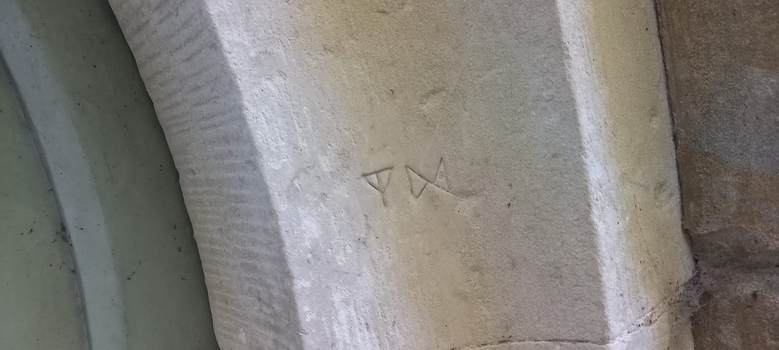
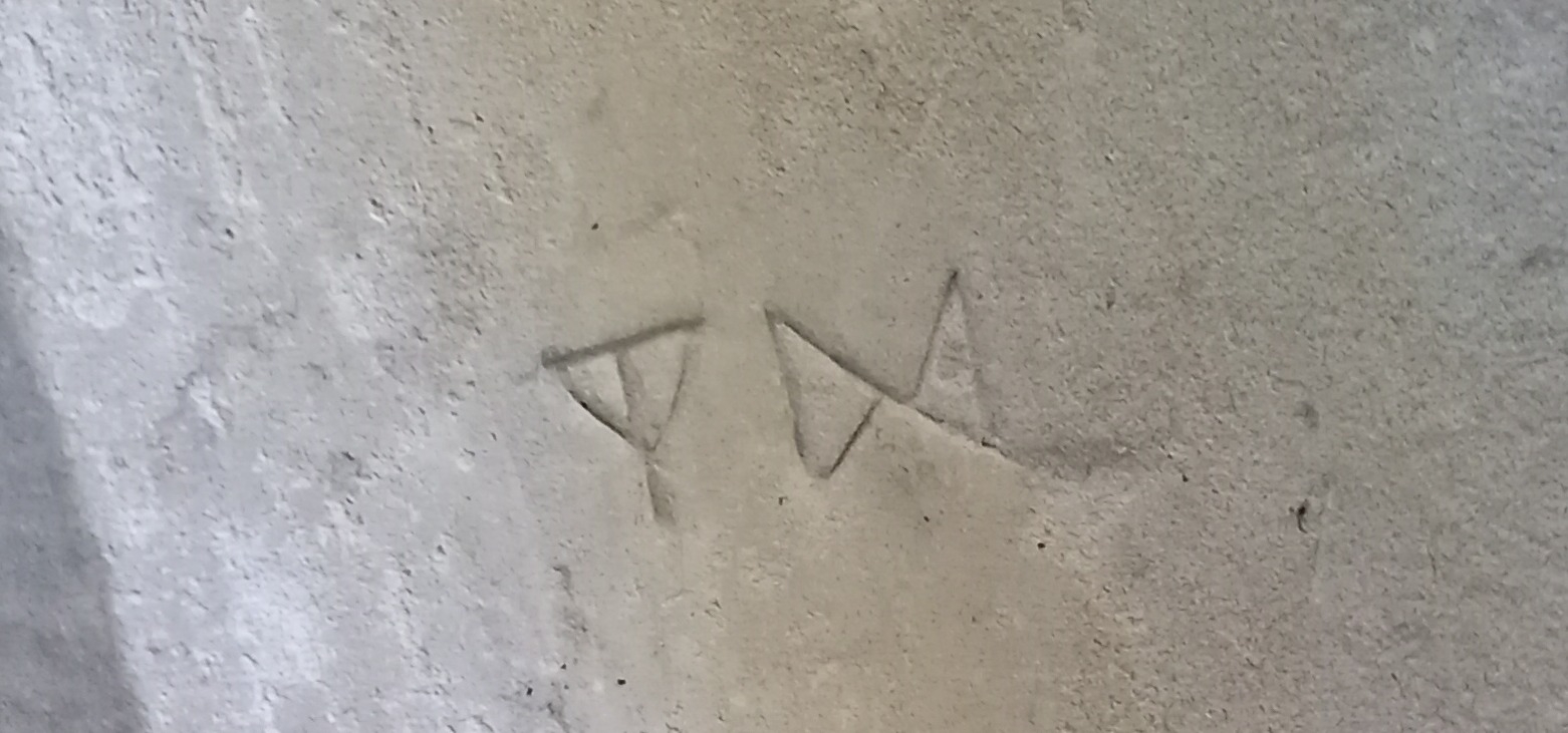
11th January: A very brief stop on the way to a watching brief nearby at the Church of St. Michael and All Angels, Teffont Evias, Wiltshire. Several inscriptions were found around the doorway into the tower.
Protection marksA closer view of protection marks‘Initials‘More ‘initials’
Some sets of the above inscribed ‘initials’ were noted more than once around the tower doorway. There were other less well defined markings too. The church warrants closer scrutiny another day when I have more time.
White Spot Cave, Cheddar Gorge, Somerset [NGR ST 4740 5443] described as a large rift-like entrance with a steep 12m descent for which a rope is useful (www.mcra.org.uk/registry/sitedetails.php?id=768)
Cave entrance
Thought I would visit this site located in Cheddar Gorge near the reservoir to check up on possible graffiti and other markings. However, on approaching and accessing the cave entrance, I was struck by the overpowering stench of human excrement and urine, the cave floor also strewn with litter, mostly empty cans and tissue paper. Not a pleasant place to be! I could only manage a quick scan of the walls before deciding to leave. Graffiti noted was mostly modern (2020s) and of no interest. Normally I would clear litter but in this case I felt it was too unhygienic to do so!