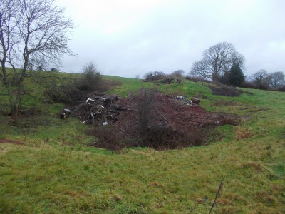
Ridge Lane was dug c. 1989 – 1992 by myself and Rob Taviner, while we both resided in the East Harptree area, with the occasional assistance of others including Tony Jarratt. Shaft approx. 7 metres deep in [silicified] dolomitic conglomerate, very hard going, to no real conclusion. Interest waned when we both moved out the immediate area, other projects took priority and the farmer started tipping waste around the depression. The depression, photographed on 31st December 2012, is now almost completely filled.
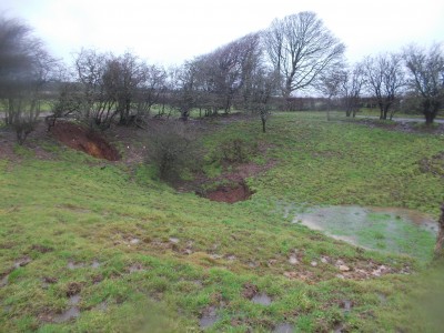
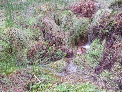
Following another period of heavy rain onto already saturated ground I thought it would be a good time to go out walking. While out on Smitham Hill came across an interesting double collapse in a depression (NGR ST 5545/5360).
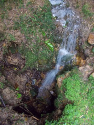
One of the collapses was taking a substantial flow of water.
This collapse is approx. 2m diameter x 2m depth, within mostly clay material, no solid rock was noted.
The second, dry collapse is slightly higher than the wet sink and is possibly some indication of ‘passage’ direction, approx. 3m long x 2m width and up to 2m depth, water appears static.
28th December 2012 and another damp day for a walk about. Decided to go up through Harptree Combe to Smithams Hill and into Harptree Woods.
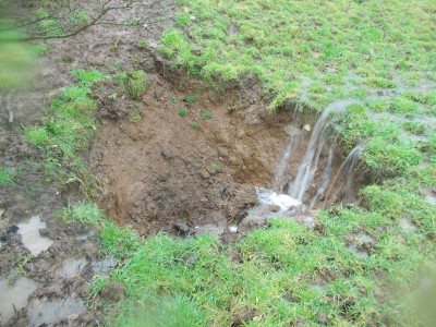
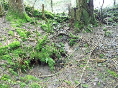
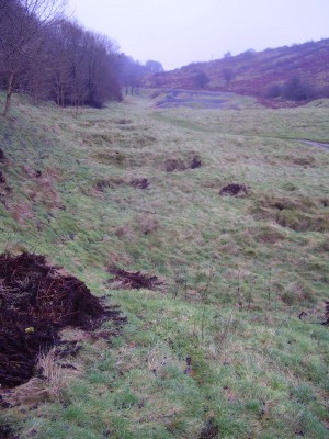
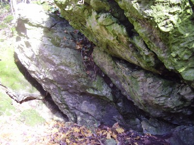
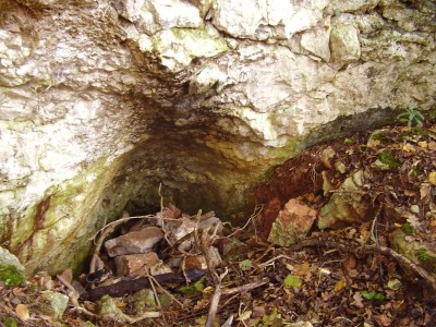
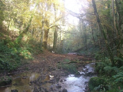
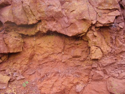
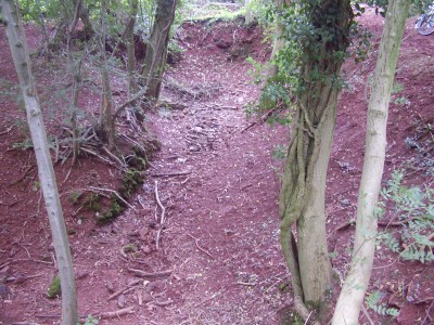
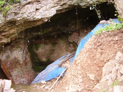
In the woods we visited a relatively recent dig site of mine – Harptree Woods Sink (NGR ST 5503/5433), a site I was originally attracted to because of the amount of water that was flowing into it. A double depression in the woods has a number of drainage ditches running into it and at times has been seen to take a substantial amount of water. The sink is developed within the Harptree Beds and there are exposures of this rock type evident in the depression sides (see image below). Since my last digging trip there has been some slumping of material and flood debris has also washed in so access to the small chamber below the entrance was not possible. Harptree Beds are not the best of material for digging and are generally fractured making it unstable, silicified and contain large amounts of clay.
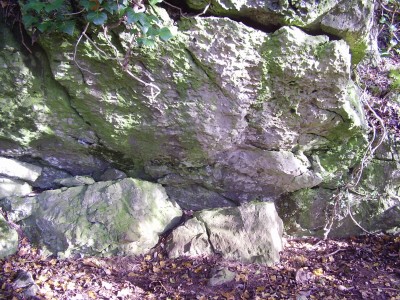
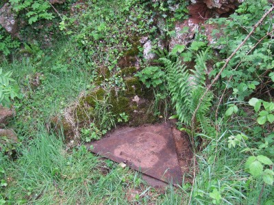
Water can be seen sinking in a number of other spots within the depression, there is one among the brambles (see image below), and there was evidence of recent high water levels.
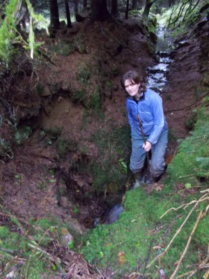
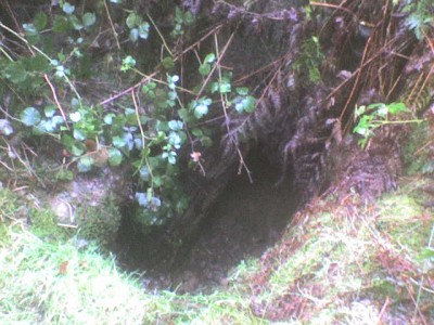
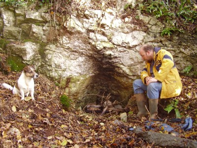
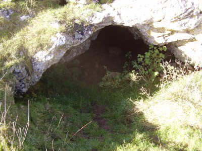
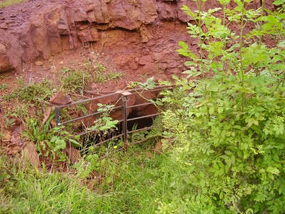
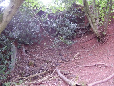
Potential is probably limited as the depression is located at a higher level, just above Frances Plantation Swallet (see image below). The majority of water flowing into this particular sink comes from a separate source to the west of the plantation.
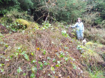
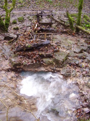
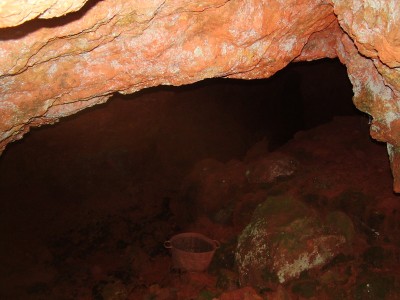
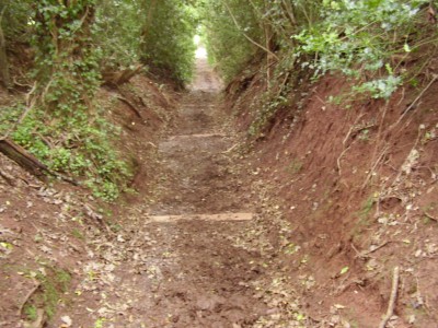
This site was dug by the Wessex Cave Club (WCC) in the mid-1960’s to a depth ~3m in Red Marl or Dolomitic Conglomerate and has been abandoned for decades. There are a number of other depressions in the woods including Smitham Sink (see image below). This site was scratched at in 1976 by the WCC, to no real conclusion.
Smitham Sink has always taken a ‘good’ flow of water, unfortunately, the potential for significant cave development is probably limited.
16th December 2012. While out walking the dog in Stockhill Woods came across small rift [~1.0m L x ~0.4m W x ~1.0m depth] with small stream, some evidence of greater water flow recently.
Located in small depression at north end of a group of larger depressions. Appears to be in limestone shale. Considered to have seen the attention of miners in the past.
Following discussions with others it is likely that the site has been previously noted.
Plans to go digging in Hallowe’en Rift today were cancelled due to adverse weather being forecast. It’s been a week of heavy rain and flooding, Cheddar Gorge has been closed to traffic because of the huge amount of debris that has washed out.
Decided to take walk down through Velvet Bottom to Longwood Valley and have a look at where the water has been sinking. All the way up through the valley it was obvious that there had been a lot of water flowing. At present the water has found it’s way into Longwood Valley Sink.
This once active site hasn’t seen any attention for a number of years – I bet there will be some interest now!
There is a lot of water disappearing into the depths below and it doesn’t seem to backing up too much.
Further up the valley is the Longwood Aust sink which has backed up and is overflowing.
In Velvet Bottom can be seen some remains of Mendip’s lead mining and smelting industry. The remains include buildings, pictured above and areas where industrial processes occurred, for example the buddles pictured below.
Buddles were used to wash the crushed ore to remove the impurities.
“A local bloke from Rodney Stoke, more fond of beer than labour, was recommended by a friend, to go and be a caver…”
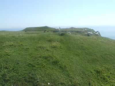
In the last few weeks a couple of different people have mentioned to me the existence of a cave, or more accurately a rock shelter that has turned up some Bronze Age pottery. So on a fine frosty sunny morning collected Alex from the Belfry and headed over to Draycott Sleight (sleight is a Mendip word for ‘sheep pasture’) and a walk over to the Stoke Woods area. Followed the footpath down through the woods to reach the field stile, then southwest to a stile into Little Stoke Woods where we located a number of possible sites on the outcropping limestone rocks.
Not entirely convinced we continued the search until we arrived at the likely location of the site we were looking for – Ewe Cave ST 4886 5040 +/- 7 metres, elevation ~80 metres.
There were very obvious signs that persons unknown had already been scratching around this site in the past.
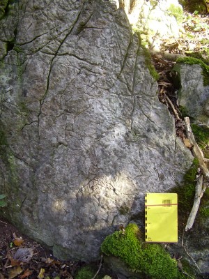
Some of the rock exposures encountered in the area had some very interesting signs of weathering.
On the return back up the hill to Draycott Sleight we decided to continue up to take a look at the entrance to Draycott Cave.
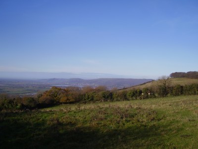
A fine 2.5 hour morning stroll with great weather and some fine panoramic views that are not fully appreciated in a photographic image.
Lunched at the Hunter’s Lodge Inn, Priddy to discuss an enjoyable morning’s walk.
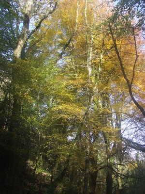
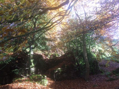
11th November 2012. A mid-morning walk through Harptree Combe with my wife and Buster, the Jack Russell.
When the sun shone through into the combe the colours were fantastic, and there was no-one else around.
In the combe is the scheduled site of Richmont Castle dating back to the early 12th century although not much now remains, the image below is taken on one of the paths leading up to the castle site.
Given the much publicised ‘Ash die back fungus’ now about to spread throughout the countryside, particularly affected will be the lime rich soils, Cotswolds, Mendips, etc. where there is a high percentage of ash growth. I wonder what the landscape will become if some forward planning to start planting alternative indigenous species is not put into action immediately, there will be obvious cost implications and the Government will have to front up.
It seem’s to be that someone has taken some shortcuts to make a’ fast buck’ and the countryside will suffer as a result. In Australia and New Zealand there are extreme restrictions regarding plant imports, hindsight perhaps, but what more ‘benefits’ will an open European market bring.
Inspired by the recent birthday gift of a book – Earth Colours: Mendip and Bristol Ochre Mining by Marie Clarke, Neville Gregory and Alan Gray, published in 2012 by Mendip Cave Registry and Archive (MCRA) – I decided on a trip down memory lane.
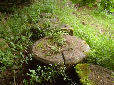
The site of Red House Quarry and the Redding Pits were the places where I had my first underground experiences many years ago. Following the byway leading south off Redding Pit Lane a number of relicts of a bygone industry are soon encountered.
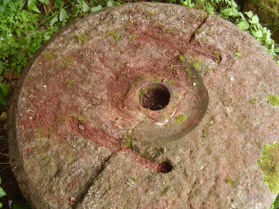
One complete millstone and three others that are incomplete or broken, the millstones are more than a metre across.
The complete millstone shows that it comprised of two haves stapled together, in the example above one of the staples can be seen still in-situ.
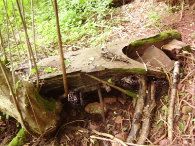
Remnants of other machinery or structures are also visible, although these are now very decayed and rather indistinct, although I suspect a former miner [or quarry worker] would recognise the equipment straight away.
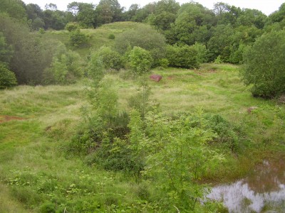
Along the track are signs of the ochre and oxide material that was the foundation of a local industry that spanned the mid to late 19th into the 20th century and provided local employment and allowed some farmers to supplement their incomes for a while.
Although the quarry has now been mostly naturalised I can remember the area as a barren red, purple and yellow landscape with a number of buildings and plenty of evidence of the extractive industry.
Winford Ochre Mine was the first place that I ventured underground at the age of 12 – 13 years, I can still remember those tentative first steps holding my bicycle lamp, nervously looking back as daylight disappeared, back tracking to make sure I could find my way back out, standing in awe looking at the size of the place (well it did look big to me then!). There were colours of red, purple and yellows, greens and most of it was engrained on me – on my hands and face, my clothes, it has to be said that my mother wasn’t quite so impressed!
Unfortunately the ‘health and safety police’ have been prominent in recent years and the entrance has been gated, and it is becoming overgrown resulting in the underground site appearing rather unvisited which I feel is a great shame.
Managed to poke the camera through the grille and take a snap of the entrance chamber. There are some significant workings beyond with a number of features still in-situ and well worth a look.
Another entrance to a mine has also been gated, at least the bats can come and go – almost as they please!
After touring around Red House Quarry headed over to the areas that flank Greatstone Lane on the south side of the lane is evidence of past workings (above).
There is always the possibility that adits lead off from these cuts, just a question of a little bit of digging to see.
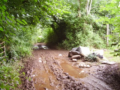
It is always very disappointing to see the extraordinary lengths that some people will go to just to illegally dump their rubbish in the countryside, Greatstone Lane is a narrow, muddy and restricted byway, the access is not easy. Why should landowners, or any one else, be left to clear up the crap left by the irresponsible and anti-social actions of others?
It is likely that Greatstone Lane was the shortest route leading from the Redding Works over Dundry Hill to Bristol in the early days when the extracted ore was processed in the Red House vicinity and when, later, the ore was taken to the mills at Littleton for processing. Along the present day byway there has been some recent repairs, it is obvious that over-usage by horse riders is causing some considerable damage although, thankfully some of the route is, at least, unused by four wheel drive vehicles and motorcycles.
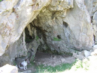
Family day trip to the seaside to enjoy the fine weather, set off for the Gower, South Wales. 3.5 hours later arrived at Pitton and a 0.5 mile walk to the beach at Mewslade. The family settled down to an afternoon on the beach while I headed off to find Paviland Cave NGR SS 4370 8590. Along the way passed by a number of forts on the cliff top path.
The fort pictured above is on the cliff top above Paviland Cave. There is not an established path down to the cave but an approach is not too difficult. On the way is a rock shelter that offers some shade [for hot dog] and is used by the local sheep population.
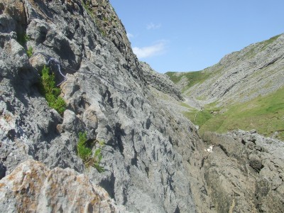
On arrival at Paviland Cave the tide was still on the high side and access from the beach was not safe so backtracked and traversed the rock face at a higher level to the cave entrance, unfortunately had to leave the dog behind for a while.
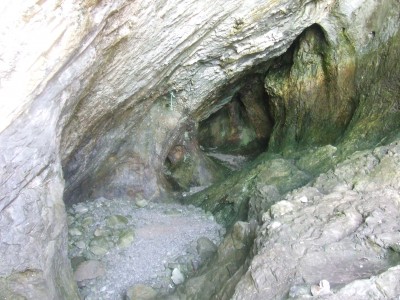
Paviland Cave is of great archaeological importance and has been excavated on a number of occasions.
The first recorded excavation was in the early 1820’s by the Reverend William Buckland who uncovered the so-called ‘Red Lady of Paviland’, which actually turned out to be a fairly complete Upper Palaeolithic human male skeleton dyed with red ochre. Along with the Red ‘Lady’ burial were found a mammoth ivory bracelet, a perforated periwinkle pendant, numerous seashells and fifty broken ivory rods. Marker stones were placed at the head and foot of the grave.
Three bone spatulae have been revealed and the cave floor has also produced numerous flint implements along with the by-products of their manufacture, together with charcoal and ash found in contexts that appear to predate the burial. Radiocarbon dating suggests earlier occupation about 3000 years before the burial and there is evidence to suggest that the cave was intermittently occupied both before and after that date (Pryor, 2003 pp 45-51).
After visiting the cave site walked back along the cliff path to the beach joining the family and spend a couple of hours swimming in the sea, body boarding and exploring rock pools before heading back home, stopping for chips on the way, the kids were flaked.
Reference: Pryor, F. 2003. Britain BC: Life in Britain and Ireland before the Romans. Harper Perennial.
Glorious day and ended up over in the Rackley/Compton Bishop area with Alex Gee looking at some of the smaller cave sites in this location:
Denny’s Hole NGR ST 3967 5497 – overgrown pit drops down to roomy chamber with several smaller chambers reached via various passages and squeezes.
Fox’s Hole NGR ST 3966 5498 – tight vertical fissure drops into low chamber, likely to be connected to Denny’s Hole less than 10 metres away.
Sandy Cave NGR ST 3976 5493 – found in old quarry. Large entance leads to sandy floored passage ends in three small chambers. The limestone in this cave is particularly sandy.
We had lunch in Priddy Hall where a Caver’s Fair was in progress so afternoon was largely occupied chatting and listening to presentations. Met up with the family at the Belfry who insisted on returnig to the Caver’s Fair. Detoured to Eastwater to catch up on the archaeological investigation of a barrow site by the University of Worcester. Interesting little site.
Following a mornings solo digging session in Hallowe’en Rift met up with Tangent at the Hunter’s. Headed over to Ebbor Gorge to meet up with the digging team at Gully Cave. Tangent drove to the car park and we carried up a supply of hessian sacks kindly donated by Cheddar Ales for the digging project.
Had a discussion with the diggers about their requirements for shoring the retained material and put forward some suggestions about how best to achieve their aims. It’s an interesting project. Tangent and I then went for a scramble around the higher rock exposures in Ebbor Gorge above Gully Cave and then around to Outlook Cave. The nettles and brambles have shot up since my last visit and shorts and trainers are not ideal in these situations. I said to Tangent that once the first lot a of tingles have taken effect then subsequent stings don’t really matter. My legs were still tingling the following day with some pretty angry looking scratches. The ivy growth also proved to be an interesting experience in my super slick soles. All good fun though.
After yesterday’s efforts at Hallowe’en Rift with Alex a more relaxed start to the day ensued with a mid-day walk around Stockhill Woods, I was joined by some of the family, Roz, Callum and Buster the dog of course!
Replaced the shattered lock on Snakepit with a nice shiny new one, as supplied by the Council of Southern Caving Clubs (saw Les Williams, Conservation & Access Officer last night in the Hunter’s). Then a stroll around the usual favourites Stock’s House, Five Buddles, Wheel Pit which was taking a good flow of water after some recent heavy rain, and Waldegrave Swallet. The water that sinks here at these sites is resurgent at Wookey Hole and Rodney Stoke Rising. Walked through the woods to the large fenced depression which is showing signs of recent collapse where a small stream was sinking. Interestingly the water in this area probably feeds into Wigmore Swallet and is therefore resurgent at Cheddar. It is possible that the divergence of water in the Stockhill area is due to secondary porosity, perhaps the result of fracturing along the Stockhill Fault.