22nd December 2013

Took a walk with the dog over to Rowberrow Cavern NGR ST 4596 5802. A large archway in Dolomitic Conglomerate, closes down with a small side passage to the left, there is evidence of limited digging in a couple of other places. Archaeological excavations by the UBSS in the 1920,s revealed Neolithic, Bronze Age , early Iron Age and Romano-British habitation.

Solution features


Natural solution features in Downside Stone exposed during an archaeological evaluation. Downside Stone is a littoral (near-shore) variation of the Langport Member and Blue Lias Formation. It is described as a typically white, coarsely crystalline, shelly and sandy limestone. Scale is 0.50 metres.

Recording sections

I haven’t done a lot of digging on the chalk, so enjoyed the
opportunity when it arose.

Trench No. 5:

This linear ditch with E<->W alignment, bottomed out
at 1.35m and was cut into the natural [weathered] chalk. It had steeply sloping
sides to a narrow, flat base and became a bit constricted about halfway down. Scale is 2 metres long although the top is slightly cut off, poor light for photo’s.


This is my 1:10 section drawing of the above ditch cut,
below the section drawing is the start of the 1:50 plan of the evaluation trench.

This was before the job was postponed at short notice due to
a pair of Stone Curlew’s deciding to nest very close to the site indeed!

Ramspit, Ebbor


23rd June 2013. Ramspit [Scrambles Swallet], Ebbor. NGR ST 5152 4913

Small stream that rises on Coal Measures sinks into the limestone at the Ebbor Thrust, in a cliff-girt depression under the left bank, and follows a steeply descending passage choked with clay, gravel and boulders. Dug by the MNRC in 1930-32, and the BEC in 1957, the hole was closed by 1968 (Barrington and Stanton, 1977).

Not completely filled in, it would only take a little bit of gardening to open it up and make it workable, I thought that I could detect a faint draught. The right hand (west) wall appears to comprise a mineral vein [probably calcite], a vein is also visible at the current limit of the cave. Geologically an interesting little spot in that the cave follows the thrust.

Ebbor, nr Wookey Hole

17th March. A Sunday stroll along the north facing cliff in Primrose valley, Ebbor and a peek at some of the smaller cave sites that are located here.

Cook’s Hill Hole, NGR ST 5216/4845. An Iron Age skeleton was uncovered when the cave was opened up by diggers in the 1950’s.

Twin Cracks, NGR ST 5218/4841. The hole to the right appears, at present, to be occupied by badgers.

Triassic Tube, NGR ST 5224/4837. A phreatic tube with possible Triassic deposits in roof [not sure of this description].

Bracelet Cave (Hope Wood Cave), main entrance NGR ST 5229/4833; HER 24334. Excavated in 1955 by E.J. Mason who revealed the remains of nine skeletons, associated with RB pottery of C1-2, overlying a barren muddy thermoclastic scree. Outside the cave a plain gold bracelet with trumpet shaped ends, probably mid to late BA was recovered. The bracelet is not necessarily connected to the bones, and no pottery or other items was found. Two chert blade implements of Upper Palaeolithic type were found unstratified beneath a vertical natural chimney at the inner end of the main chamber.

Bracelet Cave looking up through the natural chimney from inside main entrance

Fungal foray

Walking through Harptree Combe the other day and noted a variety of plant growth including the Scarlet Elf Cup (Sarcoscypha coccinea) growing on a branch lying on the woodland floor,

Many-zoned Polypore (Coriolus versicolor),

however the identification of the specimen pictured below has so far eluded me.

Trellech

Been over the Severn Bridge into south Wales to carry out an archaeological investigation at a site in Trellech.

Trellech was one of the major towns of medieval Wales, it is most likely that the town was established by the De Clare family specifically for the exploitation of local supplies of iron ore and charcoal, to provide weapons, armour and iron work for their military advances in Wales. By 1288 there were 378 burgage plots recorded in Trellech, which would have made it bigger than Cardiff or Chepstow at the time. Trellech was largely destroyed in 1291, however, as a result of a raid following a dispute over alleged deer poaching. The Black Death struck in 1340 and again in 1350. Subsequently the ravages of Owain Glyndwr and his men in the early 15th century further reduced the prosperity and in consequence the importance of Trellech.

A stroll around the present day village reveals a number of interesting sites:

Tump Terret [above] is a 13th century Norman motte, the bailey has disappeared under later village developments.

There is a medieval cross [above] located in the churchyard.

Harold’s Stones [above] dated to the Bronze Age comprise of ‘puddingstone’ a locally derived conglomerate. The name ‘Trellech’ apparently originates from these stones ‘Tri’ (Welsh for three) and ‘llech’ (meaning flat stone).

The Virtuous Well [above], also known as St. Annes Well is located on the outskirts of the present day village. It’s healing waters are thought to come from four mineral rich springs, it is still in use today.

Richmont Castle, Harptree Combe

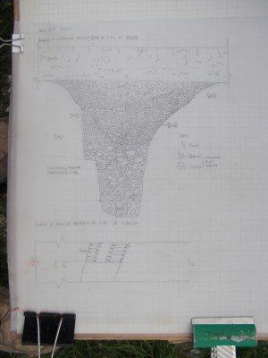
English Heritage carried out an analytical eathwork survey of Richmont Castle in March 2008 (see pdf below).

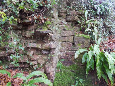
“The castle ruins have been badly affected by stone robbing and later mining activity and all that remains is a small fragment of the rubble core of the curtain wall near the donjon and the partial remains of the donjon. The earthwork evidence shows that the castle includes two concentric banks and a third, possibly earlier, outer bank and ditch. The castle lies at the end of a spur with deep combes on either side. The western combe was dammed just below the donjon, providing a fishpond and a watery landscape along the valley. Map evidence would suggest that there was a small deer park to the south and east of the castle as well as a possible deer course” (Brown, 2008. EH).

Note: the underlying geology comprises Dolomitic Conglomerate, although part of the Mercia Mudstone Group it is not Keuper Marl as stated in the EH report.

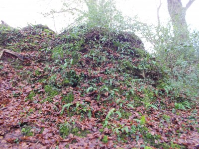
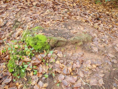
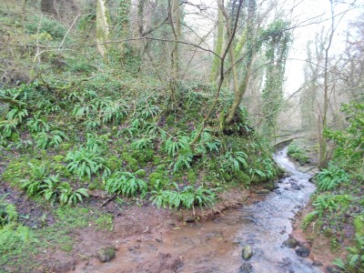
In the combe a few remants of the castle are still visible although overgrown in places.

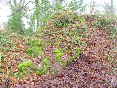
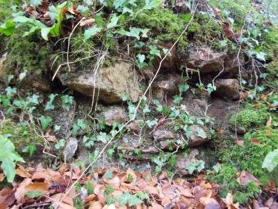
Part of a tower [donjon] remains can be seen to the northwest of the site and, here some remnants of wall are still standing.

Around the castle site glimpses of other structures are evident.

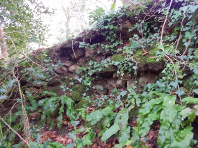
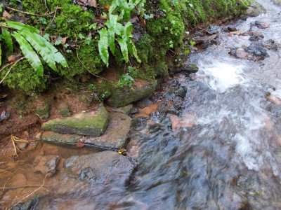
In the valley floor to the west of the castle are the remains of a dam, suggested to be medieval in date.

Where the dam has been breached there is some possible evidence of the dam’s construction.

Further up the valley are the remains of a second dam.

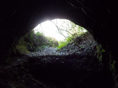
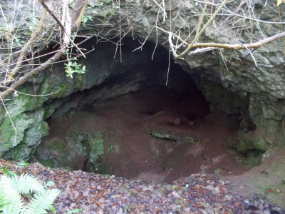
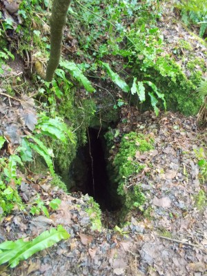
The castle site and combe are well worth a visit, especially with a copy of the earthwork survey – and bring a light to explore the mines located nearby.

Harptree Combe

6th January 2013. A while ago I noticed a small rift in Harptree Combe near to the aquaduct (NGR ST 5618/5598).

Entrance is ~1 metre x 0.7 metre, rift is ~3 metres deep. In dolomitic conglomerate and is probably formed along a slip joint, there appears to be a very small continuation at the base of the rift. There are no obvious signs of mining activity.