Nunney Castle, east Mendip

15th March 2017: Nunney Castle.

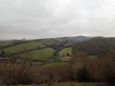
On the way back from the office, stopped for a while to admire this impressive structure at Nunney in eastern Mendip.

A quadrangular castle in the centre of Nunney village, adjacent to the church. The castle stands on the west bank of Nunney Brook at a point where the Brook and the valley in which it lies change direction from north- south to north east-south west.

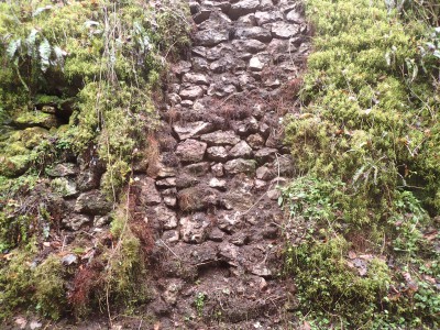
The castle is of a highly distinctive design, consisting of a high four-storey rectangular building containing principal rooms such as the great hall, with large closely-spaced circular towers providing more private chambers. It displays a high level of sophisticated planning. The towers still rise almost to their full height, and are crested by a parapet surmounted by a drum turret. The building is tightly enclosed by a wide moat.


Nunney Castle was built by Sir John de la Mare in 1373, when he obtained a licence to `crenelate’ his house. He held many offices, being in favour with the king and he appears to have served in the French Wars. The family were Royalists and Roman Catholic in the Civil War, and the castle was besieged by the Parliamentarians in 1645, falling after two days when the north side of the castle was severely damaged by gunfire. It was `slighted’ thereafter, although the walls were left intact, the north wall only finally collapsing in 1910 (www.heritagegateway.org.uk)


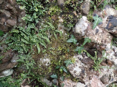
Some individuals, for whatever reason, feel the urge to leave their mark, like this 19th century example.

There is currently some renovation works being carried out at the castle.

Wookey Hole, Mendip

14th March 2017: with Jake and Nick.

The plan was to go up to the end of Chamber 20 in Wookey Hole to check the water levels in our dig there. Optimism, mostly on my part, began to waiver when a strong drip of water was noted in the show cave, further on, the calcite cascade was flowing, approaching the dig, the small side passage was overflowing into the pond in the chamber just before the dig. The dig, was of course, flooded, the water had been deeper, but for now, had receded to its perched level. A little while yet before the digging effort can re-commence.

To pass some time we made our way over to the rift to retrieve some kit left part way down, the equipment will be of use in the future. Then, we left the cave to go to the pub.

Cowleaze Lane to Compton Martin

26th February 2017: Cowleaze Lane to Compton Martin.

From Ridge Lane, West Harptree across fields to join Cowleaze Lane. At the top of the lane, just before crossing the road, is a good spread of snowdrops.

Over the road, leaving Cowleaze Lane to cross the field to the Wrangle, Compton Martin. Stopped to take a look at the rag well, that appears to have sprung a leak. The water is flowing out through the tank rather than over the spout.

Up the Wrangle for a short distance before taking the path, west, across fields, Here, in this field are some lynchets, evidence for land usage in the past.

Primrose’s in flower must be a sign that spring is not too far away.

From the combe at Compton Martin, took the steep path up the hill towards Hazel Manor. Passing the quarry where good exposures of Oxwich Head Limestone of Carboniferous age can be seen. At the top of the ridge, took the path east to re-join the combe. From the ridge are some fine panoramic views across the Chew Valley. Sadly, views that will be lost in the future as the recent planting of trees will grow and block out the vista.

Down through the combe, resplendent in mossy green-ness. There is an abundance of scarlet elf cups, not only here but elsewhere too. There are also fine spreads of snowdrops, but these are now past there best.

I didn’t make the steep climb up to the ochre mine today, but returned to West Harptree by reversing the route walked.

Shute Shelve Hill

19th February:

From the summit of Shute Shelve Hill there are extensive views of the surrounding countryside, to the west over the ridge to Wavering Down and Crook Peak, and over the moors to the south.

Getting to the top is another thing.

While the bright yellow blooms of gorse bring some colour to a grey day, negotiating the overgrown thickets is not a pleasurable experience.

Like bracken, the dominance of gorse in the landscape is detrimental to the growth of other, less aggressive plant species that would normally be found on upland limestone grassland. With the loss of these plants and associated fauna there is a decrease in natural diversity.

Callow Drove

12th February: Along Callow Drove.

I had planned to walk on Axbridge Hill, but on arrival at Shute Shelve car park, an abandonment of cars left by a group of “ramblers” meant there was no safe place to park, so a change of venue was required.

Parked at the Shipham end of Winscombe Drove and followed the track westward to the junction with Callow Drove. Followed the track, up on to the hill, a bit mucky to start but it soon opens out to a section of walled drove.

The gatepost is conglomerate (Triassic), and the wall constructed from limestone (Carboniferous). It is possible, the conglomerate originates from Draycott.

Several of the trees along the drove have been ‘ring barked’. The height to which this occurs can be gauged by the livestock fence to the left of the image.

This boundary marker is located near the eastern end of the drove where the path splits around Callow Rocks Quarry.

There are fine views from the drove, from the eastern end looking through Longbottom towards Blackdown on the horizon.

Smitham Chimney and Wurt Pit

5th February 2017: Walked up through Harptree combe towards Garrow Bottom. Passing the aqueduct, built c.1840’s, on the way. The weather, low cloud but, quite mild.

From Garrow Bottom followed a feint path, up the bank and through the woods to Smitham minery and the chimney. This is the last chimney remaining from the lead smelting industry on Mendip.

The chimney was built in 1867 by Cornish engineers. The smelting ceased in 1875 and a year later all the buildings, except the chimney demolished. The chimney was restored by the Mendip Society in the 1970’s.

From the chimney, followed the paths through the woods towards the car park, taking a detour to take a look at an old cave dig in one of the depressions. Water has been sinking here quite recently.

Across the road and into the field where Wurt Pit is located at NGR ST 558539.

The SSSI is an impressive site, it is one of the largest subsidence depressions in the Mendips. The silica-enrichment of the limetones and clays at Wurt Pit (known as the Harptree Beds, of early Jurassic age) is of considerable mineralogical importance since it took place as part of the main phase of mineralisation which emplaced the principal Mendip orefields during Jurassic times. The Harptree Beds show varying degrees of silica-enrichment, and also contain traces of other minerals, such as limonite and yellow ochre (hydrous ferric oxides), barite (barium sulphate), sphalerite (zinc sulphide) and galena (lead sulphide).

There are some good exposures of the rock type, access can be slippery when wet. The site falls within the Mendip Hills AONB.

Piney Sleight and Cheddar Gorge

29th January 2017: Not the best weather, donned the wet gear and set off up the hill to Charterhouse. Walked from Velvet Bottom, towards Longwood, then over to Piney Sleight.

Over the years stone has been cleared from fields and now fills small depressions, many with hawthorn growth.

Emmet butts in the rain. There is an accumulation of ant hills in this spot, perhaps the soil conditions are, particularly suitable here.

For a brief moment, the rain ceased and the low cloud lifted to give a fine view of the gorge.

Met some local browsers along the path, they kept a watchful eye on the dog.

The cliff top path on the west side of the gorge is suffering from footfall and is very eroded in places.

Stockhill

15th January 2017: A morning stroll around Stockhill.

In the woods there is plenty of evidence of the long gone mineral extractive industry. The landscape is pock-marked with pits and rakes. In this area the mineral of most interest was lead.

The ground here is tainted with the by products of the St Cuthbert’ smelting works and was given over to forestry many years ago.

Lichens and mosses have taken over the decaying stump of a felled tree.

There are several natural depressions found in this area, in the side of this one, a small stream sinks in a fissure in the underlying limestone shale.

There are plenty of fungi to be seen throughout the woodland.

Over the top of Mendip

5th January 2017:

Parked at Ellick Farm and followed the path keeping close to the boundary wall, then turning to head up to the trig on the top of Mendip – Beacon Batch at 325-metres. Passed a group of grazing ponies on the way.

I enjoy the sight of the ponies, and the cattle too, perhaps reminiscent of ancient herds in the past, a sentimental thought, of course.

Along the route from Beacon Batch to Rowberrow Warren the path follows the Blackdown pericline, the underlying geology comprises Devonian Old Red Sandstone (Portishead Formation).

As the path enters the warren and dropping down to the valley the geology is Triassic Dolomitic Conglomerate. In Rowberrow Forest I came across several examples of ‘angel’s hair’ an ice formation where water is extruded from fallen branches as it freezes.

Down the valley for a short distance before crossing the stile into the AWT reserve and a steep climb up to the hillfort at Dolebury Warren. Here leaving the Dolomitic Conglomerate and crossing the boundary between the Lower Limestone Shale and Black Rock Limestone of Lower Carboniferous age.

Across the warren and back onto Blackdown passing Reads Cavern, Rods Pot, and Bath Swallet along the way. As I approached West Twin Brook there are good views of the exposed limestone cliffs in Burrington Combe.

In West Twin Brook there are good exposures of the Lower Limestone Shale near West Twin Brook Adit.

Further down the stream is Sidcot Swallet, a cave in Black Rock Limestone.

There are interesting rocks in the stream bed too, such as this fossiliferous limestone.

From the bottom of West Twin Brook I followed the road passing Aveline’s Hole and the Rock of Ages before crossing the highway to gain the steeply ascending path behind the toilet block, stopping to look at the thin exposure of Dolomite in the car park.

At the top of the path is found Burrington Camp, a probable Iron Age univallate hillfort or religious enclosure. It is sub-rectangular, defined by a ditch and bank and appears to have been constructed in two phases.

Then followed the path over the common to return to the van at Ellick Farm.

Wavering Down and Crook Peak, Mendip

4th January 2017:

Some observations on a walk from King’s Wood to Crook Peak and back.

Wavering Down, looking east from Crook Peak. Along the southern flank Burrington Oolite of Lower Carboniferous (Dinantian) age is exposed through thin soils. The lower slopes comprise Triassic Mercia Mudstone and pockets of Quaternary Head. The summit of Wavering Down is Lower Carboniferous Black Rock Limestone.

Looking back, west, to Crook Peak from Wavering Down. Here a short sequence of Lower Carboniferous limestone’s (from left to right in the image). To the south side of the peak is Clifton Down Limestone. The peak is formed from an outcrop of Burrington Oolite, this overlies Black Rock Limestone, on the north side.

To the south west of Wavering Down, the inlier, Brent Knoll can be seen. Formed of Jurassic Lias rocks and surrounded by younger Quaternary deposits.

Alongside the hill top path is a fine re-constructed drystone wall, this re-construction is an ongoing process. Look closely and there are interesting rocks to be seen, like this colonial coral, Lithostrotion, admittedly it’s out of context.

This is a fine ridge top walk with extensive views, on a clear day, across the Somerset Levels to the south, and the hills and mountains of south Wales, across the Severn Estuary to the north.

Mendip geo-classic’s

2nd January 2017:

After yesterday’s wet and miserable weather, today started with a frost, it was dry and the sun was shining in a blue sky.

Followed the Mells river valley from Great Elm down to Vallis Vale, near Frome to take a look at a Mendip geo-classic; the ‘De La Beche’ unconformity.

Described in the 19th century by Conybeare and Buckland, and illustrated by Sir Henry De La Beche in the first memoir of the Geological Society in 1846.

Horizontally bedded, yellow Inferior Oolite limestone of Jurassic age overlies massively bedded, steeply dipping grey Carboniferous Vallis Limestone. There no intervening Triassic or Lower Jurassic rocks.

Then to Tedbury Camp.

Here the eroded unconformity surface is better exposed.

On the way from De La Beche to Tedbury Camp passed this good example of a lime kiln in a quarry near to the river.

Reference: Farrant, A.R. 2008. A walker’s guide to the geology and landscape of eastern Mendip. Book and map at 1:25 000 scale (Keyworth, Nottingham: British Geological Survey).