It was such a fine day that I decided to get on two wheels and go for a pedal up on to the [Mendip] hills. Warm ride up Ridge Lane but okay once into the breeze along the lane to Nordrach, then followed the track to Charterhouse and on to Priddy. A warm session that obviously required a stop at the Hunter’s Lodge Inn for refreshments and there I happened to meet up with John ‘Tangent’ Williams. After lunch we pedalled over to Stockhill Woods, pausing to discuss the possible relationships between Snakepit, the sinkholes – Waldegrave Swallet and Wheel Pit, and the mine workings – Five Buddles and Stock’s House Shaft, we then continued the ride, eventually ending up at Battery Swallet, a site that had previously dug by several members of the Mendip Caving Group in the late 1980’s, including myself. This was just before I joined a club, the Bristol Exploration Club, that was, at that time serious about cave exploration. The dig at Battery Swallet has seen some considerable recent activity and looks very industrious. We fought our way through the stinging nettles, always an interesting mission in shorts, to peer into Vee Swallet (NGR ST 5440/5383), a site that over the years has seen a number of so far fruitless attempts at digging including several members of the BEC. The sink appears to take a good flow of water on occasions. Another lengthy discussion then ensued regarding how the many sinkholes across the plateau in this area are related and we looked at the wider catchment areas visible from this position in the landscape. Finally, we headed off towards Wellsway where we went our separate ways, I trundled down the hill to return home where I noticed that my rear tyre was becoming increasingly less filled with air – just about good timing!
Category: 2012
20th May 2012
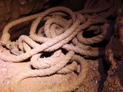
A rather later start to the day than anticipated, followed by a trail run down through Velvet Bottom with the dog and then washing yesterday’s caving kit, a change to plan’s to go to Whitcombes’ Hole. Went to the Hunter’s for lunchtime chinwag before heading over to Stockhill Woods, Mendips and the location of Snakepit (NGR ST 5482/5145). Snakepit is the site of an old dig I started with some BEC mates back in the 1990’s one of the “Far from the Maddening Crowd” series. It was obvious that nobody has entered the cave for years the lock was rotted and the key was useless so had to resort to the ‘universal’ key and will need to replace the now shattered lock. After clearing away the vegetation partially covering the lid I slid into the cave.
I wonder if this old hauling rope can now be classified as ‘cave archaeology?’
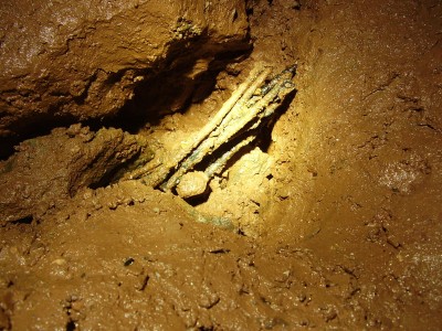
Or these remnants of rebar?
It might be worth another visit into Snakepit with some digging kit as there is an interesting partially mud filled tube that is worth further investigation. The cave is not really an ‘overall over pub clothes’ type of trip and I emerged rather on the damp and muddy side. Enjoyed it though!
13th May 2012
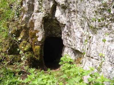
After a brief visit to Hallowe’en Rift to tidy things up I decided to take another trip up into Ebbor Gorge and visit some of the small cave sites there in particular Gully Cave. The image below is either Hidden Cave or Step Cave found at the bottom of a cliff exposure opposite Tower Rock.

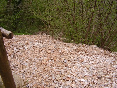
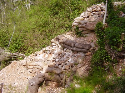
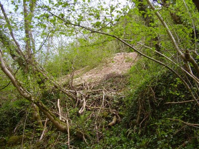
Further up the bank is found Gully Cave NGR ST 52548/48550 which has been the site of some recent excavation.
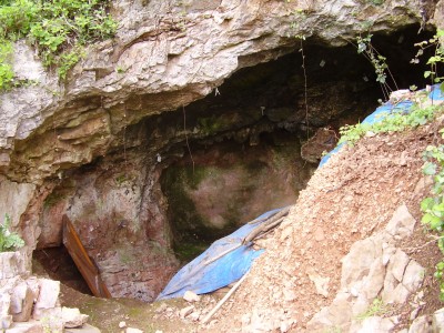
I could make some comments regarding the spoil disposal but will reserve my comments until another day!
A refreshment break at the Hunter’s was due. Some rather bizarre conversations involving stuffed cobra’s, Bavarian bear inkwell’s and ‘Big Al & Snabs’ 1960’s caving expeditions to Austria, in particular Totesgebirge, these were expeditions that lead up to the BEC’s later involvement in the Dachstien in 1965. After the Hunter’s I set off for Burrington Combe and Whitcombe’s Hole.
7th May 2012
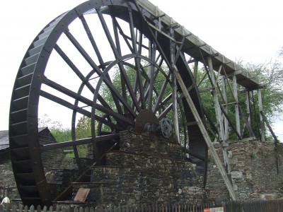
Family trip to Morwellham Quay. The site was mainly developed during the 19th century because of the copper mining industry and the necessity to ship the ore to where the coal was in South Wales. It retains much of the history of that period even though some items that are displayed did not originate from the site, such as the overshot wheel pictured below.
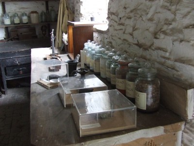
There are a number of interesting displays such as the Assayer’s Room (see below image) and plenty of re-enactments.
The site at Morwellham is the location where ‘Edwardian Farm’ was filmed and many of the sites are recognisable.
We also took a trip on the narrow gauge railway along the River Tamar and into the George and Charlotte Copper Mine. A conversation with Rick, the mine manager, revealed that he had visited Mendip on a number of occasions and had ventured underground to sites such as Stock’s House Shaft in the company of Tony ‘J’rat’ Jarratt, and had enjoyed the welcome of the BEC and the Hunter’s.
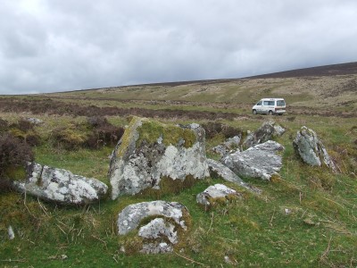
We travelled through Tavistock the town where I had been born and I tried my best to point out where the house we lived was once located. Nostalgia trip over we returned home over Dartmoor so that I could look at some of the settlement features seen in this remarkable landscape.
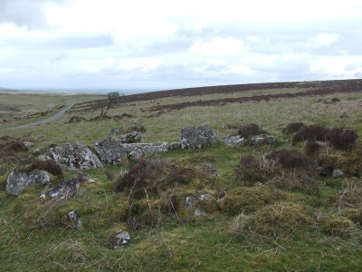
The settlement pictured above and below is found at East Bovey Head south of Challacombe Cross NGR SX 695/623 and comprises a number of hut circles and field systems.
6th May 2012
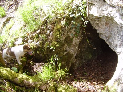
Pleasant day so decided to take the opportunity for a scramble with the dog to look at some of the small caves that are found high up in Ebbor Gorge, Mendip Hills.
Outlook Cave (above ) MNRC dug at this site early 1900’s and found human and animal remains dated Neolithic and later.
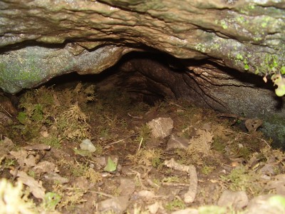
Eagle’s Nest (?) and hot dog, Buster. My hand-held GPS gave bearing co-ordinates of 5247/4862 although there was plenty of tree cover to affect the signal, Barrington and Stanton in Complete Caves, 1977 give NGR 5246/4859 for Eagle’s Nest.

Interesting spot – potential ? Best not give the bearing co-ordinates for this spot or the one below.

Another interesting little spot. Unfortunately digging is frowned upon in Ebbor, for most people anyway.
5th May 2012
Alex didn’t feel like a Hallowe’en Rift digging trip and suggested going for a mooch over the hills to look at some closed basin developments, none better than Cross Swallet (NGR ST 5157/5000) I suggested.

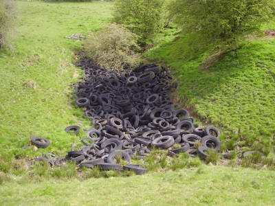
Described in ‘Complete Caves’ (for full reference see entry 4th May 2012) as a cruciform depression about 8 metres deep, taking a small stream, in centre of a deep closed basin a mile in circumference. Dug by the BEC and WCC at various times from late 1930’s to the late 1950’s. Dig was filled by dumping of tyres in the 1970’s and they are still there 40 years later.

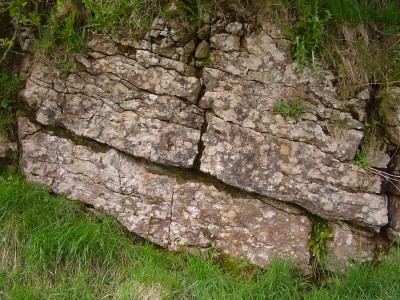
Walked on to take a look at Locke’s Hole (NGR ST 5088/5072) and Brimble Pit (NGR ST 5081/5075) where we ventured below the surface, good job I took a torch and a camera this time although the underground shots were not very successful. As usual a lengthy discussion ensued regarding a variety of points including the potential instability of Locke’s Hole and the interesting rock type/formation in Brimble Pit. Returned to Deer Leap car park via Cox’s Fields and the medieval field systems at Ramspits.
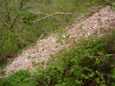
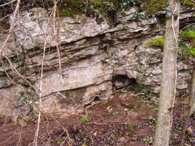
Headed over towards Dursdon Drove, Pen Hill end, where we stopped to look at some rock exposures in a shallow quarry by the side of the road. Rather interesting point here is that the bedding dips to the north east rather than to the south west as at Hallowe’en Rift area.
The image below shows the strata dipping to the southwest in the rock exposures lower down the hillside near to Hallowe’en Rift.
While we were in the area strolled over to the large circular, 100 metre circumference and 10 metre deep depression that is Bishop’s Lot (NGR ST 5496/4947), H. E. Balch dug at the site in the 1900’s and found there was a deep clay deposit (Barrington and Stanton, 1977).
4th May 2012
Walked from the Bristol Exploration Club’s (BEC) the ‘Belfry’ across to the Mineries, the former site of the St. Cuthberts lead works on the Mendip Hills. On the way stopped to look various sinks such as Waldegrave Swallet (NGR ST 5473/5155), Five Buddles, etc which are taking water after the recent heavy rain. Carried on through Stockhill Woods and across fields to Fairman’s Folly (NGR ST 5509/5273) the site of an old BEC dig in the 1950’s, later the Wessex (WCC) in the 1960’s to no avail, and Pounding Pot (NGR ST 55025262) dug by WCC in the 1970’s; both of these large depressions are in Harptree Beds, not good for digging. The significance of the depressions in this area is that they indicate there must be a cave drainage network beyond the passages already discovered in Wigmore Swallet and, perhaps some thought should be given to investigating this prospect further. Continued walk through ‘The Belt’ around Wigmore Farm to All Eights mineshaft and passing Home’s Close (BEC dig) and on towards Red Quar (NGR ST 5610/5181), noted on the way that Eric’s (another BEC dig) is already showing signs of collapsing, the shoring here apppears rather inadequate and I cannot see any logic in dumping spoil within the cone of depression and loading the slope. Back into Stockhill Woods to look at the fenced depression there, again taking a good flow of water before returning to Belfry. Unfortunately I didn’t take a camera or field bag which is rather bad practice for a geologist/archaeologist!
Reference: Barrington, N. and Stanton, W. 1977. Mendip: The Complete Caves and a view of the hills. Barton Productions in conjunction with the Cheddar Valley Press.