A Beast of Mendip?

Sunday 19th August 2012, Mendip Hills.

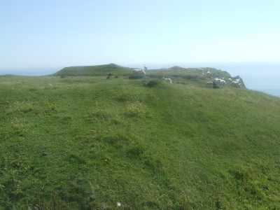
One of my, and of course my running partner, Buster’s favourite off-road runs is from Charterhouse down through Velvet Bottom to the Blackrock – Longwood path and back, about 3 miles in total.

On this particular Sunday morning at 08:00 there was a pretty thick fog and as we passed through the kissing gate down to Velvet Bottom and along the track I remember thinking to myself that the sheep were rather vocal, calling to each other. We continued on our way down to the Blackrock – Longwood path passing a solitary dog walker on the way. On reaching the path we turned and headed back towards Charterhouse, the pace was just slightly slower than normal – it’s been a hard couple of weeks after deciding to make a career change into commercial archaeology. Anyway, on the return I was rather surprised to see that the solitary dog walker was not much further ahead of where we had met on the way down and, as we passed by, he remarked “I’ve just seen a big black cat go into there” pointing into the thick undergrowth on the hillside, “There are a number of farms close by” I replied, “No” the dogwalker retorted, gesticulating with his hands wide apart in a classic angler pose, “A BIG, BIG BLACK CAT!” The dogwalker appeared to be genuinely shocked.

Was this the reason the sheep were being so vocal? Is there a Beast of Mendip?

What did I think? I kept on running, with an occasional backward glance at the hillside still shrouded in thick fog…

25th July 2012

Family day trip to the seaside to enjoy the fine weather, set off for the Gower, South Wales. 3.5 hours later arrived at Pitton and a 0.5 mile walk to the beach at Mewslade. The family settled down to an afternoon on the beach while I headed off to find Paviland Cave NGR SS 4370 8590. Along the way passed by a number of forts on the cliff top path.

The fort pictured above is on the cliff top above Paviland Cave. There is not an established path down to the cave but an approach is not too difficult. On the way is a rock shelter that offers some shade [for hot dog] and is used by the local sheep population.

On arrival at Paviland Cave the tide was still on the high side and access from the beach was not safe so backtracked and traversed the rock face at a higher level to the cave entrance, unfortunately had to leave the dog behind for a while.

Paviland Cave is of great archaeological importance and has been excavated on a number of occasions.

The first recorded excavation was in the early 1820’s by the Reverend William Buckland who uncovered the so-called ‘Red Lady of Paviland’, which actually turned out to be a fairly complete Upper Palaeolithic human male skeleton dyed with red ochre. Along with the Red ‘Lady’ burial were found a mammoth ivory bracelet, a perforated periwinkle pendant, numerous seashells and fifty broken ivory rods. Marker stones were placed at the head and foot of the grave.

Three bone spatulae have been revealed and the cave floor has also produced numerous flint implements along with the by-products of their manufacture, together with charcoal and ash found in contexts that appear to predate the burial. Radiocarbon dating suggests earlier occupation about 3000 years before the burial and there is evidence to suggest that the cave was intermittently occupied both before and after that date (Pryor, 2003 pp 45-51).

After visiting the cave site walked back along the cliff path to the beach joining the family and spend a couple of hours swimming in the sea, body boarding and exploring rock pools before heading back home, stopping for chips on the way, the kids were flaked.

Reference: Pryor, F. 2003. Britain BC: Life in Britain and Ireland before the Romans. Harper Perennial.

23rd July 2012

Summer holidays for the kids so taking a couple of weeks off to spend time with them. Another super day so decided to go for a walk up to Crook Peak and along Wavering Down. This is the same general location as Saturday’s excursion and the kid’s could not resist looking into Denny’s Hole.

One of our objectives was to locate Scragg’s Hole which is close to Denny’s Hole and we found some interesting spots on the way. The location pictured below was interesting as it had evidence of relatively recent block breakdown.

Very soon we had located Scragg’s Hole NGR ST 3964 5496 – a short but roomy cave containing a floor deposit of sandy thermoclastic scree. There has been archaeological excavation at the site, sporadically, between 1943 and 1953 revealing some Romano-British occupation.

Then it was out of the shade into the sunshine up to Crook Peak and over Wavering Down. Almost too hot for dogs.

Very satisfying to look back to where you have been. From Wavering Down looking west to Crook Peak.

At the top of the walk, now a drop down off the hill and stroll back across fields to Compton Bishop and the van. A very warm day.

Noted a couple of [possible] boundary stones along the way to Compton Bishop, they are not marked on the OS 1:25 000 Explorer Map 153 – Weston super Mare & Bleadon Hill.

Image Thumbnail
Image Thumbnail

21st July 2012

Glorious day and ended up over in the Rackley/Compton Bishop area with Alex Gee looking at some of the smaller cave sites in this location:

Denny’s Hole NGR ST 3967 5497 – overgrown pit drops down to roomy chamber with several smaller chambers reached via various passages and squeezes.

Fox’s Hole NGR ST 3966 5498 – tight vertical fissure drops into low chamber, likely to be connected to Denny’s Hole less than 10 metres away.

Sandy Cave NGR ST 3976 5493 – found in old quarry. Large entance leads to sandy floored passage ends in three small chambers. The limestone in this cave is particularly sandy.

We had lunch in Priddy Hall where a Caver’s Fair was in progress so afternoon was largely occupied chatting and listening to presentations. Met up with the family at the Belfry who insisted on returnig to the Caver’s Fair. Detoured to Eastwater to catch up on the archaeological investigation of a barrow site by the University of Worcester. Interesting little site.

4th July 2012

Left for someone else to clear up. What goes on in the heads of people who think that it is acceptable to drive into the countryside just to dump their rubbish?

This pile was spotted in a gateway on Dundry Hill. This sort of behaviour costs everyone who pays taxes even more money. It probably takes more effort to dump than it would to take it to a local authority tip and costs more in fuel!

16th June 2012

Following a mornings solo digging session in Hallowe’en Rift met up with Tangent at the Hunter’s. Headed over to Ebbor Gorge to meet up with the digging team at Gully Cave. Tangent drove to the car park and we carried up a supply of hessian sacks kindly donated by Cheddar Ales for the digging project.

Had a discussion with the diggers about their requirements for shoring the retained material and put forward some suggestions about how best to achieve their aims. It’s an interesting project. Tangent and I then went for a scramble around the higher rock exposures in Ebbor Gorge above Gully Cave and then around to Outlook Cave. The nettles and brambles have shot up since my last visit and shorts and trainers are not ideal in these situations. I said to Tangent that once the first lot a of tingles have taken effect then subsequent stings don’t really matter. My legs were still tingling the following day with some pretty angry looking scratches. The ivy growth also proved to be an interesting experience in my super slick soles. All good fun though.

10th June 2012

After yesterday’s efforts at Hallowe’en Rift with Alex a more relaxed start to the day ensued with a mid-day walk around Stockhill Woods, I was joined by some of the family, Roz, Callum and Buster the dog of course!

Replaced the shattered lock on Snakepit with a nice shiny new one, as supplied by the Council of Southern Caving Clubs (saw Les Williams, Conservation & Access Officer last night in the Hunter’s). Then a stroll around the usual favourites Stock’s House, Five Buddles, Wheel Pit which was taking a good flow of water after some recent heavy rain, and Waldegrave Swallet. The water that sinks here at these sites is resurgent at Wookey Hole and Rodney Stoke Rising. Walked through the woods to the large fenced depression which is showing signs of recent collapse where a small stream was sinking. Interestingly the water in this area probably feeds into Wigmore Swallet and is therefore resurgent at Cheddar. It is possible that the divergence of water in the Stockhill area is due to secondary porosity, perhaps the result of fracturing along the Stockhill Fault.

References

Many of the references used regarding cave sites given in these posts are sourced from two worthy tomes, in particular NGRs and descriptions, these references are mostly taken from;

Barrington, N. and Stanton, W. 1977 (3rd revised edition) Mendip: The Complete Caves and a view of the hills. Cheddar Valley Press.

Irwin, D.J. and Jarratt, A.R. 1999 Mendip Underground: A Cavers Guide. Bat Products. I have many different issues of this volume but only one signed ‘Cheers Vince’ by J’Rat and given to me after digging him out of a boulder collapse in Stock’s House Mine Shaft – a very fine man indeed and sorely missed!

27th May 2012

It was such a fine day that I decided to get on two wheels and go for a pedal up on to the [Mendip] hills. Warm ride up Ridge Lane but okay once into the breeze along the lane to Nordrach, then followed the track to Charterhouse and on to Priddy. A warm session that obviously required a stop at the Hunter’s Lodge Inn for refreshments and there I happened to meet up with John ‘Tangent’ Williams. After lunch we pedalled over to Stockhill Woods, pausing to discuss the possible relationships between Snakepit, the sinkholes – Waldegrave Swallet and Wheel Pit, and the mine workings – Five Buddles and Stock’s House Shaft, we then continued the ride, eventually ending up at Battery Swallet, a site that had previously dug by several members of the Mendip Caving Group in the late 1980’s, including myself. This was just before I joined a club, the Bristol Exploration Club, that was, at that time serious about cave exploration. The dig at Battery Swallet has seen some considerable recent activity and looks very industrious. We fought our way through the stinging nettles, always an interesting mission in shorts, to peer into Vee Swallet (NGR ST 5440/5383), a site that over the years has seen a number of so far fruitless attempts at digging including several members of the BEC. The sink appears to take a good flow of water on occasions. Another lengthy discussion then ensued regarding how the many sinkholes across the plateau in this area are related and we looked at the wider catchment areas visible from this position in the landscape. Finally, we headed off towards Wellsway where we went our separate ways, I trundled down the hill to return home where I noticed that my rear tyre was becoming increasingly less filled with air – just about good timing!

20th May 2012

A rather later start to the day than anticipated, followed by a trail run down through Velvet Bottom with the dog and then washing yesterday’s caving kit, a change to plan’s to go to Whitcombes’ Hole. Went to the Hunter’s for lunchtime chinwag before heading over to Stockhill Woods, Mendips and the location of Snakepit (NGR ST 5482/5145). Snakepit is the site of an old dig I started with some BEC mates back in the 1990’s one of the “Far from the Maddening Crowd” series. It was obvious that nobody has entered the cave for years the lock was rotted and the key was useless so had to resort to the ‘universal’ key and will need to replace the now shattered lock. After clearing away the vegetation partially covering the lid I slid into the cave.

I wonder if this old hauling rope can now be classified as ‘cave archaeology?’

Or these remnants of rebar?

It might be worth another visit into Snakepit with some digging kit as there is an interesting partially mud filled tube that is worth further investigation. The cave is not really an ‘overall over pub clothes’ type of trip and I emerged rather on the damp and muddy side. Enjoyed it though!

13th May 2012

After a brief visit to Hallowe’en Rift to tidy things up I decided to take another trip up into Ebbor Gorge and visit some of the small cave sites there in particular Gully Cave. The image below is either Hidden Cave or Step Cave found at the bottom of a cliff exposure opposite Tower Rock.

Further up the bank is found Gully Cave NGR ST 52548/48550 which has been the site of some recent excavation.

I could make some comments regarding the spoil disposal but will reserve my comments until another day!

Image Thumbnail

Image Thumbnail

Image Thumbnail

Image Thumbnail

A refreshment break at the Hunter’s was due. Some rather bizarre conversations involving stuffed cobra’s, Bavarian bear inkwell’s and ‘Big Al & Snabs’ 1960’s caving expeditions to Austria, in particular Totesgebirge, these were expeditions that lead up to the BEC’s later involvement in the Dachstien in 1965. After the Hunter’s I set off for Burrington Combe and Whitcombe’s Hole.

7th May 2012

Family trip to Morwellham Quay. The site was mainly developed during the 19th century because of the copper mining industry and the necessity to ship the ore to where the coal was in South Wales. It retains much of the history of that period even though some items that are displayed did not originate from the site, such as the overshot wheel pictured below.

There are a number of interesting displays such as the Assayer’s Room (see below image) and plenty of re-enactments.

The site at Morwellham is the location where ‘Edwardian Farm’ was filmed and many of the sites are recognisable.

We also took a trip on the narrow gauge railway along the River Tamar and into the George and Charlotte Copper Mine. A conversation with Rick, the mine manager, revealed that he had visited Mendip on a number of occasions and had ventured underground to sites such as Stock’s House Shaft in the company of Tony ‘J’rat’ Jarratt, and had enjoyed the welcome of the BEC and the Hunter’s.

We travelled through Tavistock the town where I had been born and I tried my best to point out where the house we lived was once located. Nostalgia trip over we returned home over Dartmoor so that I could look at some of the settlement features seen in this remarkable landscape.

The settlement pictured above and below is found at East Bovey Head south of Challacombe Cross NGR SX 695/623 and comprises a number of hut circles and field systems.