Centred on NGR SX 5476 5377
Published in Descent (285) April/May 2022 pages 34-37
Introduction:
A doline and associated network of cave passages were uncovered during infrastructure works for a major building development at Sherford, near Plymouth, Devon. In late July 2021, the author was asked to undertake a site visit and assessment when it was established that the talus material within the doline and cave passages, contained an important faunal assemblage. There followed several subsequent visits before archaeological/palaeontological investigations were commenced in November 2021.
This summary provides a general description of the cave and some observations on the cave formation processes. The faunal remains are currently undergoing specialist analyses and a separate, full report on the findings are expected to be published in the future.
Geology:
The underlying solid geology consists of Middle Devonian Limestone formed 385 to 398 Ma when the local environment was dominated by shallow carbonate seas in the Devonian Period. In the surrounding area are outcrops of pyroclastic, basaltic, igneous rocks (Middle Devonian Slates) also formed 385 to 398 Ma, these forming in an environment dominated by explosive eruptions of silica-poor magma. Also, in the wider area are superficial deposits consisting alluvial clay, silt, sand, and gravel formed during the Quaternary Period up to 2 Ma, isolated remnants of this material are likely be found locally, possibly filling other sinkholes (BGS online).
The cave:
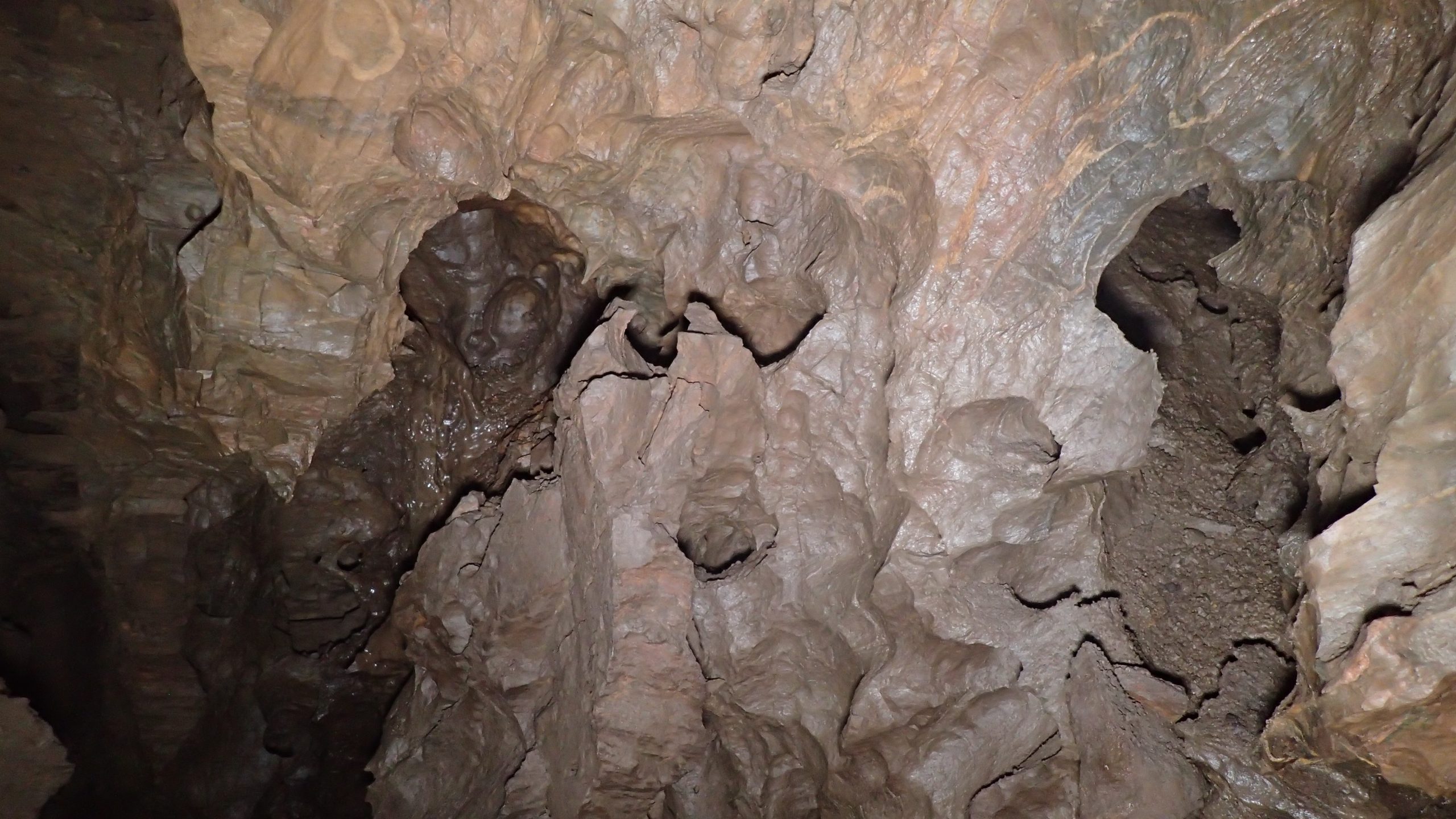
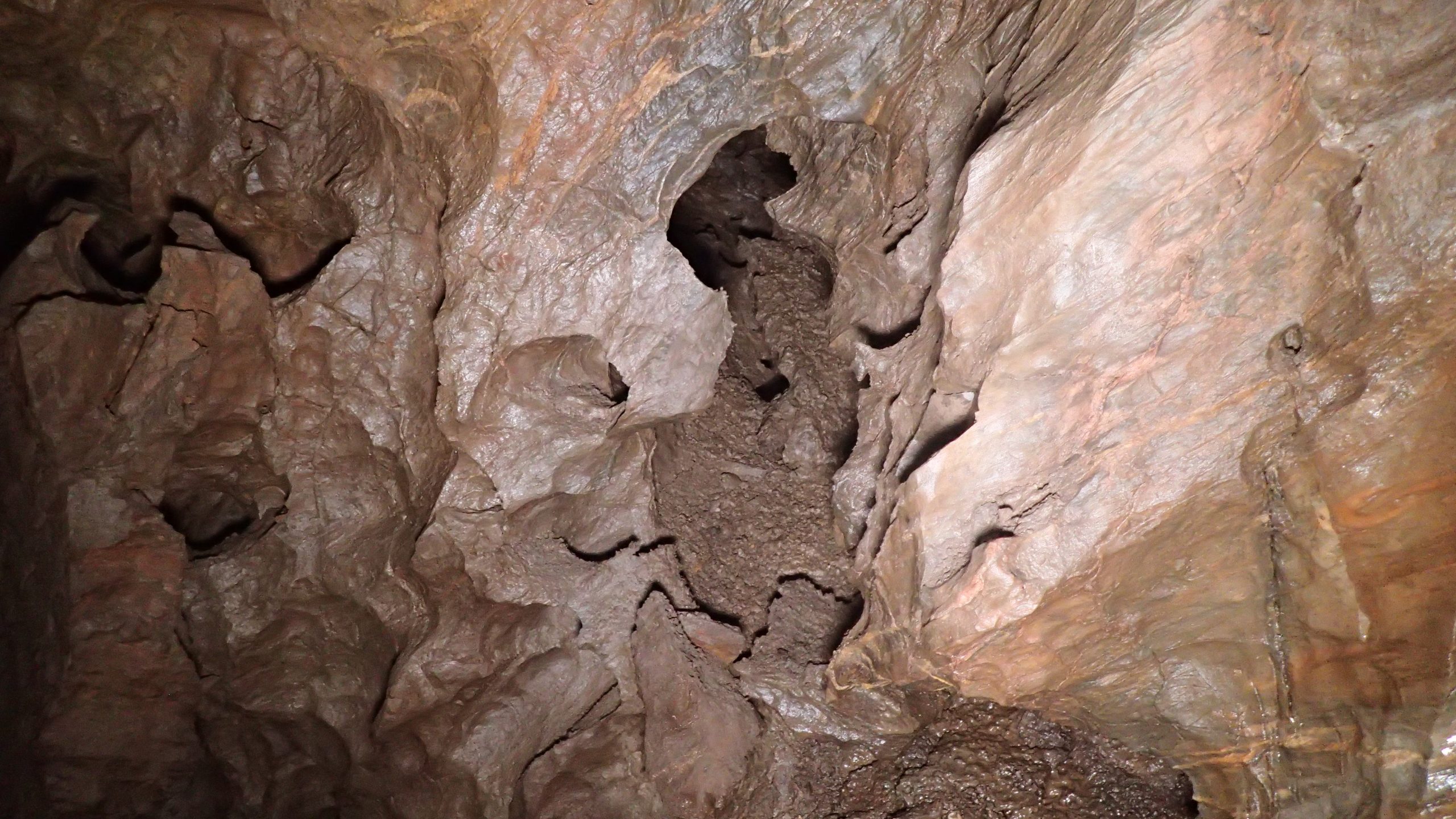
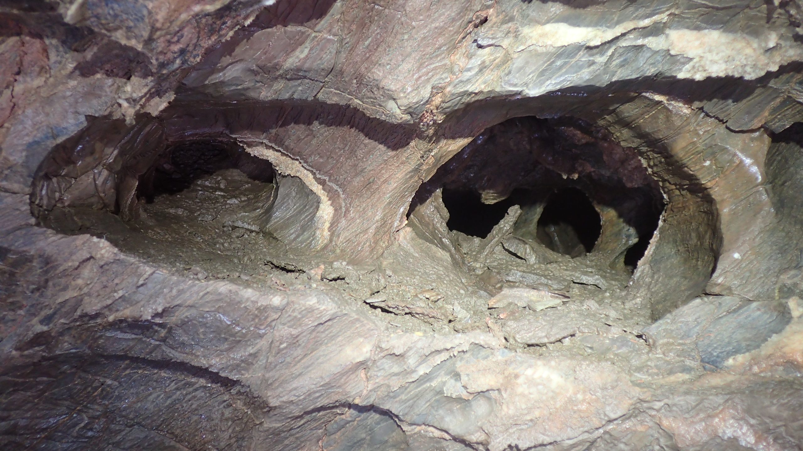
The open sinkhole, or doline, formed by collapse of the cave roof, is situated on a line of weakness along a fault fracture. From the bottom of the doline, an opening in the south wall leads downslope to gain access into roomy chambers to the east- and west-sides. To the east, a boulder-strewn walking size passage with some fine speleothems trends in a north-easterly direction passing a talus slope with a visible connection to the doline. A 5m climb up at the end leads into lowering passages that close down, eventually becoming too tight, the route is partially blocked by rubble from borehole works. On the southern side of the east chamber, a short climb over large boulders leads into the approximately 45m long south passage passing through a wriggle to The Last Rip. This passage is a mix of stooping, walking, and crawling among and over sharp and jagged boulders, along the way there are some decent calcite formations.
To the west side of the entrance slope, another roomy chamber with boulder-strewn floor, contains a fine white calcite drape in the roof. On the west side of the chamber a crawl, wolf passage, eventually becomes too tight. A small alcove on the northern side leads to a short 4m climb to gain access to a narrow rift, moving forward a couple of metres, followed by a tight climb down a small, decorated chamber is reached. This leads to another boulder floored chamber, on the north-side a 4m climb up through a small opening and climb down into the impressive Izzy’s Big Chamber, approximately 40m long, up to 12m wide and averaging 5m-6m high. This chamber is partitioned by massive boulders essentially into two sections, to the southwest a climb over boulders drops into the airy south-west section where possible cryogenic calcite was noted. The north-east section contains some very nice speleothems especially at the northern extent. A wriggle through one of a number of narrow holes leads to a continuation that soon closes down becoming sediment filled. A north/south rift links to the doline at the southern extent, this was probable another access route before the doline became filled.
Throughout the accessible passages the effects of modern intrusions from piling-works and boreholes are evident in the form of copious dust covering, grout and concrete overspill.
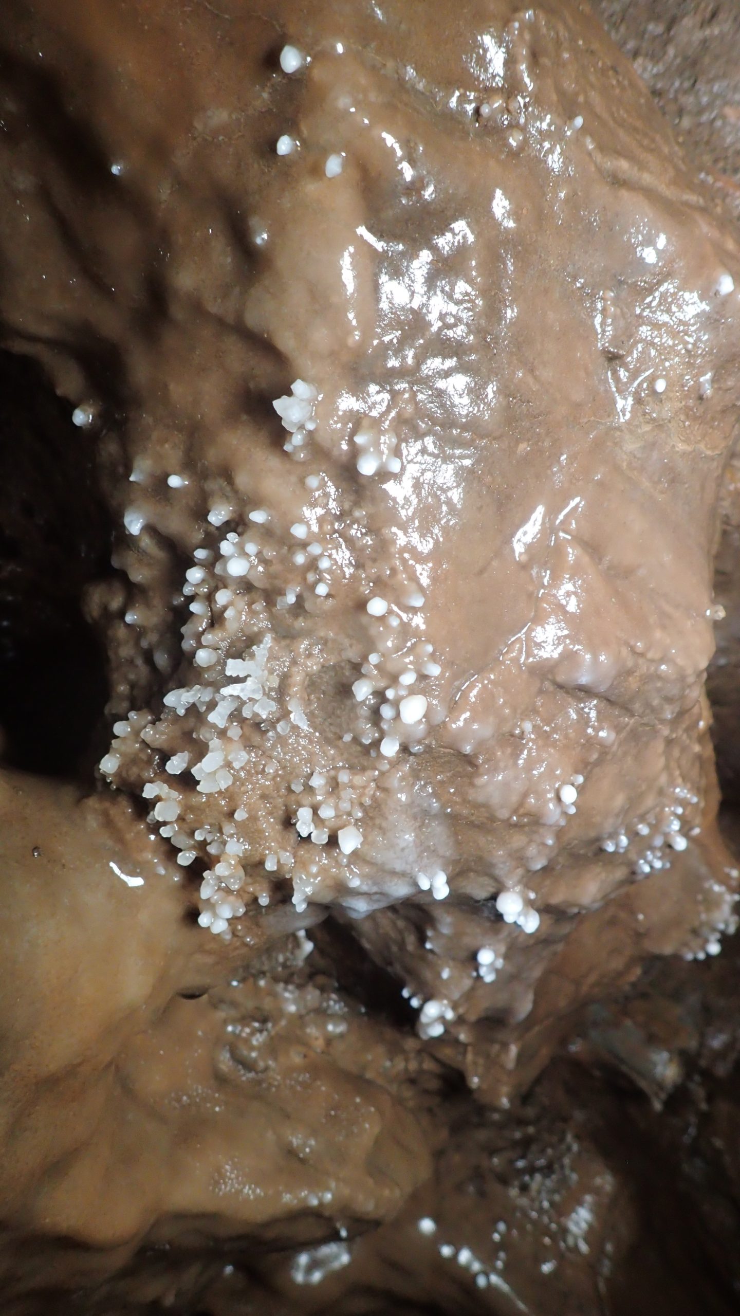
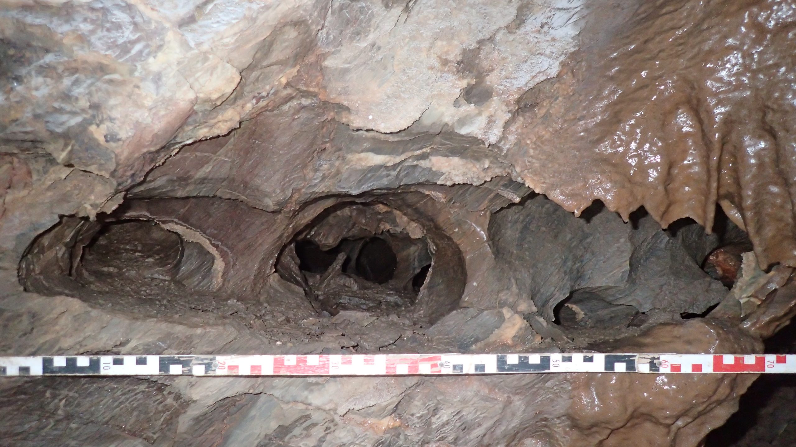
The extensive and complex cave system appears to be of hypogenic origin with the occurrence of later epigenic processes. Hypogenic speleogenesis is the formation of solution-enlarged permeability structures by waters ascending from below in leaky confined conditions, where deeper groundwaters in regional or intermediate flow systems interact with shallower and more local groundwater flow systems. Hypogenic caves are identified in various geological and tectonic settings (Klimchouk, 2009). There are no clear hydrological feeders to the system, later flow appears to originate down fissures. The cave walls show morphologies including semi-isolated chambers separated by lows blind terminations, domed roofs, large wall scallops, wall pockets, pierced partitions, bridges, and stepped wall-facets typical of slow convective currents of air or water. Many of the features are typical of initially isolated voids that have become integrated over time (Smart and McArdle, 2019). Botryoidal speleothems (cave popcorn) are a late phase secondary calcite precipitation which is often but by no means uniquely associated with hypogenic cave systems (Smart and McArdle 2019) are abundant throughout the cave network.
The cave deposits:
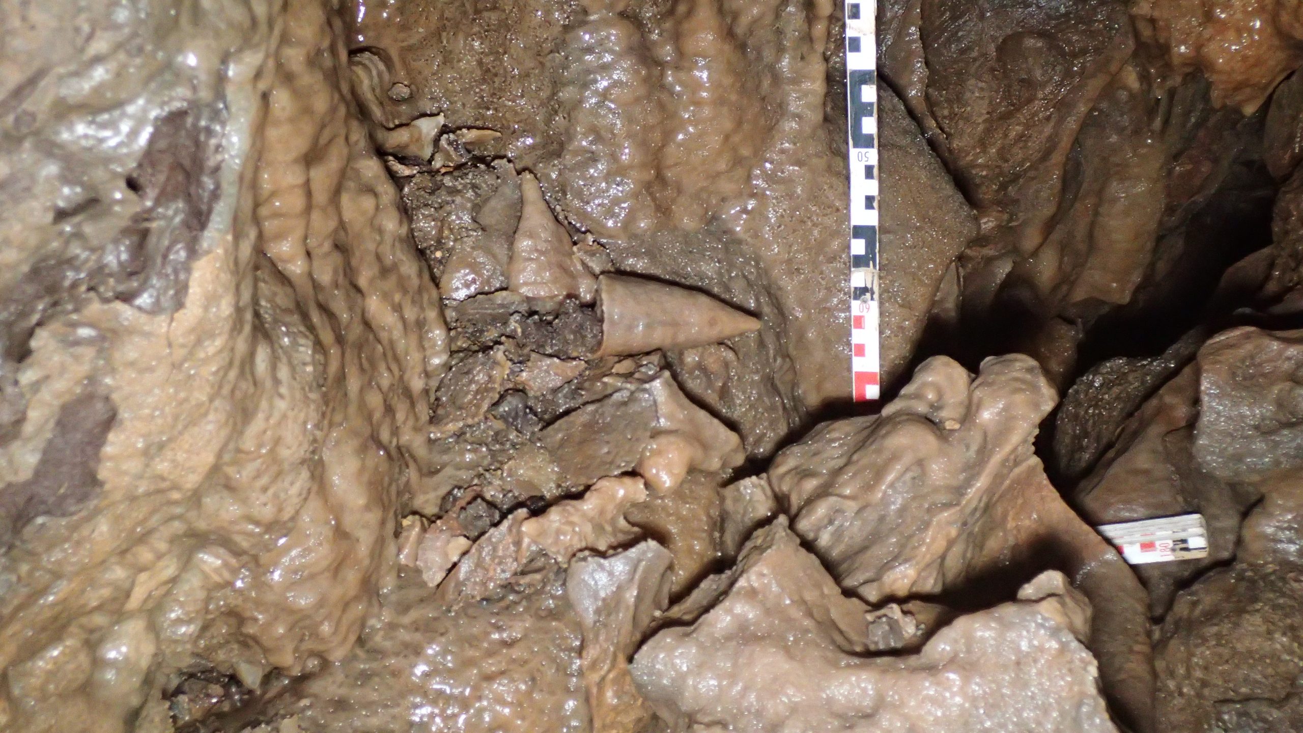
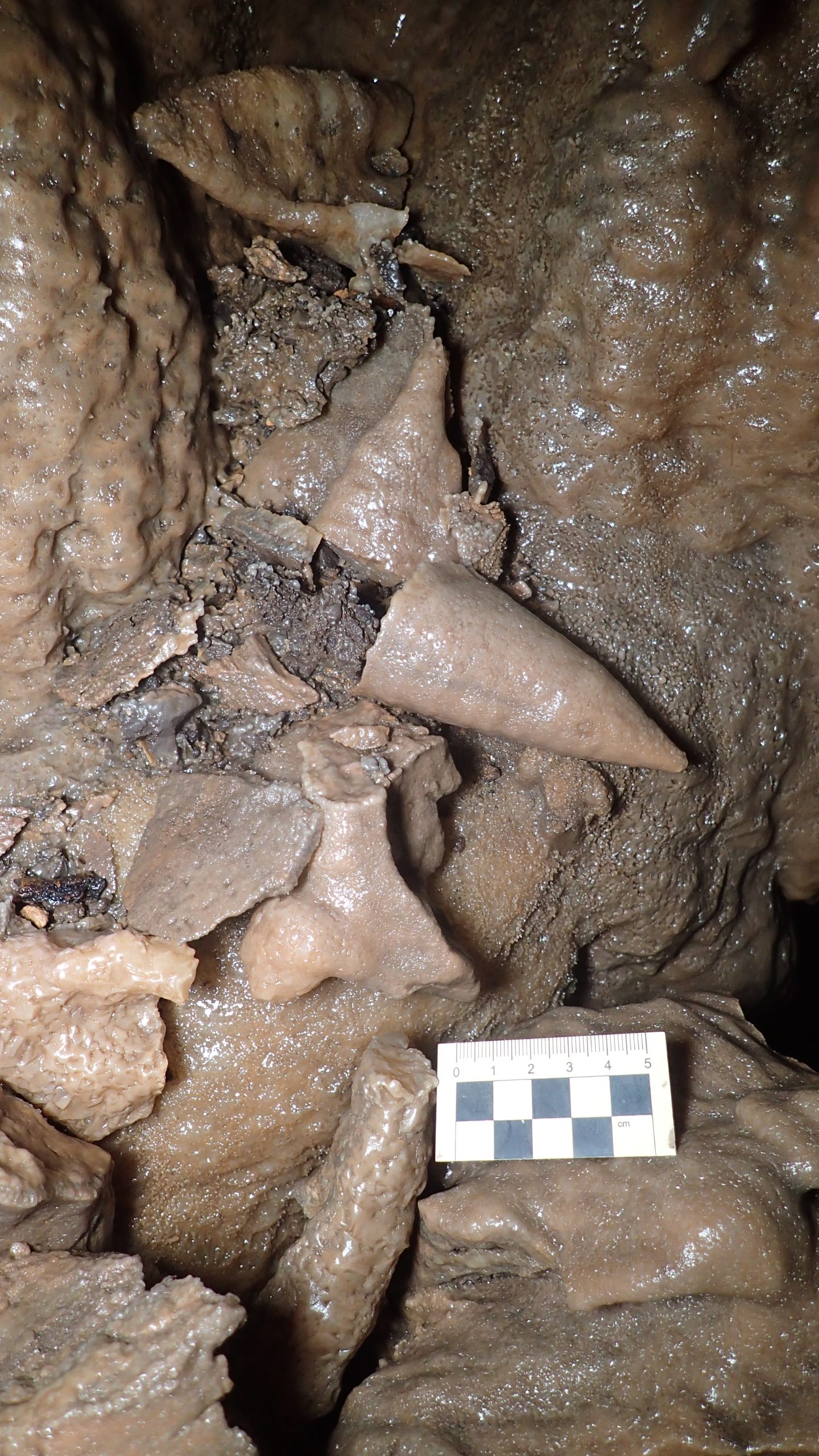
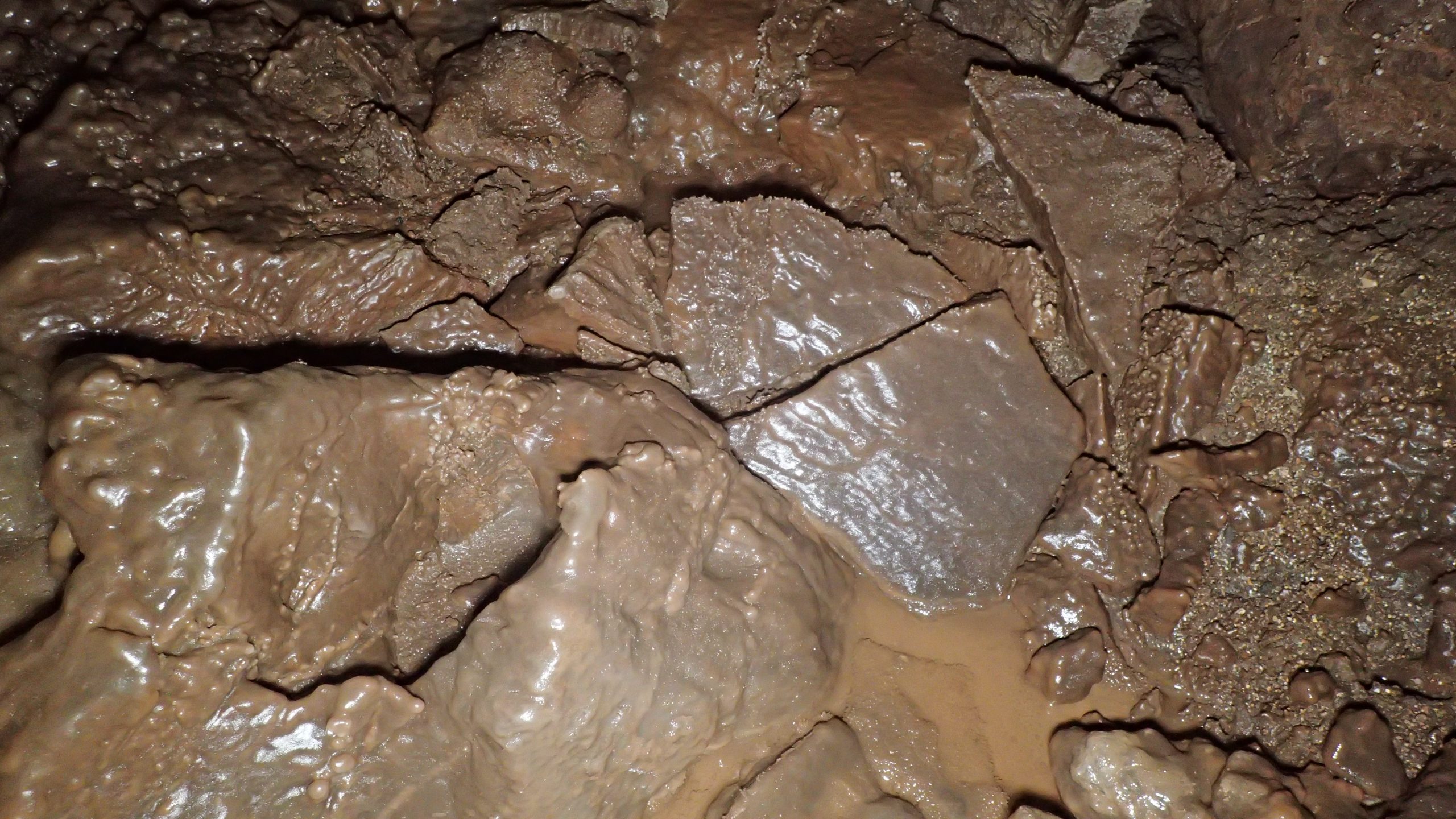
The open sinkhole is partially filled with talus (scree) that slopes downwards into the cave system below. It consists of mixed red, grey, and brown silty sandy gravel, cobbles, and boulders, thermoclastic in origin (the product of freeze/thaw processes). Granular material is angular to subangular, some tabular, of limestone. The talus material contains numerous bone fragments from a wide range of species, and within the cave, on the surface of the talus slope can be seen faunal remains. There is noticeable calcite deposition (flowstone) of the talus slope, especially deeper into the cave, and much of the granular material, including bones, has become cemented. Finer sediments below the coarse granular material might contain micro-fauna and human artefacts.
Faunal remains so far recovered and identified include woolly mammoth, wolf, woolly rhinoceros, horse, reindeer and hyaena. The faunal assemblage is suggested to originate from the Middle Devensian (MIS 3) period, c.60 to 20ka (Schreve, pers comm). At this time Homo sp. return to Britain. Pin Hole, Creswell Crags in Derbyshire is the defining locality for the Stage 3 faunal grouping. The Pin Hole mammal assemblage-zone (50 – 38 ka) includes woolly mammoth, woolly rhinoceros, wolf and bovid, as well as mountain hare, red-cheeked suslik, red fox, brown bear, stoat, polecat, spotted hyaena, lion, wild horse, giant deer, and reindeer. Humans are represented as part of the of the Pin Hole mammal assemblage-zone by skeletal material at Kent’s Cavern and Paviland and by artefacts of Middle and Early Upper Palaeolithic types at more than thirty other localities (Currant & Jacobi, 2001). Similar faunal assemblages have been identified to the west of Sherford Cave at Cattedown Caves, Plymouth (LEN 1021406) and south-east at Kitley Caves near Yealmpton (Freeman, 2015).
Evidence for the effects of Pleistocene frost and /or ice.
During the Pleistocene period, interglacial and warmer interstadial periods allowed the precipitation of calcite carbonate (CaCO3), resulting in speleothem (including stalagmites, stalactites, and flowstone) growth within caves in the region generally. The following glacial or stadial periods may have resulted in periglacial activity in the cave, during which the calcite layers became fractured by freeze /thaw processes. The term ‘periglacial’ is widely used to refer to those regions where frost action constitutes the dominant geomorphological process. Cyclic freeze-thaw activity, the growth of ground ice, and the presence in many (but not all) periglacial environments of permanently frozen ground, permafrost, leads to the development of a suite of highly distinctive deposits, sedimentary structures, and landforms. It has been suggested that permafrost in caves might have reached considerable depth, consequently forming an ice plug. During the following interglacials, thawing might occur to a lesser depth. Effectively the cave would be ‘plugged,’ causing meltwater to ‘pond’ or outflow. During the build-up of ice, as it freezes ice swells, during subsequent thawing episodes, the melting ice might flow and slide, thereby causing stalactites and curtains to be sheared off the roof and stalagmites tipped over or sheared off their bases and displaced. Lumps of calcite enclosed in ice can be deposited on inclined surfaces or be left in precarious positions which would not be stable if deposited by falling, for example, during earth movements (Simmonds, 2019). Some of these fractured, displaced, and redeposited speleothems can become cemented during later precipitation periods. Izzy’s Big Chamber contained several deposits of possible cryogenic calcite and samples of these were taken as well as reference speleothem samples.
Sources consulted:
British Geological Survey (BGS) Geology of Britain viewer: Accessed 22nd August 2021 https://mapapps.bgs.ac.uk/geologyofbritain/home.html
Currant, A. and Jacobi, R. 2001. A formal mammalian biostratigraphy for the Late Pleistocene of Britain. Quaternary Science Reviews 20 (2001) 1707-1716
Freeman, J. 2015. William Buckland’s connections to the last surviving Pleistocene collections from Yealm Bridge Caverns, Devon. The Geological Curator, Volume 10, No. 4 147-158
Klimchouk, A. 2009. Morphogenesis of hypogenic caves. Geomorphology 106 (2009) 100-117
Schreve, D. Head of Department and Professor of Quaternary Science, Royal Holloway University of London. Editor of Quaternary Science Reviews. Personal communications, August 2021
Simmonds, V. 2019. Evidence for Pleistocene frost and ice damage of speleothems in Hallowe’en Rift, Mendip Hills, Somerset, UK. Cave and Karst Science, Vol.46, No.2, p74-78. Transactions of the British Cave Research Association
Smart, P.L. and McArdle, S. 2019. Geomorphology of Denny’s Hole and associated caves, Crook Peak, West Mendip: A newly recognised hypogene cave complex. Proceedings of the University of Bristol Spelaeological Society, Vol.28, No.1, p65-102