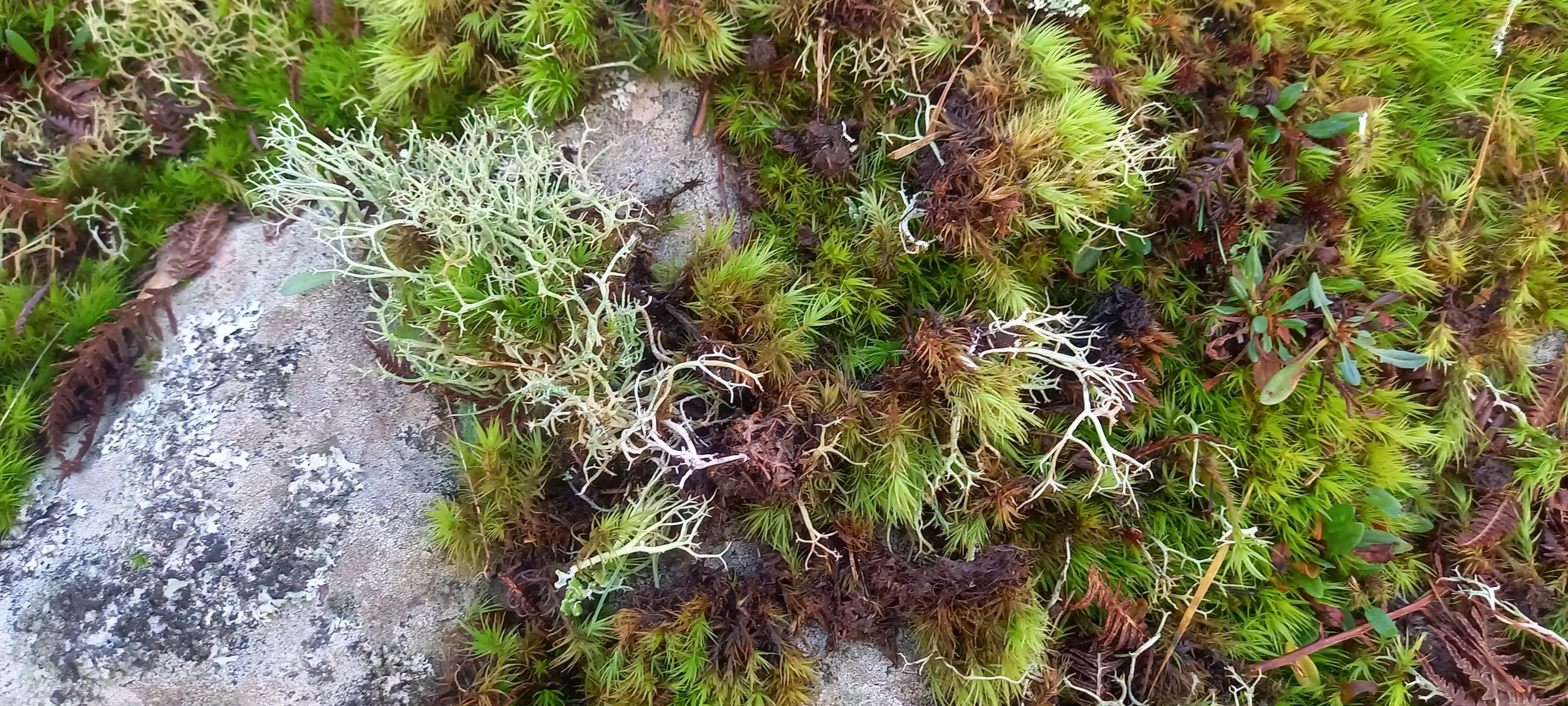
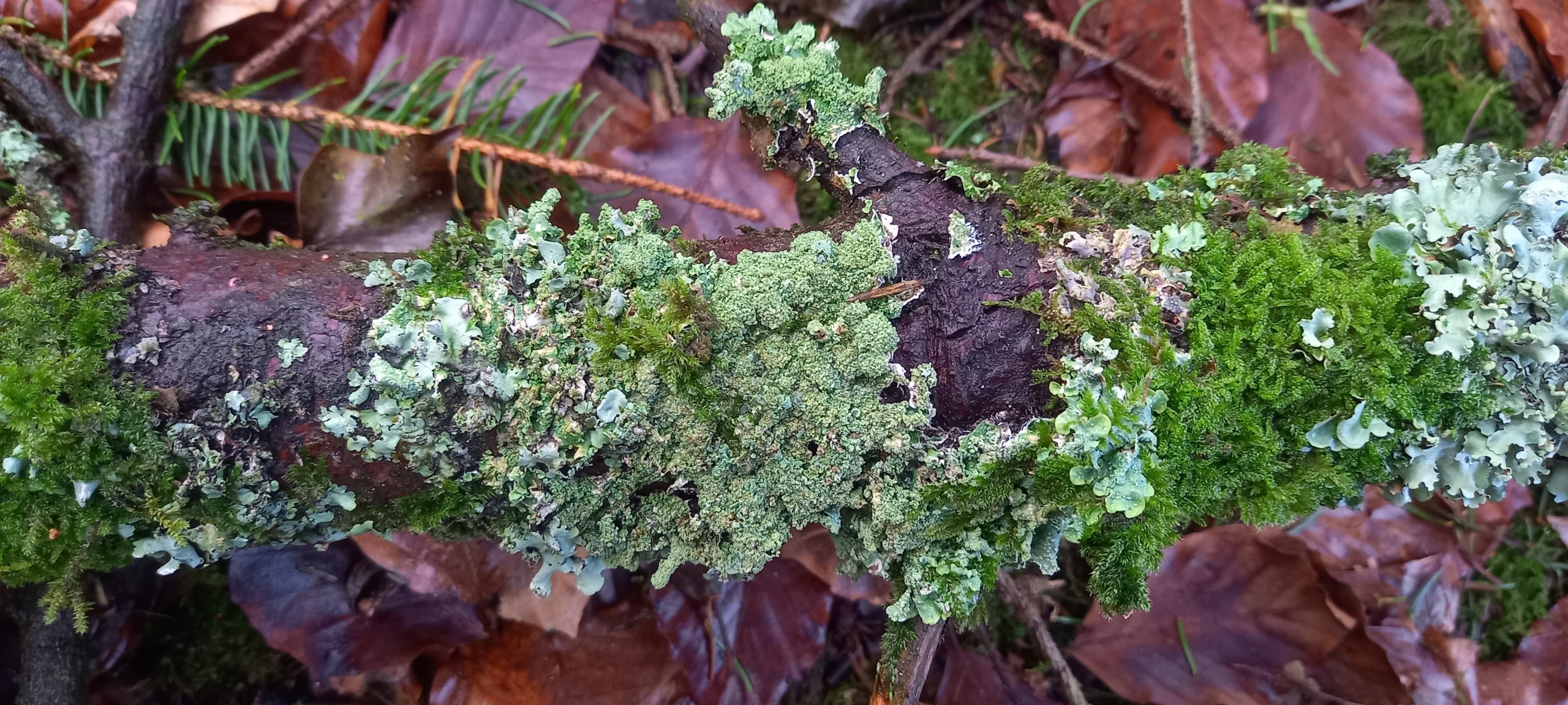
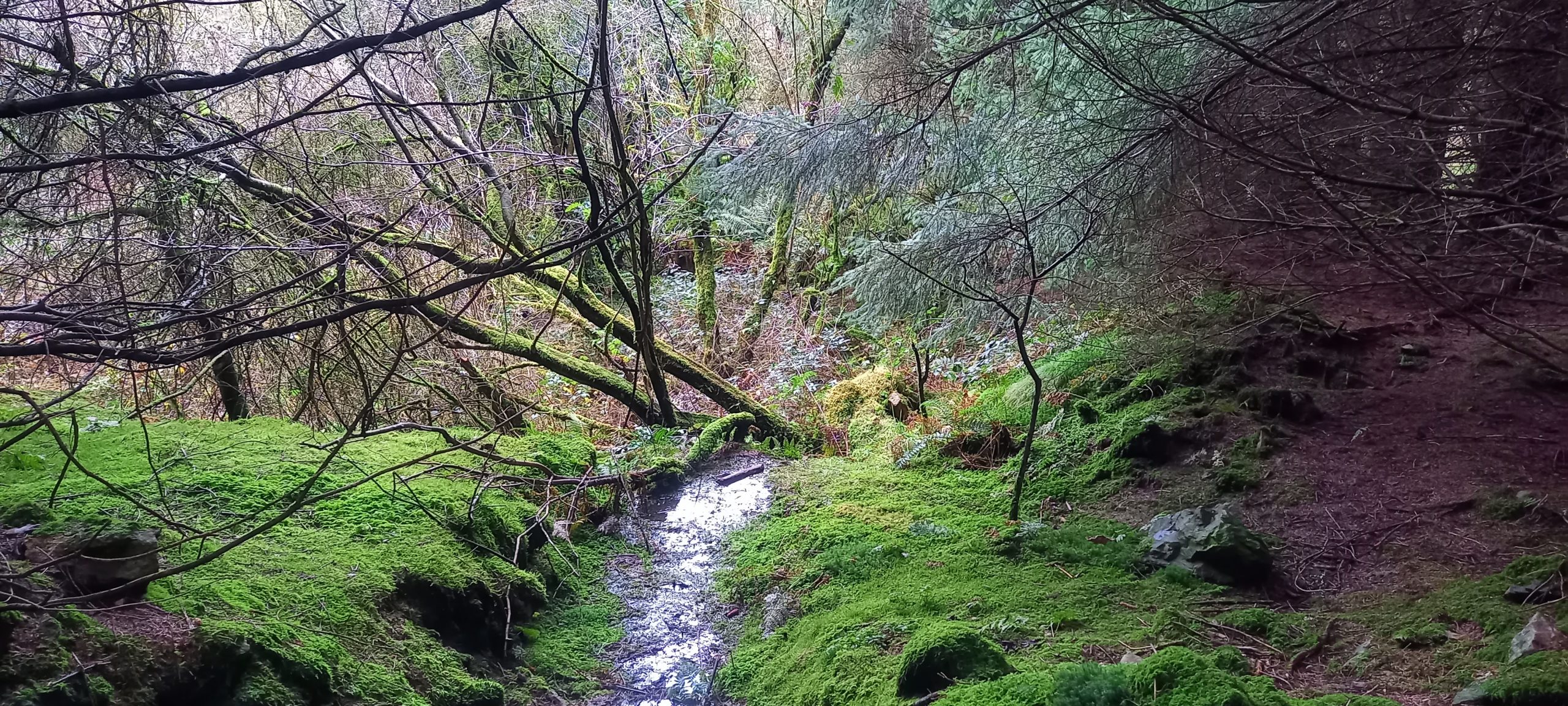
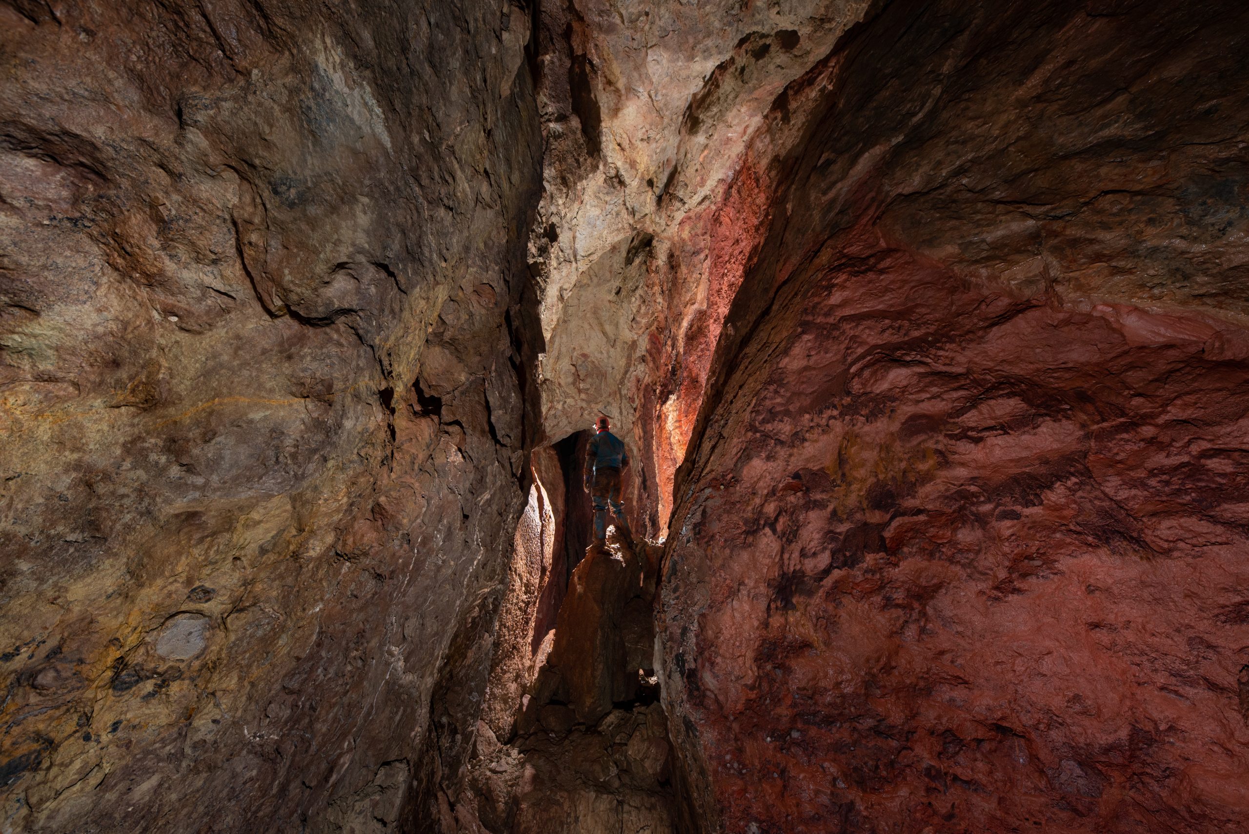
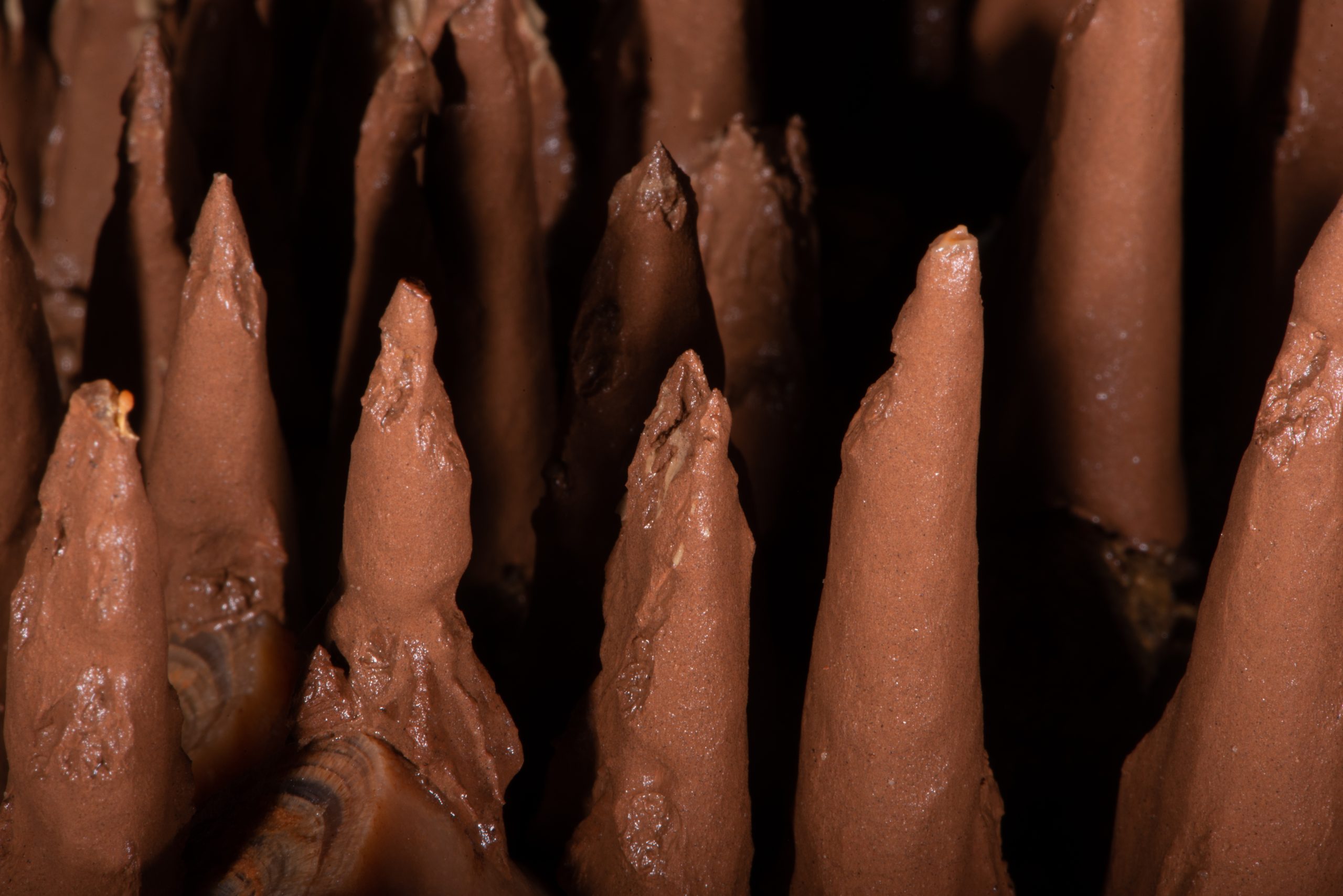
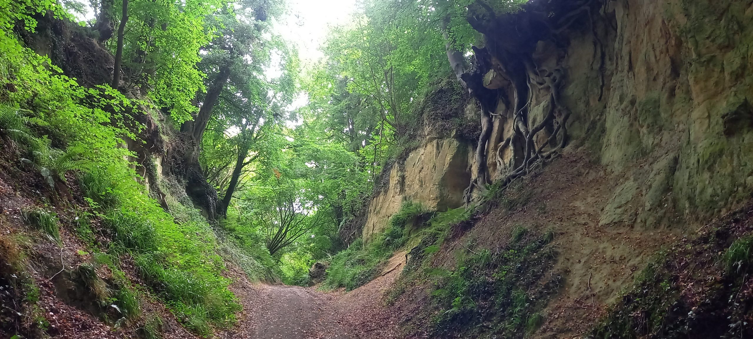
is all about excursions in the countryside including caving and digging trips, walks and thoughts.
Simmonds, V. 2014. An overview of the archaeology of Mendip caves and karst. Mendip Cave Register & Archive (MCRA). (currently being revised, 2016)
An overview of the archaeology of Mendip caves and karst is freely available online at www.mendipgeoarch.netand in the archaeology section of the Mendip Cave Register & Archive at www.mcra.org.uk
[A similar version of this report was published in Cave & Karst Science, Vol. 52 (1), 2025, p.32-34. Transactions of the British Cave Research Association.]
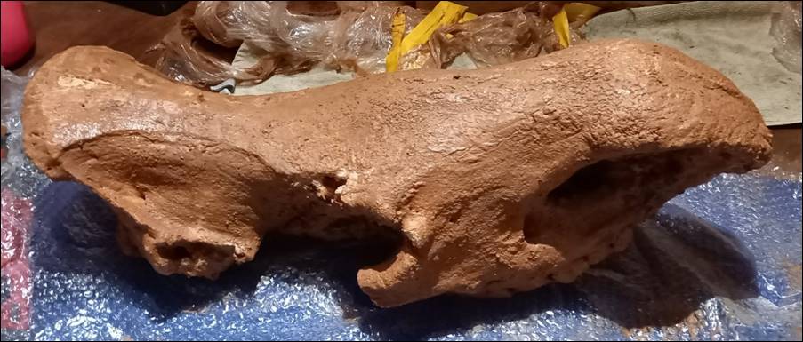
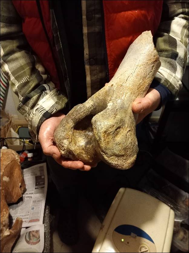
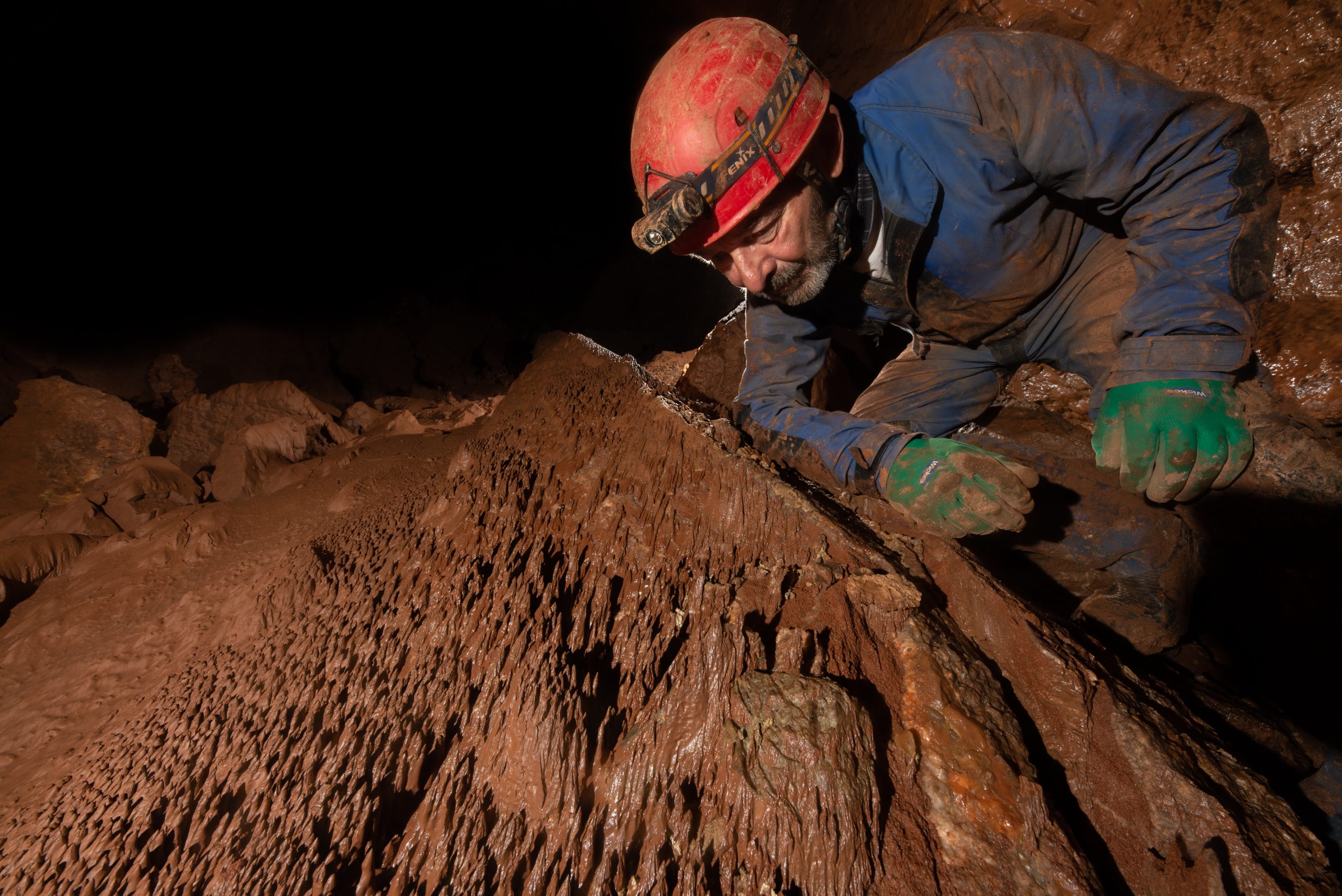
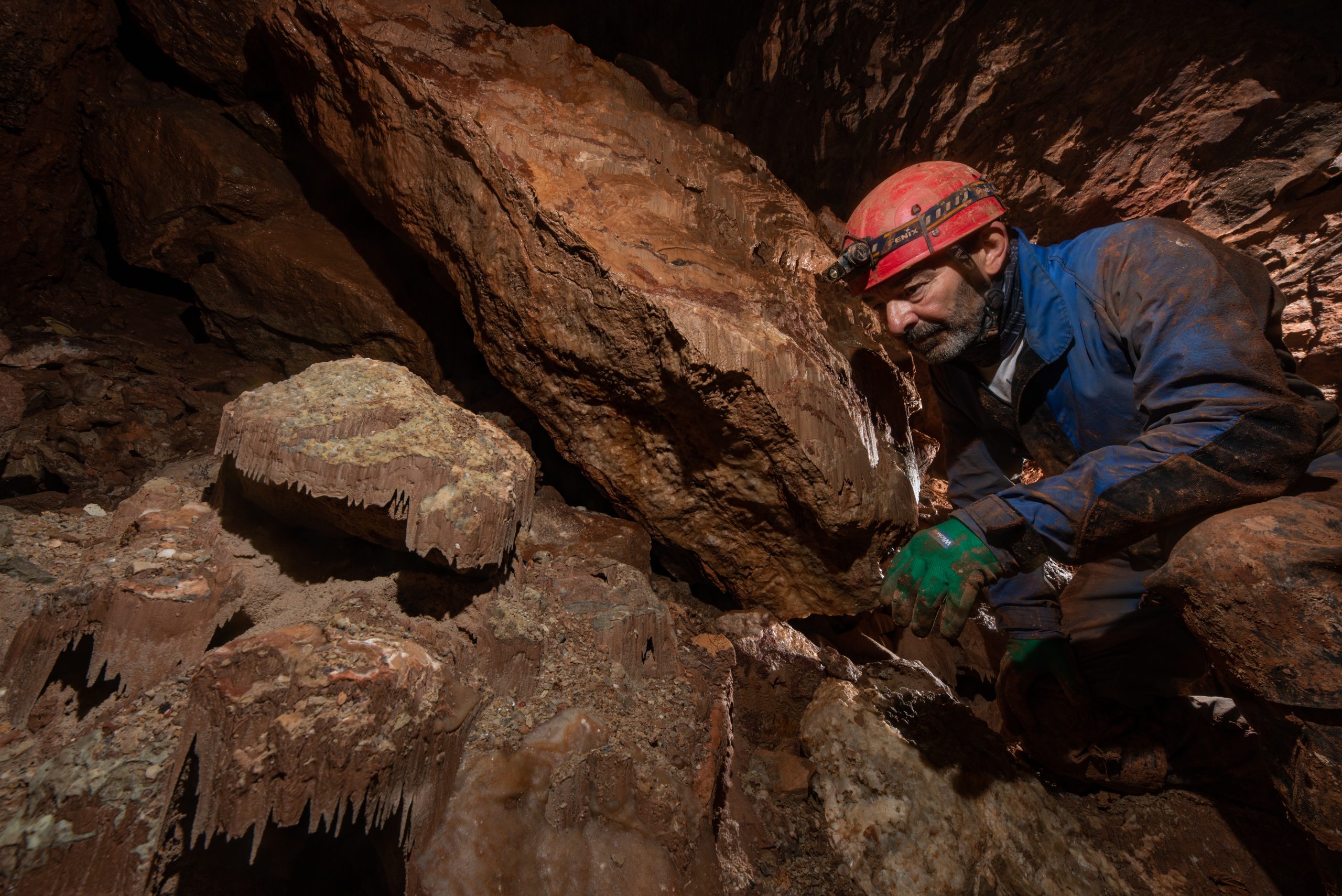
Quarter Way Up Hole (QWUH) is a small cave in Fairy Cave Quarry, Mendip Hills, Somerset (NGR ST 65529 47500). It is being dug actively by cavers in an effort to extend its current open length. It was during this process, early in 2025, that they uncovered some interesting and significant faunal remains, the digging team immediately sought advice and assistance. On 9th February 2025, the excavation leading to the recovery of a woolly rhinoceros (Coelodonta antiquitatis) skull took place at the cave. The skull had been located within an unstable boulder ‘choke’ and, because it was lying in an especially vulnerable position, it was clearly evident that immediate recovery was the only safe option. Several other partial skeletal elements, including femora and humeri, had previously been recovered, and these together with the skull form a substantial assemblage.
Vince Simmonds admires the woolly rhino skull following its excavation in QWUH cave. Photograph by Martin Grass 09/02/2025
Subsequently, the skull and other remains were cleaned carefully, to remove fine-grained sediments and granular material, after which they were allowed to dry slowly under controlled conditions. The skull and associated assemblage of faunal remains (including other species) have been deposited in the care of Professor Danielle Schreve at the University of Bristol. After an initial examination, Danielle has provided the following observations:
“The skull is absolutely magnificent, and I can confirm it is that of a large, male woolly rhinoceros. It’s also an old animal. Not only are its teeth very worn but it has a completely ossified nasal septum (the bony plate separating the two nostrils), which is a feature that gradually develops as the animal gets older, in order to strengthen the skull and support the very large nasal horn. Other features of the skull and shape of the nose also support this being an old individual and based upon comparison with the longevity of the extant white rhino, which has a similar morphology and grazing diet to the woolly rhinoceros, my provisional estimate is that the QWUH specimen was around 40 years old at time of death…
I haven’t looked in detail at the bones of the skeleton yet and there is work to be done refitting the fragments but there are parts of the major limb bones (humerus and femur) present. I am sure this must have been a whole animal that fell into the cave. It is very rare to find a complete individual in the fossil record and I only know of two other complete or partially complete woolly rhino skeletons in Britain, both of which were also accidental deaths…
The skull is beautifully preserved and covered with thin flowstone encrustation. It might be possible to get a Uranium series date on the stal, but the best initial option would be a radiocarbon date on the bone. For the time being, in terms of the geological age of the specimen, it is probably 40-50 000 years old and dates to the middle part of the last Ice Age…They are extinct in Britain by about 35 000 years ago.”
Currently, the recovered faunal assemblage from QWUH is undergoing more detailed study and conservation work, as mentioned above several of the fragmented bones refit.
Other sites on the Mendip Hills where woolly rhinoceros have been found include Gully Cave (Ebbor), Hyaena Den (Wookey Hole), Picken’s Hole (Compton Bishop), and Sandford Hill. Woolly rhinoceros, Coelodonta antiquitatis, has been recorded from the Lower Cave Earth deposits at Pin Hole, Creswell Crags, Derbyshire and has therefore been listed as part of the Pin Hole Mammal Assemblage Zone (MAZ), attributed to the Middle Devensian, MIS 3, c.59-24 ka. The Pin Hole MAZ also includes other large herbivores such as woolly mammoth, Mammathus primigenius, steppe bison, Bison priscus, wild horse, Equus ferus, and reindeer, Rangifer tarandus (Currant & Jacobi, 2001). During the Middle Devensian conditions were generally cold and dry, although the period is characterized by sharply oscillating climates ranging between milder periods and short cooling episodes, in which dry grassland ‘mammoth-steppe’ environments were dominant (Webster, 2008).
The woolly rhinoceros skull measures c. 75cm in length. Photograph by Vince Simmonds 09/02/2025A view of the teeth showing occlusal surfaces after ‘soft’ brushing.Photograph by Roz Simmonds 14/02/2025Woolly rhino, distal end of humerus. Photograph by Roz Simmonds 14/02/2025
Sources consulted
Andrew Currant & Roger Jacobi. 2001. A formal mammalian biostratigraphy for the Late Pleistocene of Britain. Quaternary Science Reviews 20 (2001) p. 1707-1716
Chris Webster. 2008. The Archaeology of South West England, South West Archaeological Research Framework (SWARF). Somerset County Council
Professor Danielle Schreve personal communications
A similar version has previously been published in Caves & Karst Science, Vol.51, No.3 (2024) pp.129-133. Transactions of the British Cave Research Association.
Abstract
During 2024 excavations in the area known as ‘Can of Worms’ in Hallowe’en Rift, an interesting sediment deposit was exposed and later sampled. A sub-sample was washed to remove the silt and clay fractions and revealed an abundance of ferro-manganese spherules. On closer examination, the spherules exhibited a concentric layered internal structure with several having a central, angular mineral grain around which the layers were formed, analogous to the growth of pearls in oysters or the formation of ooids, which are a type of carbonate or iron-coated grain, commonly with a cortex of fine laminae lacking biogenic features, and with a nucleus, such as a shell fragment or sand grain. Permafrost conditions on Mendip during the Pleistocene Epoch are thought to have penetrated to significant depth, with subsequent periods of thaw reaching lesser depths resulting in a deep impervious ice plug causing meltwater to be trapped and ‘ponded’. The ponded meltwater was ‘topped up’ by the ingress of surface-derived water, probably reflecting seasonal changes. The rise and fall of water created currents within the flooded cave, leading to agitation of particles and precipitation of minerals that coated particulates by a process analogous to that which creates ooids. The ‘pulsing’ of water also led to the deposition of rhythmites, which are observed in sediments throughout the cave.
Introduction
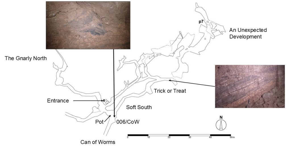
Hallowe’en Rift, at British National Grid coordinates ST 5353 4811 and altitude 148m above Ordnance Datum (aOD), has a current surveyed length exceeding 300m, with a vertical range of about 25m. The cave is located in a wooded hillside northeast of Wookey Hole Cave (Mendip Hills, Somerset). Initial excavation of the cave began in 1982, when the current access route was blasted open, but by the end of the 1980s interest at the site had waned. In the early-1990s, activity at the cave re-commenced briefly before other projects and interests took precedence. The current phase of activity began in 2009, and the exploration and investigation of the increasingly complex cave is ongoing (2024); several potential leads are actively being pursued.
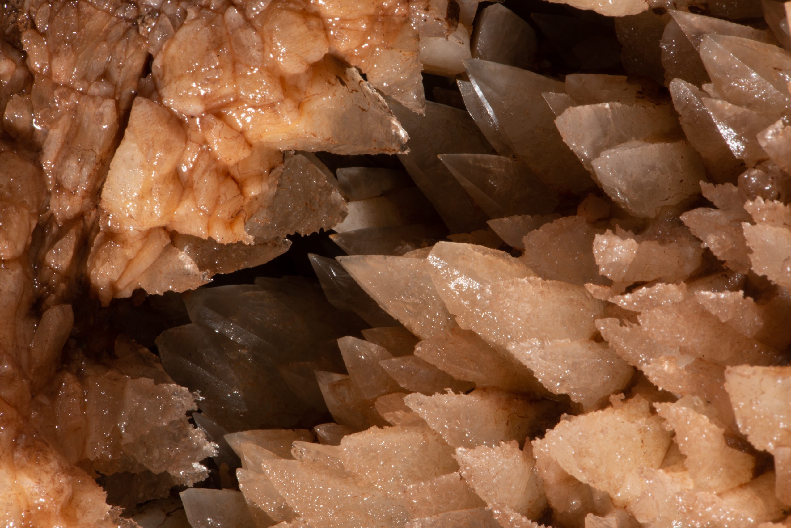
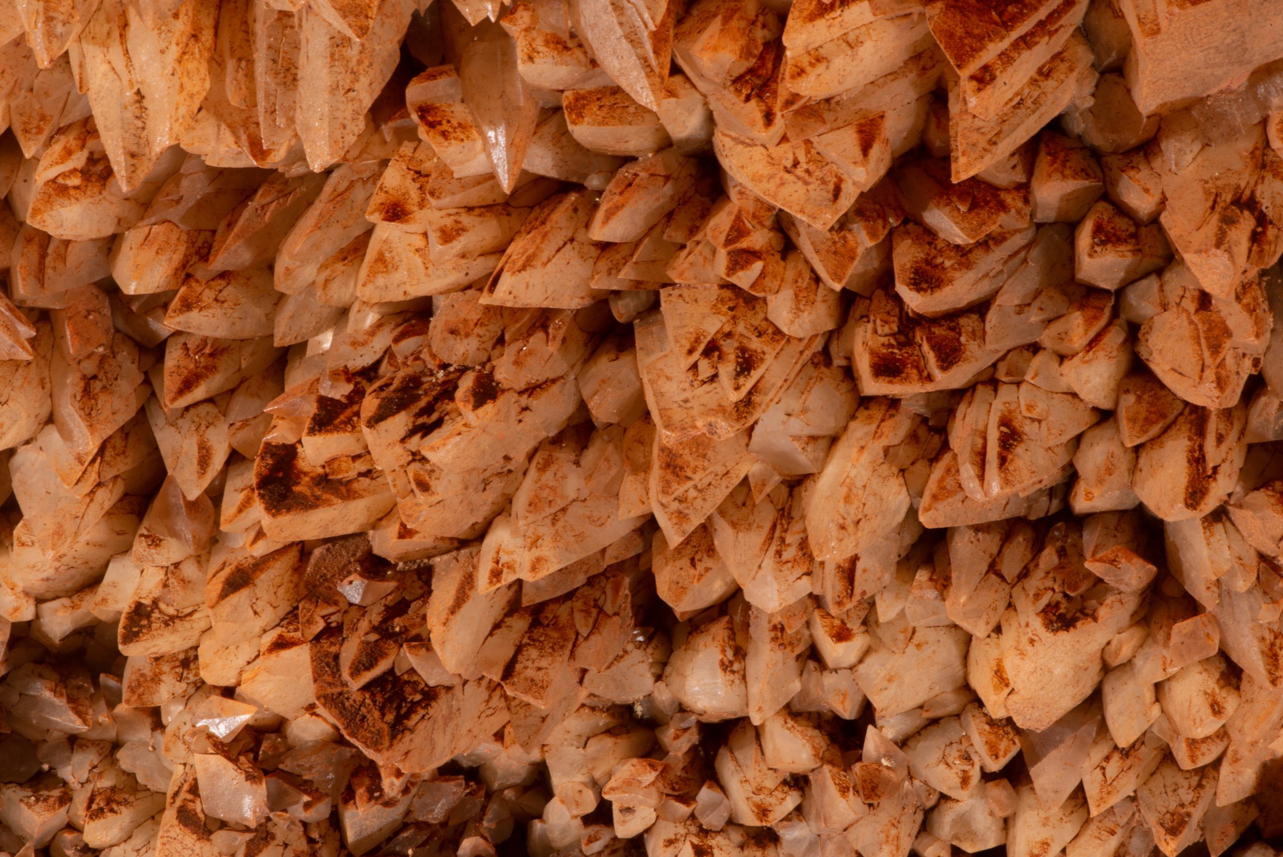
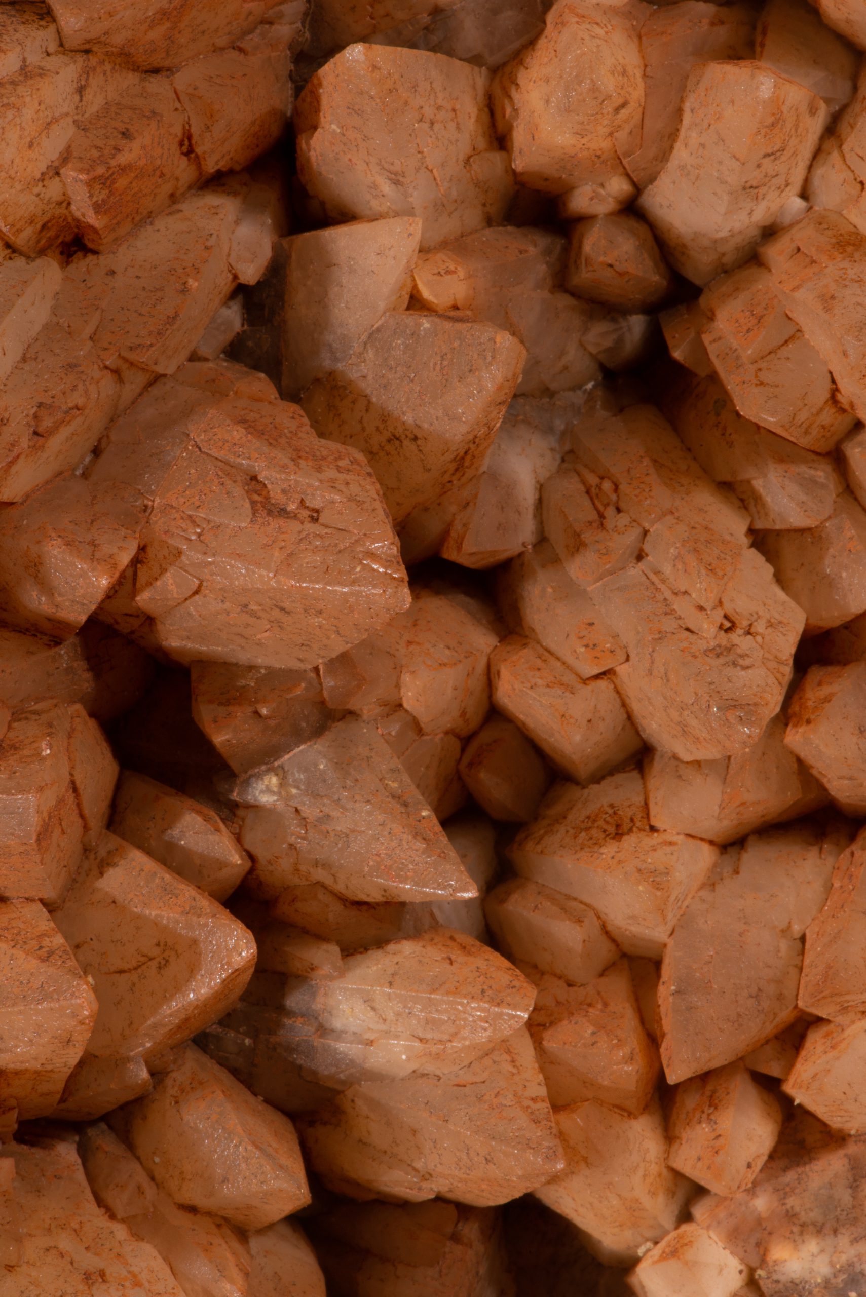
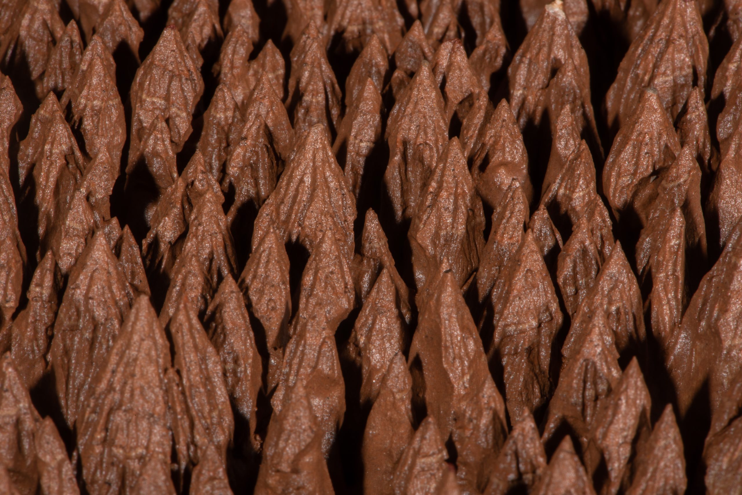
Figure 1. Hallowe’en Rift survey. BCRA 5c by D. Price, R. Taviner and V. Simmonds
The ‘upper’ cave passages consist mostly of low passages leading to the more spacious area of An Unexpected Development (Fig.1). The ‘lower’ sections of passage, known as the Soft South, are more generally walking- to stooping-sized with several good exposures of sediment deposits. The cave passages are all formed within strata deposited during the Triassic Period, 251.9 to 201.3 million years ago. Most of the now accessible passages were completely or partially filled with deposits of sandy silt/clay, containing many scattered cobbles and boulders of dolomitic conglomerate and common clasts of fragmented speleothems, including broken stalagmite, stalactite, and flowstone; in places there is also evidence for bioturbation, in the form of root disturbance. U-series dates of speleothems range from c. 500 thousand years (ka) to 50 ka, indicating that the cave passages were open to some extent during that time. Sediment deposition within the cave passages occurred mostly late in the Pleistocene Epoch and in the Holocene Epoch. Most of the known passages have been made accessible by excavation. Recently discovered sections of open cave passage were found to contain abundant shattered speleothems and a variety of interesting geomorphological features relating to frost/ice damage within the cave (Simmonds, 2019). Currently, work continues to follow a large sediment-filled fossil passage trending towards northeast-to-east, leading from the base of a c. 3m deep pot, where a connection to Trick or Treat has been achieved and access to passages beyond is currently being pursued.
Sediments
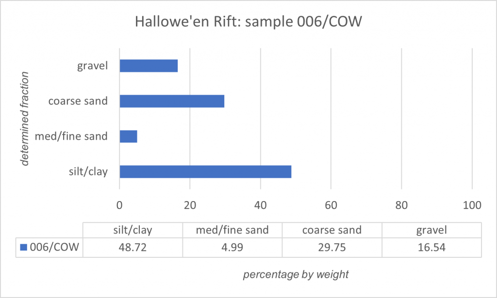
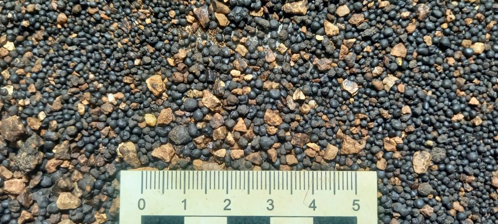
During 2024, a change of circumstances prompted a review of the digging strategy and the development of an ‘alternative’ dig (now known as ‘Can of Worms’) leading approximately south-westwards from the ledge at the top of the pot in the Soft South. During digging activities, an interesting-looking sediment deposit was exposed (Fig.1). A bulk sample (about 1kg) was taken on 03/02/2024, from which a sub-sample weighing c.200g was later washed over a set of nested test sieves (2mm, 0.6mm, 0.063 mm), removing the silt/clay fraction and retaining the sand- and gravel-size particles (Fig.2 and Plate 1). Visibly evident in the residue was an abundance of iron/manganese (Fe/Mn) spherules. Most of the spherules were coarse-sand size (passing 2mm mesh, retained 0.6mm mesh) with a smaller quantity classified as granule-size (passing 6.3mm mesh, retained 2mm mesh).
The presence of these Fe/Mn spherules had previously been noted in other sediment samples taken in Hallowe’en Rift although not in such high concentrations.
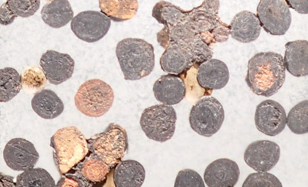
To investigate their mode of formation, a representative selection of spherules was set in a small block of epoxy resin and polished down to determine their internal structure. The resulting polished epoxy block revealed that most of the spherules examined had a concentrically layered internal structure. Several of the spherules also contained a central, angular, mineral grain around which the layers had formed, in a manner analogous to the growth of ‘pearls in oysters’ or the formation of ooids. Broadly in the current context, ooids are a type of carbonate or iron-coated grain with a cortex of fine laminae, lacking biogenic features, with a nucleus, most commonly comprising a shell fragment or a sand grain (Kearey, 2001). The term ‘pisoid’ (or ‘pisolith’) might also be used, because structurally they are similar to ooids, but pisoid is generally, applied to larger sizes (≥ 2mm in diameter), whereas ooids are normally considered as ≤ 2mm (Kalinina et al., 2024).
Plate 1. Sample: 006/COW, washed over 63-micron test sieve (ungraded). Abundant iron/manganese spherules are clearly evident ranging from sand- to fine gravel-size
Plate 2. Ferro-manganese spherules set in epoxy resin block and polished to reveal internal structures. Fe (iron) spherules are reddish brown, Mn (manganese) are dark grey. Most of the spherules display a concentric pattern, with others appearing to be formed around an angular mineral grain, much as pearls are formed in oysters.
Initially, it was thought that these spherules had been accumulated through turbulent eddies during multiple flood events occurring throughout the Pleistocene, the denser sand- and gravel-sized Fe/Mn particles being deposited as pockets or lenses. Subsequently, as energy and turbulence dissipated, the interstices between the coarse-grained particles becoming filled by silt and clay transported by water movement through the sediments over an undetermined period. However, it is now thought more likely that the laminated coarse- to fine-sediments (fining upwards) deposited in Hallowe’en Rift are a result of freeze/thaw ponding causing water to ‘pulse’ through the cave in a cyclical process (Bull, 1980).
Rhythmites are finely laminated sediments in which two or three different lithologies are regularly repeated, they are common features of glacial lakes (Kearey, 2001). Permafrost conditions on Mendip during glacial periods throughout the Pleistocene period might have reached depths of ~80–100m, resulting in the blocking of Hallowe’en Rift (and other caves) by ice plugs. During warmer interglacials and interstadials, thawing might occur to a lesser depth, perhaps ~50m. Effectively the cave would still be ‘plugged’ by deeper ice, causing meltwater outflow and ‘ponding’ (Simmonds, 2019). The ponded meltwater ‘topped up’ with the ingress of surface-derived water, probably reflecting seasonal changes. The rise and fall of water creating currents within the flooded cave allowing for agitation of particles and the precipitation of minerals coating particulates in the same process that creates ooids. Precipitation is dependent upon the concentration of ions in solution and factors such as temperature and pressure. Water with high oxygen saturation is favourable for the formation and precipitation of ooids (Kalinina et al., 2024). Precipitation can occur when the temperature of the solution falls, when solute evaporates, or with changing chemical conditions in the solution. Saturation is the point at which a solvent can hold no more solute. Observations in Hallowe’en Rift confirm that ongoing ingress of water through surface soils into the cave readily precipitates carbonate, and that only short time-scales are required for this to occur. Water presently encountered in the cave originates via percolation, there are no sinking streams.
Cave sediments can be divided into two broad categories: clastic sediments and chemical sediments. Clastic sediments are moved mechanically whereas chemical sediments are formed in place, precipitated from solution in seeping, dripping, or flowing water. Clastic sediments can be further subdivided into materials that are derived locally within the cave (autochthonous) and those that are transported into the cave from the surface (allochthonous). Chemical sediments are subdivided into categories based upon their composition (White, 2007), including travertines, evaporites, phosphates, resistates, and ice. In the case of the Hallowe’en Rift spherules, clastic sediments provide the nucleus around which chemical sediments precipitate. Iron (Fe) and manganese (Mn) are commonly found in cave environments, especially as oxides and hydroxides. Their presence is generally indicated by characteristic colours, including reddish-brown, orange, and yellow in the case of iron, and dark brown to black in the case of manganese (Kotula et al., 2019). These compounds are essentially insoluble in neutral pH water and so are known as resistates (White, 2007), i.e. they are minerals that are resistant to chemical weathering. Black coatings that commonly occur to cover stream sediments are usually described as manganese oxide. These oxides appear as thin (<1 mm) coatings although thicker and more massive deposits are known to occur (White, 2007). In general, the clastic sediments found within Hallowe’en Rift comprise variably red to red-brown silt/clay abundantly layered with variably grey to grey-black silty sand containing many subangular or subrounded cobbles and boulders of the locally occurring (Triassic) Dolomitic Conglomerate and of calcite flowstone and fractured stalagmites and stalactites. There are also less extensive deposits of yellow and greenish-yellow, slightly silty, sand, though this layer generally lies towards the base of sediment sequences in the deeper sections of the cave, in some cases underlying a degrading calcite layer.
Chemical Analyses
The local host rock mostly comprises part of the Triassic Dolomitic Conglomerate. Most of the clasts within the conglomerate bedrock are of Carboniferous limestones and less commonly Devonian ‘Old Red Sandstone’; the rock clasts are also interspersed with various minerals. Weathering of the local bedrock releases iron, manganese, and other trace elements to be transported throughout the cave by water. Generally, any ‘metals’ released into caves from bedrock or allochthonous sediments appear as oxides and/or hydroxides. The mineralogy of Fe and Mn compounds in caves is also affected by the microclimatic conditions of the cave environment (especially humidity), which govern the hydration or dehydration of compounds. A wide variety of Fe and Mn compounds can be observed in caves developed in carbonate rocks, because these rocks and their weathering products are commonly enriched in minerals that contain Fe and Mn, including pyrite, hematite, rhodochrosite, marcasite, limonite, and goethite. Many fissures and caverns in karst limestones are filled or partially filled with red masses of iron oxides. For this reason, soils formed on limestone under some climatic conditions exhibit a characteristic red colour (Kotula et al. 2019). Fe and Mn compounds are sensitive to changes in pH and Eh (oxidation/reduction) of water environments and oxidize when geochemical conditions change from anaerobic to aerobic, resulting in precipitation of minerals (Kotula et al, 2019).
Note: for the purposes of comparison between Tables 1 and 2, 1 ppm = 1 mg/kg
The samples presented in Table 1 were taken at the surface to provide background data, and underground from successive layers about 5m east of the base of the cave entrance, in the south bank of the approach passage. It is noted that the analysis was limited to three samples.
Sample
As
Ba
Fe
Mg
Mn
Zn
Ca
Pb
Si
(all samples = PPM – parts per million)
1
<LOD
823
57004
10474
24710
387
3151
6352
37255
2
<LOD
324
13578
31275
10623
306
257
2342
30686
3
<LOD
1134
43118
7928
48279
543
4680
9132
31427
4
<LOD
1193
73518
8324
34602
514
3854
9251
29849
Table 2: A comparative selection of elements as determined by portable hand-held XRF analyses of ferro-manganese spherules (Nick Hawkes, personal communications.) <LOD below level of detection
The results for portable hand-held X-ray fluorescence (XRF) analysis of the ferro-manganese spherules sampled are presented in Table 2, showing a representative selection of elements allowing for comparison with the elements analysed and the results presented in Table 1. Underground, a mean soil pH of 5.1 was recorded for the fine-grained sediments in-situ at the sampling location (006/CoW) in Can of Worms.
X-ray diffraction analysis
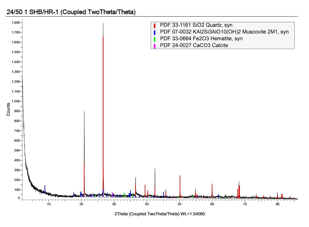
X-ray diffraction (XRD) analysis was conducted at the School of Earth and Environment at the University of Leeds using the following methodology. The XRD scan was conducted on fine powder derived from a single spherule using a Bruker D8 with the scan range of 2-86deg two theta, step size of 0.02deg and speed of 1s/step. Bruker Eva Search/Match and the ICDD PDF database were used to match the observed peaks and thus identify the phases present.
Figure 3: Details of the XRD scan and the ‘fits’ that the automated software generated (quartz, muscovite, and calcite as well as hematite). The fact that the quartz and muscovite peaks are larger than the hematite ones does not mean they are more abundant, just that they are more crystalline and so give stronger peaks (Professor Simon Bottrell, personal communication).
The XRD analysis indicates that the principal Fe mineral is hematite. Quartz is probably detrital, possibly providing the nucleus grain for the spherule, whereas the calcite, which is consistent with the carbonate content revealed by the above analysis (Table 1), could either be detrital or an authigenic precipitate. The muscovite is probably detrital mica that was incorporated as the spherule grew. Assignment of the mica as muscovite is a generalization and the material present could lie within the range of compositional range illite-muscovite (Professor Simon Bottrell, personal communication).
From the analytical results presented above, it is clear that the spherules exhibit elevated mineral/trace-element levels, especially Fe and Mn, as might be expected when compared to the background sediment samples, and due to the enriched mineral precipitation that occurs around a particulate core.
Comments
Much of the cave passage found in Hallowe’en Rift has been formed along mineral veins and throughout the cave there is evidence of hydrothermal activity. Scallops in the deeper sections of cave are indicative of upwelling fluids.
There are thick deposits of calcite throughout the cave, and the flowstones and other speleothems probably derive from supersaturated fluids. Supersaturation might be a consequence of the of cave passages at shallow depth being subject to more ‘aggressive’ surface waters that leached carbonate minerals from the host rock.
Further samples taken from a section of cave beyond Trick or Treat also contained abundant ferro-manganese spherules confirming the wider distribution of spherules throughout the cave. They are especially common in ‘grey’ bands within rhythmite sediments. Scope remains to study sediments in the wider catchment area, to investigate whether the distribution of Fe/Mn spherules is more widespread.
In future it is hoped that suitable speleothem sample(s) might provide U-series dating results and so contribute to establishment of a time-frame for sediment deposition.
It is acknowledged that the research to date is limited with regard to the number and scope of analyses conducted; therefore, a detailed interpretation is not presented at this stage. Hopes are that this can be addressed in the future by more sampling and analyses, leading to an increase in the quantity and value of the information available.
Acknowledgements
Special thanks to Professor Simon Bottrell and Lesley Neve, at the School of Earth and Environment, University of Leeds for providing the XRD analysis and in doing so adding valuable information about the composition of the Fe/Mn spherules.
My thanks also the BCRA referees for their constructive and helpful comments, which helped to improve the clarity of this Report.
Without the commitment, determination, and camaraderie of a dedicated group of diggers, including (in alphabetical order) Paul Brock, Nick Hawkes, Graham Johnson, Mike Moxon, Jonathon Riley, and Robin Taviner, the discoveries made in Hallowe’en Rift would not have happened.
Reference sources consulted
Bull, P.A. 1980. Towards a reconstruction of timescales and palaeoenvironments from cave sediment studies. In Cullingford, R.A., Davidson, D.A. and Lewin, J. (1980) Timescales in Geomorphology. John Wiley & Sons Ltd.
Huang, L. 2022. Pedogenic ferromanganese nodules and their impacts on nutrient and heavy metal sequestration. Elsevier, Earth-Science Reviews 232 (2022) 104147 https://doi.org/10.1016/j.earscirev.2022.104147
Kalinina, N. A., Rudmin, M. A., Sherstyukov, M., Maximov, P., and Kerimov, A-G. 2024. Origin of iron-rich minerals ooids and pisoids in the Jurassic ooidal ironstones of the Labino-Malkin region (Caucasus). Journal of Palaeogeography, 2024, 13(3) : 475-494
Kearey, P. 2001. The New Penguin Dictionary of Geology, 2nd Edition. Penguin Books
Kotula Piotr, Andreychouk Viacheslav, Pawlyta Jacek, Marynowski Leszek, Jendrzejewska Izabela. (2019). Genesis of iron and manganese sediments in Zoloushka Cave (Ukraine/Moldova) as revealed by δ13C organic carbon. “International Journal of Speleology” (2019, iss. 3, s. 221-235). https://digitalcommons.usf.edu/ijs/vol48/iss3/1/
Simmonds, V. Evidence for Pleistocene frost and ice damage of speleothems in Hallowe’en Rift, Mendip Hills, Somerset, UK. Cave and Karst Science, Vol.46, No.2, (2019) 74-78. Transactions of the British Cave Research Association
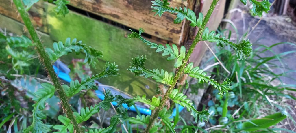
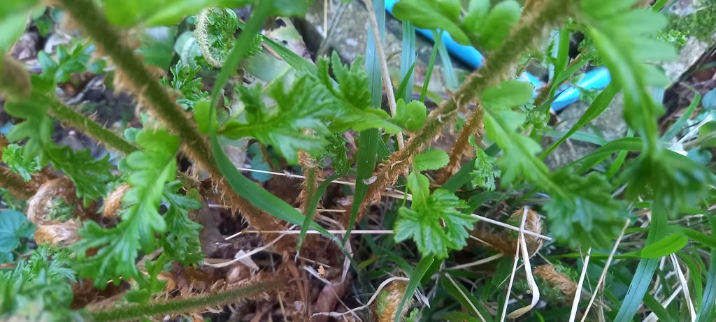
Common male-fern, Dryopteris filix-mas. Bipinnate; growth form: shuttlecock; scales are pale brown; sori not yet visible. There is an interesting mutation on the ends of the pinna, a similar phenomenon, known as fasciation, has also been noted to occur on Hart’s tongue fern. Habitat is my back garden in a partially shaded, sheltered spot next to the shed. Location: NE Somerset.
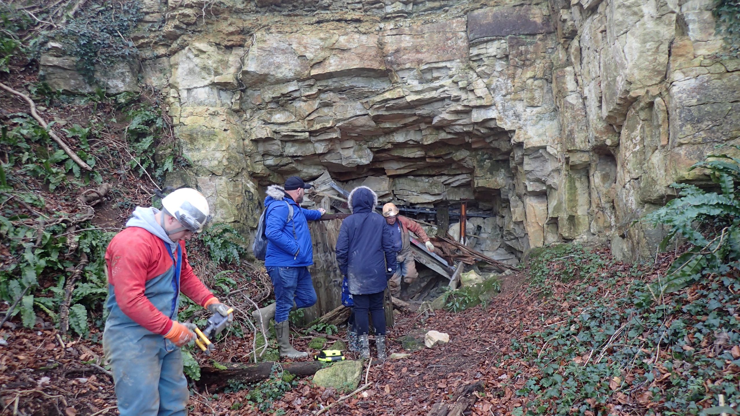
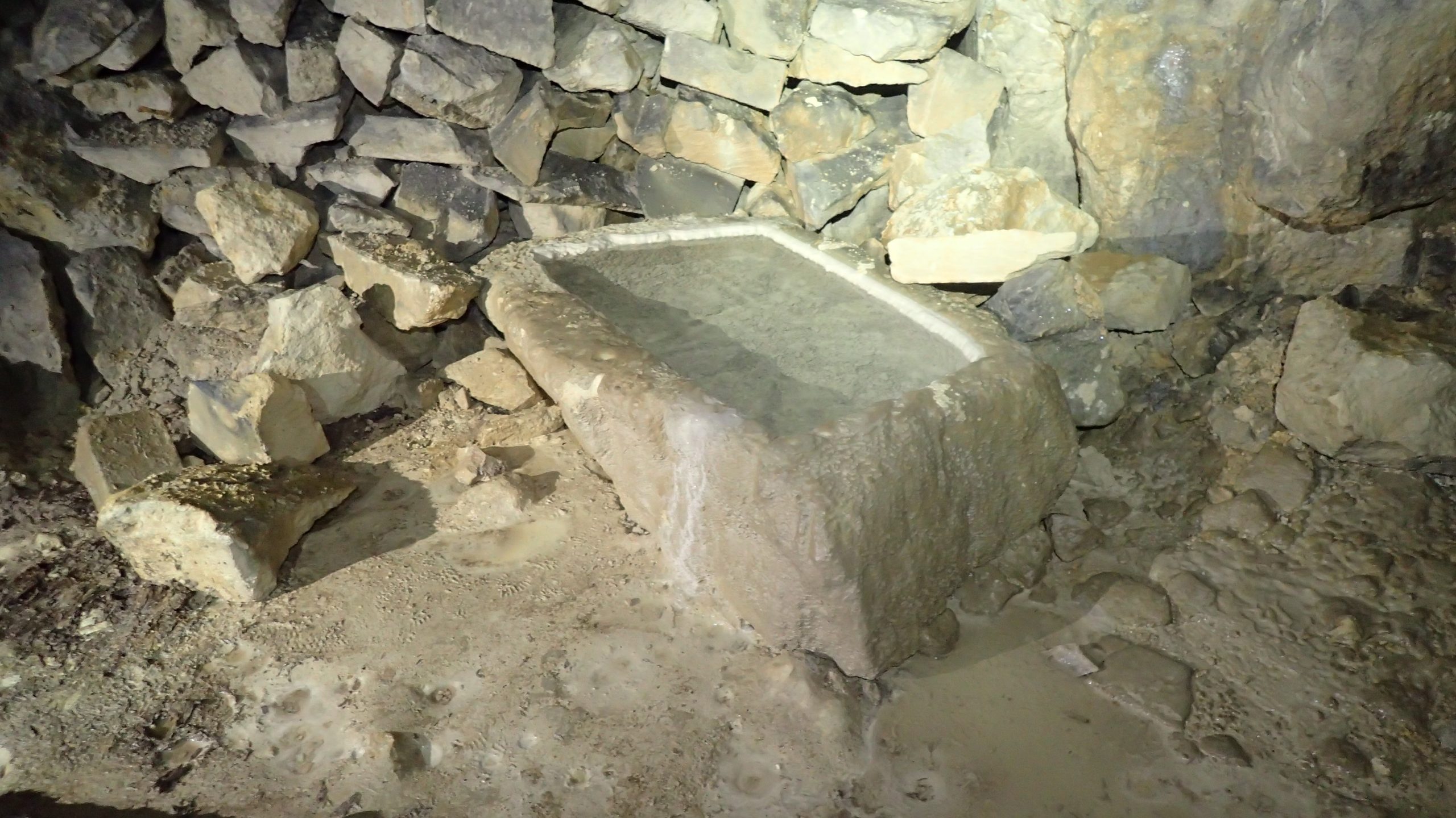
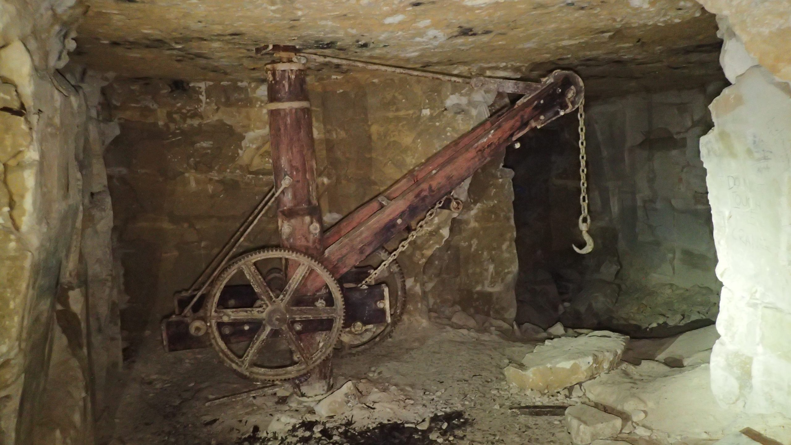
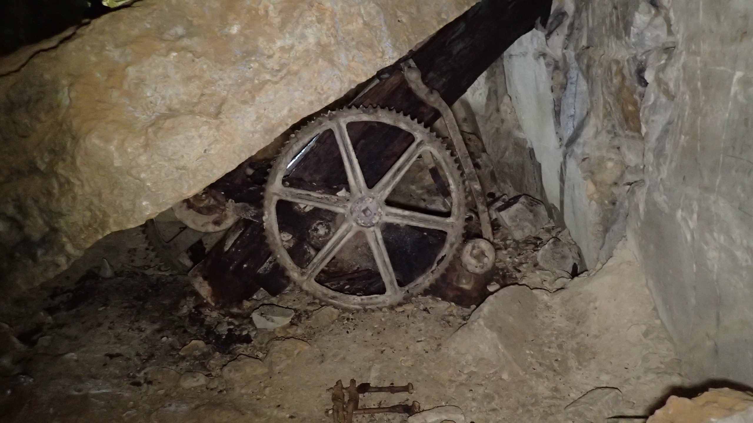
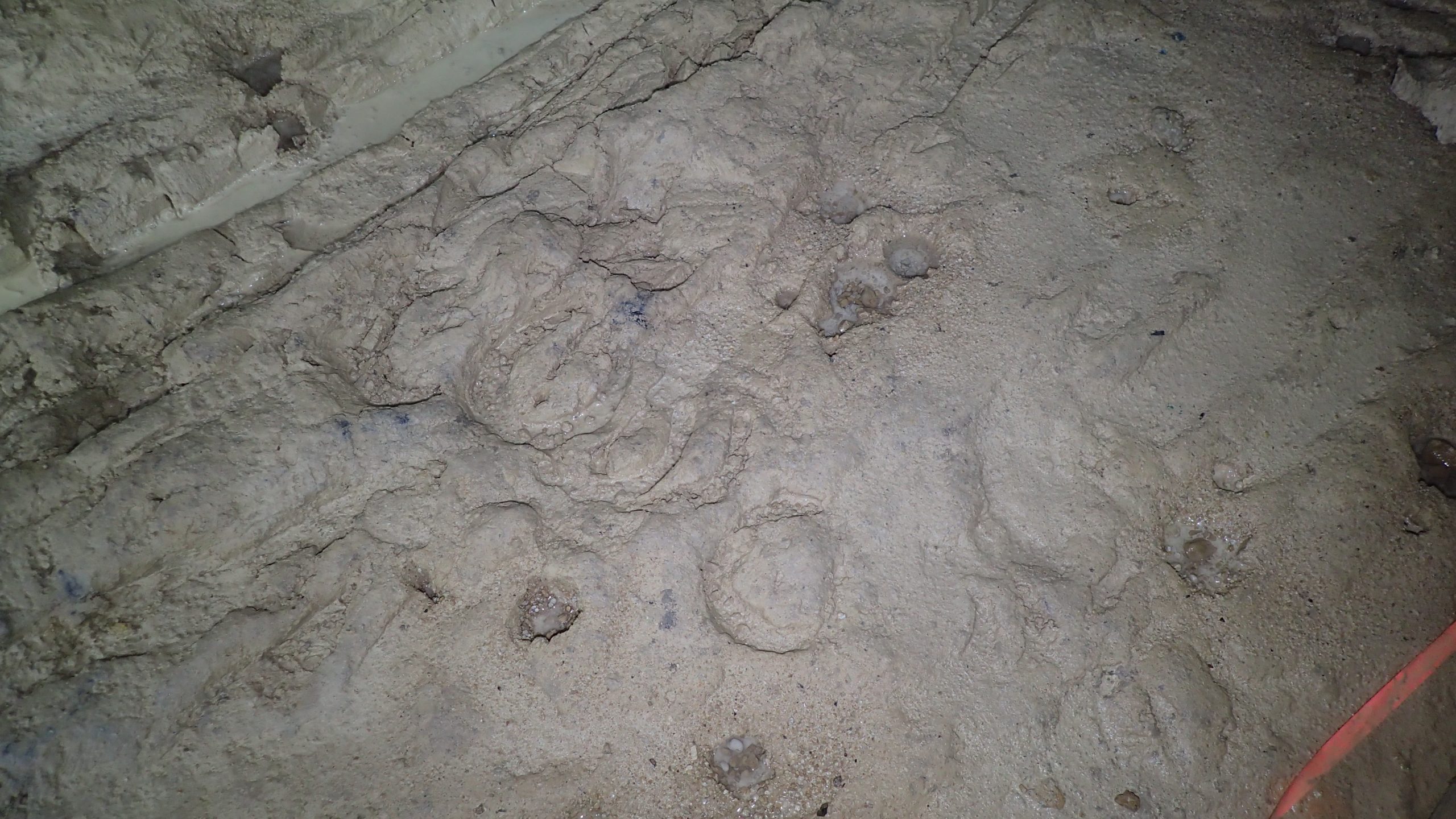
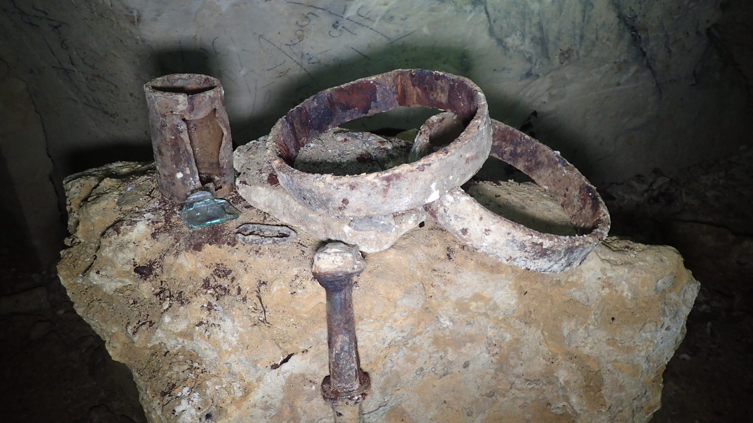
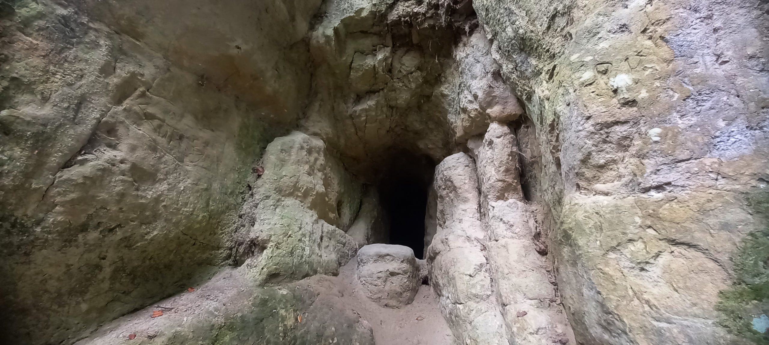
Entrance located opposite the Swan Inn public house. There were originally three entrances. A small but interesting stone mine (Freestone) where extraction is believed to have started in the late 18th century and ended in 1932. It is thought to be the last operational stone mine in the UK to remove stone using horse and carts – wheel ruts are a predominant feature throughout the mine passages, a few hoof-prints still remain. A major attraction of the mine is the numerous artefacts that are still in-situ including a well-preserved crane, a second crane has been crushed under a rockfall, a fine carved stone trough, and a variety of other industrial paraphernalia.
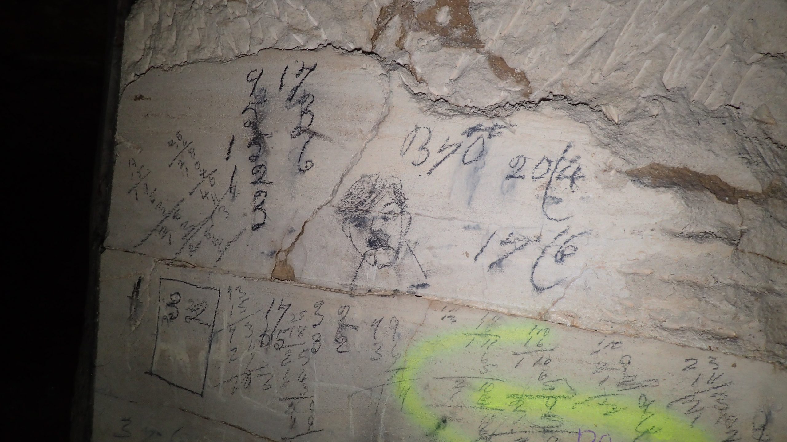
There are abundant historic markings throughout the mine related to quarrying activities sadly many markings have been defaced by unnecessary graffiti and, in places, calcite deposition.
A mixed panel of markings including quarrying related, a possible depiction of ‘Hitler’ and a poorly placed spray paint direction arrow!
Mostly easy walking although there are places where scrambling over rocks and negotiating lower sections is required. An interesting couple of hours spent wandering around and taking photographs. Some decent fossils were also noted, in particular, corals perhaps evidence for Jurassic reefs.
Coral groupA stop to admire some hoof-printsA dead end!
Lichens are a stable, mutualistic association between a fungus (= mycobiont), the dominant species in the association, and a green alga or cyanobacteria (= photobiont). The mycobiont provides the photobiont with a safe place to live and grow, and in return, receives sugars from the photobiont which are the products of photosynthesis. When the mycobiont and photobiont join, they both change physically and chemically to become a lichen. The fungus is said to be “lichenized”.
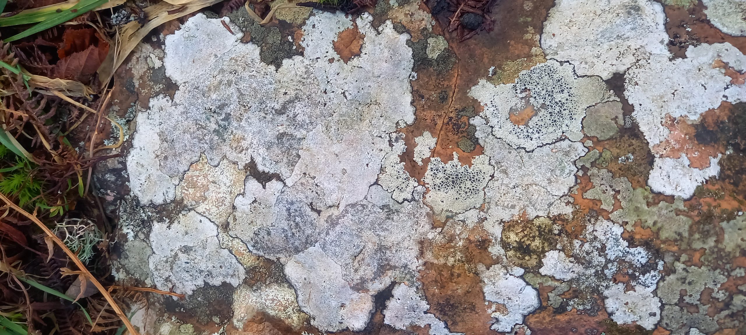
Crustose lichen. Image taken 01/01/2024
Lichens are known in five forms:
Crustose – ‘crusty’, firmly attached to substrate
Foliose – ‘leafy’, with rhizines, loosely attached
In the past, forestry operations in Harptree Woods, Mendip channelled surface water into naturally occurring sinkholes. The drainage for these sinks is localised and there are several springs along the flank of Garrow Bottom, including Garrowpipe Spring, where the water re-emerges to flow into Molly Brook.
I had a tentative poke into this sink several years ago but gave up due to the instability of the small chamber gained. It has since slumped and filled in with debris.
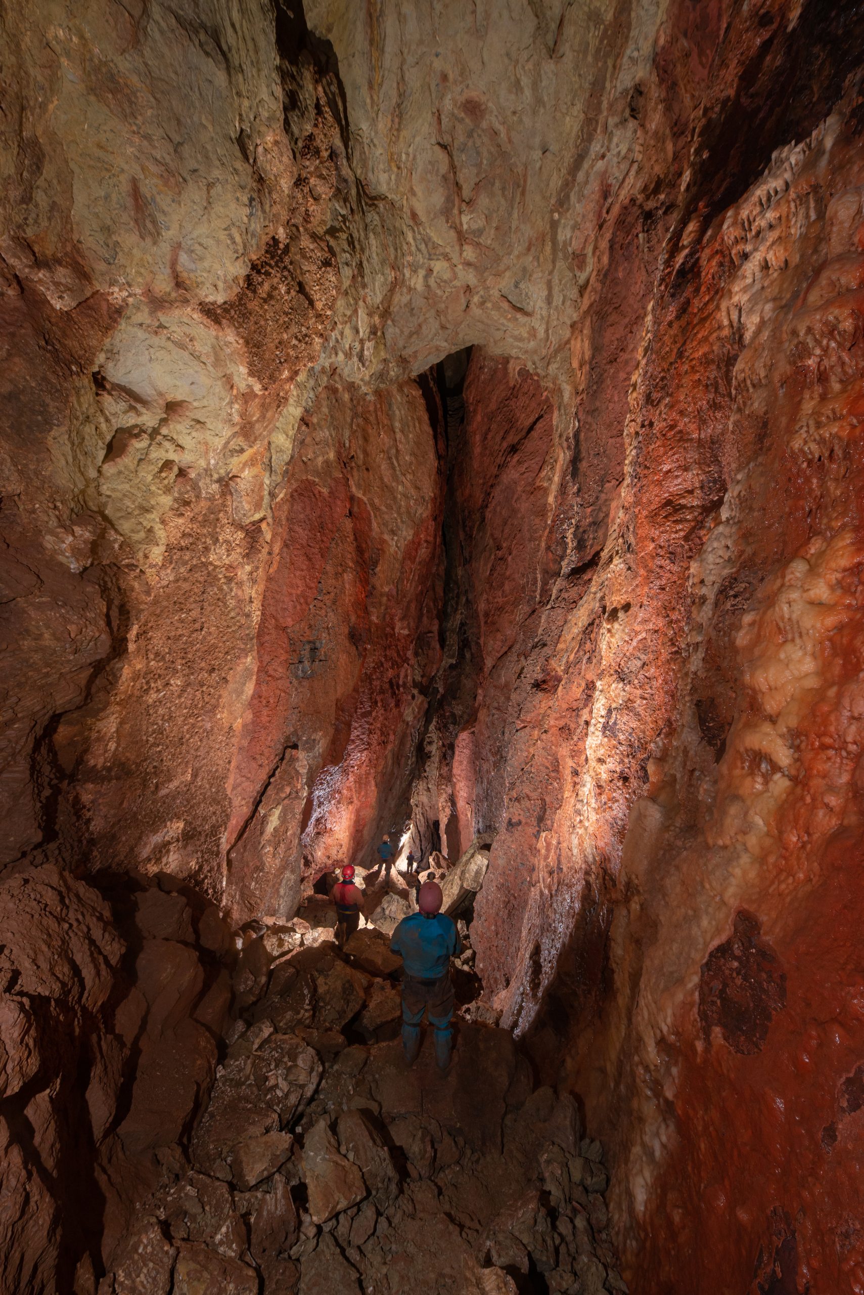
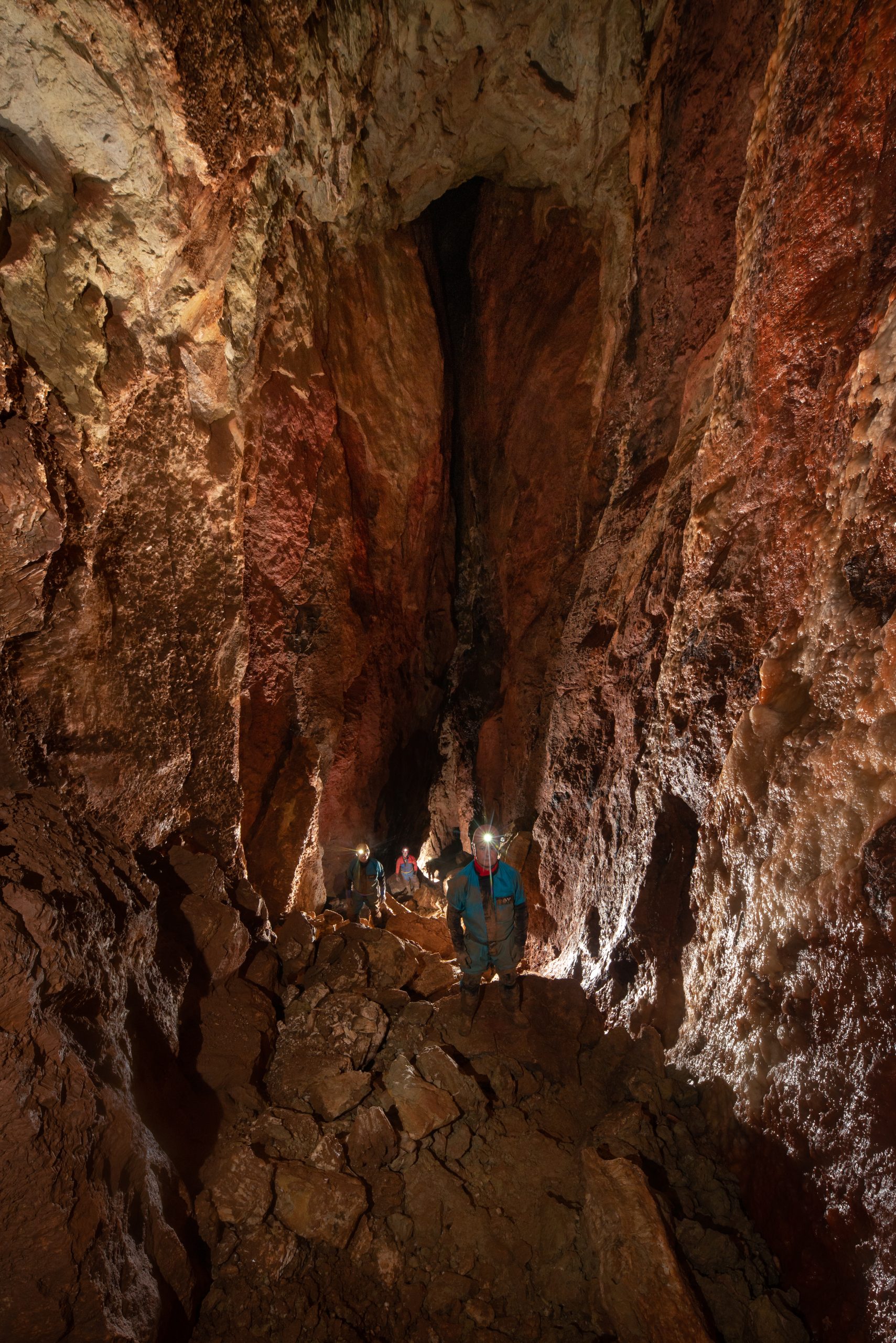
The expansion of the Wookey Hole showcave by a driven tunnel into Wookey 20 was completed in 2015. The tunnel allowed easy access to the cave passages beyond by ‘dry’ cavers, more specifically to ‘diggers’ eager to check out the potential leads. In late 2015, the regular diggers at Hallowe’en Rift were invited to take a look at a lead on the east side of the far reaches of Wookey 20. This route had been explored by divers, Tom Chapman and Keith Savory, in the 1990s to a low and too tight arch. There followed a period of expansion and induced rapid speleogenesis culminating in about 70m of gnarly passage gained and leading to another sump, named ‘23¾’, linking to the Sting Corner area in Wookey 24. Diving continues in this area.
In early August 2020, another project was set in motion by the regular team of Wookey Hole diggers in a small side passage off the route that leads down to sump 23¾. Following a collaboration between divers and diggers to establish a voice connection and pinpoint the best location, an intense digging effort of almost non-stop activity, finally, on the evening of October 29th 2020, a ‘non-diving dry’ route from Wookey 20 to Wookey 24 was completed by Vince Simmonds, Nick Hawkes, Graham Johnson, Mike Moxon, and Duncan Price. The route, following the small side passage off the route to sump 23¾, connects to the recently discovered extension, Beginner’s Luck, above the streamway found by divers, Connor Roe, Max Fisher, and Duncan Price leads down a steep descent into the Wookey 24 stream passage. The route is physically demanding, especially on the return, and has some difficult, awkward climbs.
A few days later, the English government plunged everyone into a second lockdown and our activities were, somewhat curtailed. This also meant that several of the regular diggers, absent on the breakthrough, had not yet passed the connection to Wookey 24. We are still in lockdown!
Subsequently, a disappointing and blatant “poacher’s” trip to the connection has occurred. Video clips of the trip were posted, then removed, there was some negative feedback posted on various platforms along with a lot of bullshit and bollocks being uttered. It is categorically stated here that none of the participants involved on this “poacher’s” trip were, or have ever, been involved with any of the digging activities to make the connection to Wookey 24 or any of the other recent discoveries in Wookey 20 (Land of Hope and Glory) and any inferences of such is just not true!
There was a rapid response to this post, a dialogue ensued and an apology received. It still rankles, but the clock can’t be turned back and we need to move on rather than enter an endless cycle of recriminations and finger-wagging. A line was drawn under it.
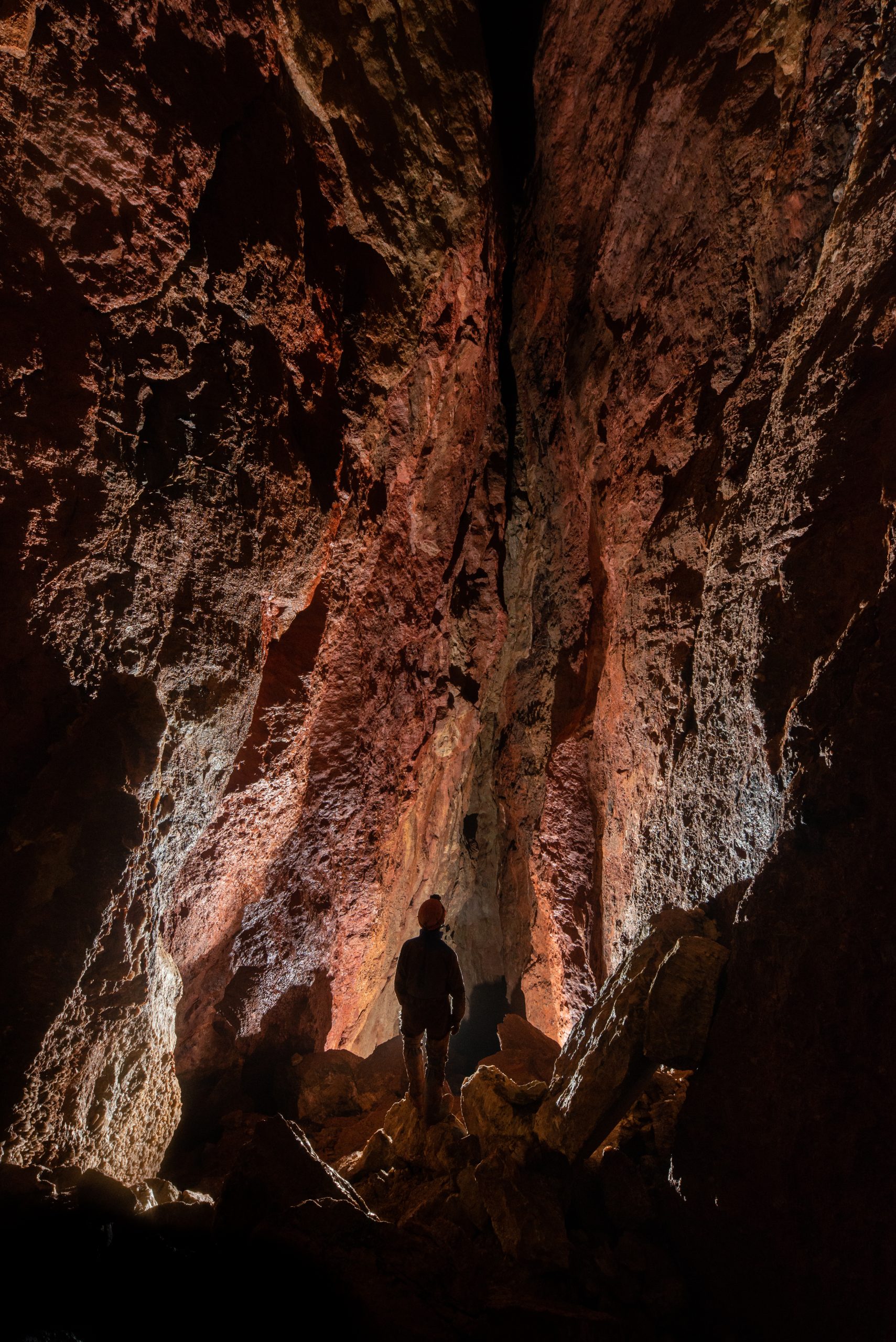
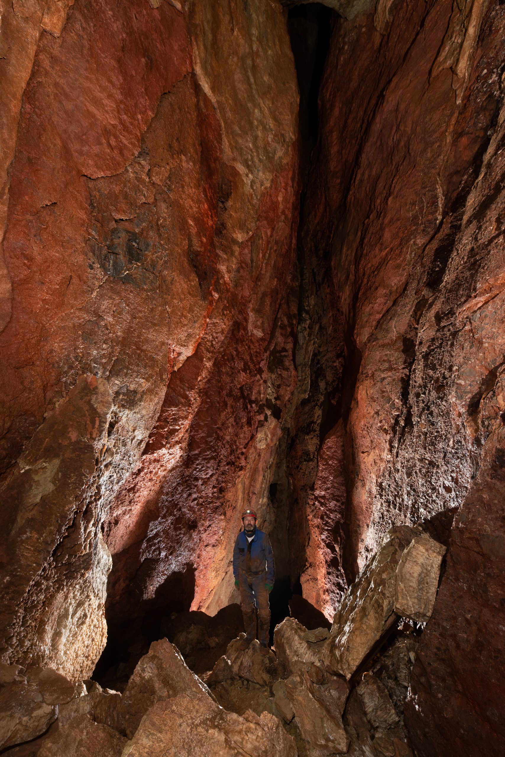
First entered on 15th September 2020, on the 80th anniversary of the “Battle of Britain”, by Vince Simmonds, Rob Taviner, Nick Hawkes, Graham Johnson, Jon Riley, et. al.
A selection of photographs taken by Mark Burkey, 27th September 2020
Some brief notes on the similarities of the rock-types of Pool Farm cist-slab, Hautville’s Quoit, Somerset, and Sarsen Stones at Fyfield Down, Wiltshire.
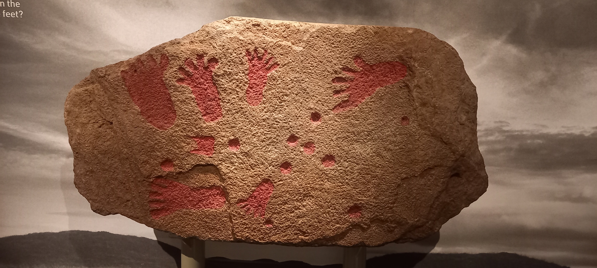
On a recent visit to Bristol Museum to view an exhibition – The Cave Art of Lascaux: A Virtual Reality Experience, I took some time to examine the Pool Farm cist-slab on display in the “Curiosities” section.
In 1930 a round barrow was excavated at Pool Farm, West Harptree, Somerset (NGR ST 5375, 5417). At the centre of the barrow a stone cist was discovered. The cist was constructed from several slabs comprising Dolomitic Conglomerate, Carboniferous Limestone, Liassic Chert, and sandstone. In 1931, the barrow was removed, and the material used for road-widening, the cist was left in-situ (Grinsell, 1958). The ‘carvings’ on the Pool Farm cist slab were recognised in May 1956 when the slab was removed to the City of Bristol Museum where it still remains. A replica of the slab is on display at Wells and Mendip Museum.
Pool Farm cist-slab on display at Bristol Museum
In Grinsell (1958) the cist slab rock type is described as “…a fine-grained pinkish sandstone containing numerous lamellibranchs”. Lamellibranchia (and Pelecypoda) are alternative names for Class Bivalvia, Phylum Mollusca. The bivalves are distinguished from other molluscs by their laterally compressed body enclosed between two bilaterally symmetrical, calcareous valves which are joined on the dorsal side by an elastic horny ligament. The bivalves are entirely aquatic, found in both marine and freshwater environments, the majority in shallow water. The fossil record of the Mollusca dates from the earliest Cambrian to Recent. Modern examples of bivalves include clams, cockles, mussels, and oysters (Black, 1988). A later description by Roger Clark, [then] Curator of Geology, at Bristol City Museum presented in Coles, et al (2000) reports “that thestone is almost certainly from the Harptree Beds, which consist of siliceous limestones and calcareous shelly limestones: these outcropon the northern slope of the Mendip Plateau between East Harptree and Oakhill. The slab has abundant traces of decalcified bivalve molluscs, mostly corbulids and/or nuculids. The stone is local, perhaps coming from within a kilometre or so of the barrow”.Nucula is a Mesozoic bivalve living an a richly organic substrate from offshore to abyssal depths. Date ranging from Cretaceous to Recent (Black, 1988).
Personally, I do not agree with Clark’s assignment of the rock-type as originating from the local Harptree Beds. The rock-type of the cist-slab bears some remarkable similarities to that of Hautville’s Quoit at Stanton Drew, where a detailed archaeological investigation of the scheduled ancient monument (Monument No.BA44) was undertaken by the author and members of the Bath and Camerton Archaeological Society (BACAS) and a report was later published in 2012 in collaboration with Bath & North East Somerset Council.
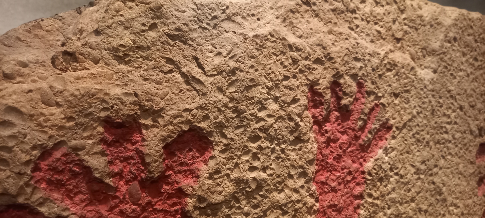
A closer look at Pool Farm cist-slab
Hautville’s Quoit is located at Quoit Farm, near Stanton Drew (NGR ST 60173, 63811). According to the BGS 1:50 000 Map (Sheet 264) the underlying geology comprises Mercia Mudstone strata of Triassic age, this in turn overlies, unconformably, strata of Supra – Pennant Measures which form part of the Upper Coal Measures of Carboniferous age, below at an unspecified depth.
Hautville’s Quoit showing surface features
To the east and south of the site is alluvium of Pleistocene and Recent age; also, to the east of the site and below at unspecified depth is the Pensford No.2 Coal Seam. The soils found at Quoit Farm are likely to be derived from the erosion and subsequent transport of material from the Lias strata of Jurassic age that forms the high ground to the north of the site. In particular, from a layer consisting of mainly clay and shale, there is a substantial area of landslip on the slopes of Maes Knoll (East Dundry) and around the village of Norton Malreward. The strata that comprise the landslip are described as mainly clay with White and Blue Lias, mainly limestone, also of Jurassic age. The clay content of these soils is likely to retain a higher moisture content than the sandy soils of the stone circle site on the south side of the River Chew.
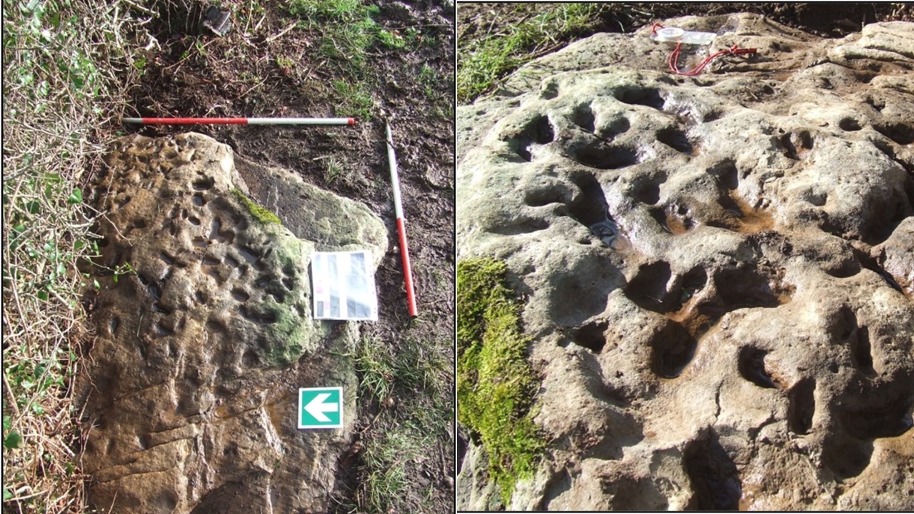
Hautville’s Quoit consists of a pale brown to grey sandstone. The sandstone can be described as comprising subrounded to rounded (high sphericity), fine to medium (250 – 375 microns), well to medium sorted, shiny, polished, mostly translucent grains of quartz, that appear matrix supported in a siliceous cement. There are noted numerous small clam-like (bivalve) fossil shells measuring up to 10mm x 6mm in an area of exposed bedding surfaces, these fossils are possibly a marker bed and might be useful in determining the origin of the rock type; these fossils have not yet been identified. A white scaly appearance on some parts of the stone was likely due to lichen growth or as a result of weathering. The pock-marked surface might be the consequence of a number of factors, including the effect of roots or solution. There are a number of lines of cleavage and other surface features visible on the stone. With regard to the Pool Farm cist-slab, Coles et al (2000) observe that “The whole surface of the slab appears to have been ground down to make some sort of uniform canvas for carving…”
Other surface features visible on Hautville’s Quoit
Discussionand follow-up fieldwork:
On a purely personal note, the rock type that comprises Hautville’s Quoit is not one that is recognised either locally, or in the broader surrounding area. There are a number of features of the stone that require further consideration. Some subsequent fieldwork in the Mendip area has been carried out in the Ebbor Gorge area to look at exposures of the Quartzitic Sandstone Group (QSG) associated with the Ebbor Thrust. However, it is thought unlikely that this particular exposure provided the source for Hautville’s Quoit.
Lloyd-Morgan (1887) described the rock type that comprises the quoit as fine-grained sandstone. Lloyd-Morgan hesitates to offer any opinion as to the source of sandstones found at Stanton Drew, either that of the quoit or the stones found in the stone circle close by and states, “of the source, geological and local I am doubtful”, he does, however go on to ask the question “Is it possible that one or more of the sandstone monoliths may be sarsen – but whence?”
Roger Mercer, Inspector of Ancient Monuments for the Ministry of Public Buildings and Works, carried out an excavation at the site in 1969 and also attributes the stone as of ‘Wiltshire sarsen stone’ origin.
Hardy (1999, p. 176, 181) in his book ‘The Geology of Somerset’ describes a ‘tough silica-cemented sandstone found as loose masses in the surface of softer rocks’. A number of these ‘sarsen’ stones were uncovered during the construction of the M5 motorway in the Blackdown Hills area close to Taunton but many of these appear to have been ‘lost’.
The references of Lloyd-Morgan and Mercer prompted a field trip to Fyfield Down in Wiltshire, an area that is renowned for the sarsen stones, also called ‘grey wethers’, that are found there, and many have been used in monument sites such as Avebury and Stonehenge. There are a number of similar features in the stones at Fyfield Down and Hautville’s Quoit.
Surface features on ‘sarsen’ stones observed at Fyfield Down.
Grey ‘wethers’ can generally be described as sandstone that comprises of grey, fine to medium (250 – 375 microns), sub-rounded to rounded (high sphericity), well sorted, shiny, polished, mostly translucent grains of quartz, the clasts are contained in a matrix comprising siliceous cement. Occasional stones were also noted to have variable colour from a pale grey-brown to more orange, possibly a result of iron content. Some of the stones contained rare flint nodules and very occasional fine to medium, sub-rounded to rounded gravel of quartz. The shape of the ‘grey wethers’ was also variable from rounded and spherical to more sub-angular blocks, with sizes ranging from <1m3 to several m3. It should be noted that no occurrences of fossils were noted in any of the stones observed at Fyfield Down.
Some further rock-types that might be considered:
The chert from the Upper Greensand that occurs in the Blackdown Hills near Taunton was formed as silica solution in the ground water filled the voids within the sandstone to convert it to quartzite or chert; this rock-type is of Cretaceous age. Fossils found in these sandy sediments are preserved in a similar process as silica replaced the calcium carbonate content of the shells (Hardy, 1999, pp. 176, 181). A field trip to this area to examine any outcrops or older buildings might provide further evidence.
Ganister is hard, fine-grained quartzose sandstone cemented with secondary silica and typically has a characteristic splintery fracture. Cornish miners originally coined this term for hard, chemically, and physically inert silica-cemented quartzose sandstones, commonly, but not always found as seatearths within English Carboniferous coal measures. Where a ganister underlies coal as a seatearth, it typically is penetrated by numerous root traces. These root traces typically consist of carbonaceous material. Ganisters that contain an abundance of fossil roots, which appear as fine carbonaceous, pencil-like streaks or markings, are called “pencil ganisters”. In other cases, the root traces consist of fine, branching nodules, called “rhizoliths”, which formed around the roots before they decayed (Wikipedia, online, accessed 30th April 2012). It is feasible that this rock-type was found within the Coal Measures in the Pensford area but no reference to it has, so far, been found in publications accessed.
X-ray fluorescence (XRF) is a non-destructive analytical technique used to determine the elemental composition of materials. Hand-held analyser units are widely available (although expensive) and might provide useful information regarding the relationships, or not, between these rock-types.
References:
Black, R.M. 1988. The Elements of Palaeontology, 2nd Edition. Cambridge University Press
British Geological Survey, Natural Environment Research Council, 1: 50 000 Series. Sheet 264, Bristol, Solid and Drift Edition. Ordnance Survey, Southampton.
Coles, J., Gestsdóttir, H., and Minnitt, S. 2000. A Bronze Age Decorated Cist from Pool Farm, West Harptree: New Analyses. Proceedings of the Somerset Archaeological and Natural History Society. Volume 144 (2000): pp 25-30
Grinsell, L.V. 1958. A Decorated Cist-slab from Mendip. Proceedings of the Prehistoric Society, Volume 23, January 1958, pp 231-232
Hardy, P. 1999. The Geology of Somerset. Ex Libris Press, Bradford on Avon.
Lloyd-Morgan, C. 1887. The Stones of Stanton Drew: their source and origin, Part II. Proceedings of the Somerset Archaeological and Natural History Society. Volume 33 (1887): pp. 37 – 50.
Mercer, R. 1969. Hautville’s Quoit Excavation Notes includes Clark, A.J. Geophysical Survey Report (Unpublished)
Richards, J., Oswin, J., and Simmonds, V. 2012. Hautville’s Quoit and other investigations at Stanton Drew. Bath and Camerton Archaeological Society in collaboration with Bath & North East Somerset Council.
At Folly Wood, Easterton Sands, south of Devizes, a small ‘cave’ is located on the southwest side of a small gorge/ravine with sunken lane at its base. The ‘cave is found mid-section of an exposure of Upper Greensand, described as sand and sandstone, fine-grained silt, glauconitic, shelly, formed during the Cretaceous Period, 113 and 93.9 million years ago and very close to the geological boundary with Gault Formation – Mudstone formed between 113 and 100.5 million years ago during the Cretaceous period. (BGS, online). The entrance, ca 1-metre-high x 0.5-metre-wide, leads to a small chamber with abundant pick-marks evident on both sides and roof, the passage soon lowers and closes down, overall length <6 metres. There were etchings/inscriptions in the chamber and to the left side of the entrance, these were of modern date. The soft nature of the substrate makes it likely that potential inscriptions of older date have been eroded away.
Inscriptions can be seen on right side of entrance (and in the cave interior)
The anthropogenically altered ‘cave’ might have an alternative identity as described below:
“…Quabb’s Hole. This was a hole dug out of the sand, on the hill above Maggot Castle, separated from the Folly by a deep ravine, where the land slopes from Easterton to Crook’s farm. Quabb was a loner, a poacher and petty thief, whose exploits have been much embroidered. He stole sheep and hens and poached when and where he could, living alone in his cave where he died. When discovered, the cave was full of sheepskins and feathers. It was then filled in and forgotten. The story is never heard now but the events must have taken place about the beginning of the 19th century.”(Market Lavington Museum, online)
It is interesting to note that “quabb” is possibly derived from the Old English word cwabba “marsh”. A reflection on the ‘soft ground’ in the surrounding area perhaps.
Sources consulted:
British Geological Survey (BGS), https://geologyviewer.bgs.ac.uk Accessed 18/09/2023
May 28th to July 2nd 2023: Spent 36 days walking the 630 miles South West Coast Path National Trail from Minehead, Somerset to South Haven Point, Dorset. The coast path includes the Devon (north and south) and Cornwall coastlines. The walk was solo and self-supported using a variety of accommodation options, basically, whatever suited on the day!