BCRA 2017 Field Meeting: Caves and Karst of the Gower Peninsula, Wales.
19-21 May 2017. A personal account.
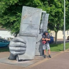
 The Salt House, Port Eynon.
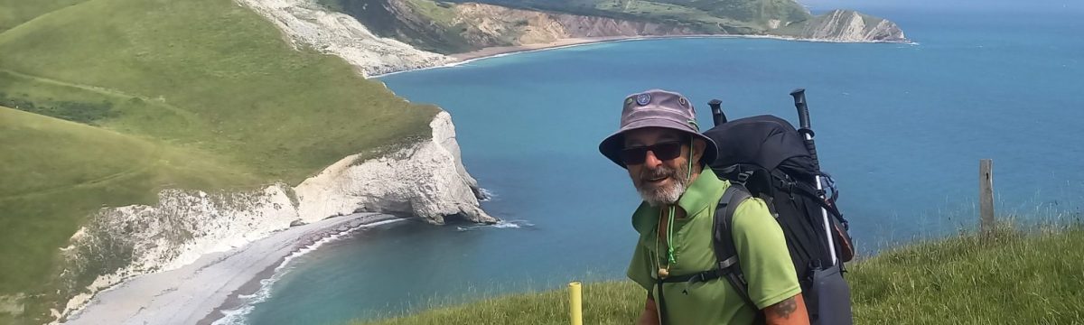
Friday afternoon. Walk: Pilton Green (NGR SS 4465 8710) via Long Hole Cliff, along the coast path back to the campsite at Port Eynon. The aim of this excursion was to look at various unrecorded resurgences, and a number of archaeologically sensitive sites.
John Cooper talked about the caves, karst and the glacial moraine that seals much of the limestone in this locality. Paviland Cave was not visited due to adverse tides, but the water levels didn’t look much different to when I visited the cave a few years ago.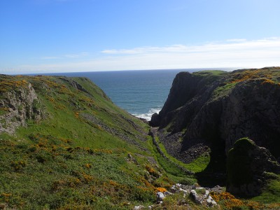
It was a pleasant stroll along the coast path, stopping every now and then to admire the view and discuss the geological out-crops.

Oxwich Head Limestone Formation, described as thickly bedded, fine to coarse-grained, recrystallized, bioturbated, skeletal packstones with distinctive pale to dark grey mottling and pseudo-brecciation and ooidal limestones. Units of dark grey, irregularly bedded skeletal packstones with shaly partings are developed at intercals. Thin unitof calcareous sandstone and sandy skeletal packstone [Pant Mawr Sandstone Member and Honeycombed Sandstone Member] at the base in Vale of Glamorgan and north-west crop of South Wales Coalfield respectively. Unit of ooidal limestone in lower part [Pendyrn Oolite Member] on north-west crop of South Wales Coalfield. Palaeo-karstic surfaces, overlain by red and grey clay palaeosols, punctuate the formation; thin coals developed in Gower (BGS iGeology online).
High Tor Limestone Formation, mid-grey, predominately thick bedded, fine to coarse-grained, burrowed, skeletal packstones with thin beds and partings of shaly dolomite mudstone and siltstone. Some thin-bedded, dark grey bituminous packstones interbedded with thin argillaceous wackestones and mudstones. Coarse, locally cross-bedded, peloidal/skeletal/oolitic packstones/grainstones developed in lower and upper parts in north sections. On south-east crop of the South Wales Coalfield the formation is predominately dolomitized (BGS iGeology online).
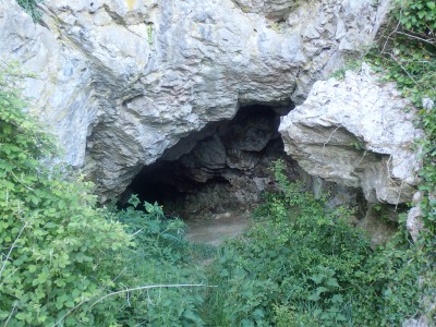
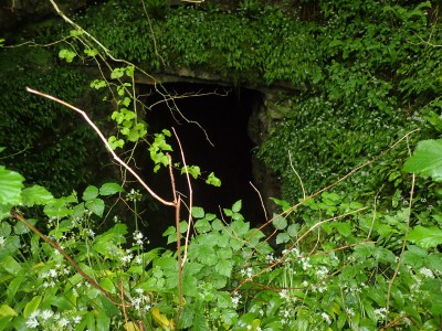
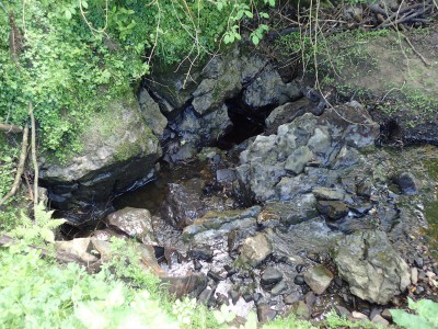
A detour from the path was made to visit Long Hole, a c.20m long, phreatic tunnel. The cave once had a thick sloping flowstone floor, but this had been excavated c.1850 by antiquarians, in the search for animal bones. Evidence for the flowstone floor visible, in places, on the cave walls. The animal remains recovered were from the last interglacial and the last glacial periods.
From here some of us continued along the coast path to Port Eynon, the rest returning to Pilton Green. On the way, those of us on the coastal path, stopped to admire Culver Hole, it has been blocked with stonework construction to create a dovecote, or so one of the stories go.
Saturday. Today’s itinerary involved two excursions, the first was to the Bishopston Valley, beginning at Barland Quarry. Meeting at the car park (NGR SS 5785 8968).
The geological sequence: Bishopston Mudstone Formation overlies Hunt’s Bay Oolite Sub-group, which in turn overlies High Tor Limestone.
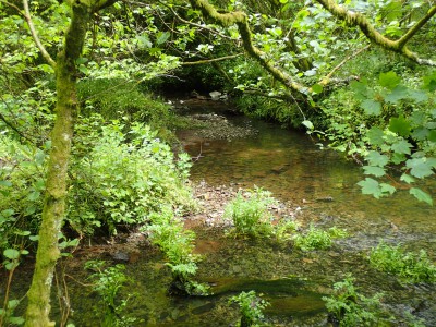
Barland Quarry Cave, was exposed during quarrying operations. A narrow rift section, c.40m long and c.10m high, ends at a small stream and choked sump. There are several remnants of caves (Kittle Hill Caves) that are likely to be connected to the quarry cave. From here, we followed the Creten Stream to where it disappears into Bishopston Sinks No’s 1 & 2, there are a succession of, currently, dry sinks further down the valley.

Along the way we stopped to look at the fine Daw Pit, it is an impressive sight.

Relic caves in the valley possibly indicate that the valley floor was c.10m higher. Ogof Ci Coch was excavated by Rob Dinnis in 2012, no archaeology was encountered. A short detour was made to Gulver Pit, another fine sight, described as a “large rent in the hillside”.
Guzzle Hole is accessible for c.50m to the first sump. Beyond the sump, some 400m of passage have been surveyed by divers. Near the bottom of the valley the water can be seen to emerge from several springs.
The second excursion of the day was to Coed y Parc (NGR SS 5393 8975) to visit Green Cwm and LLethryd Cwm. These cwm’s together form a c.1.5km dry valley in the centre of an extensive area of faulting.
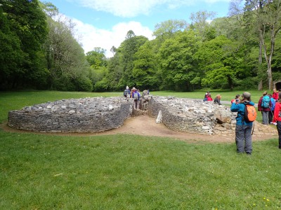
In Green Cwm evidence for Upper Palaeolithic, Mesolithic, Neolithic, Bronze Age and Roman presence has been found in the caves and cliffs. There is a Neolithic chambered tomb of Cotswold/Severn type, known as the Giants Grave.
It is interesting that the re-constructive work at Parc le Breos has similarities to that seen at Stoney Littleton, Wellow in Somerset, another Cotswold/Severn type.
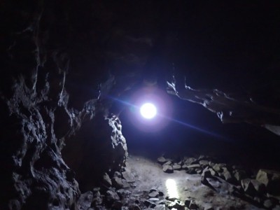
Although Cat Hole Cave has a gated entrance the group were permitted access. In the cave, the roof consists of a number of high fissures, narrowing at the top. The base of these fissures has been eroded away to form the main chamber of the cave.
 Lower Cat Hole Cave.
Further up the valley, is found Llethryd Swallet, where I managed to gain access through the, now exposed, flood sink and re-emerge from the gated entrance.
On the way back down the valley a brief stop at Tooth Cave, the longest recorded cave on the Gower Peninsula with over 1500m of surveyed passages. It is also an archaeologically sensitive site, hence the now gated entrance.
Sunday. Started the day on Cefn Bryn, where I parked the van, and walked over to visit Maen Ceti (Arthur’s Stone), an impressive burial chamber.

The large boulder that forms the capstone, is an erratic carried to the hill top by an ice-sheet, it originates from Mynydd Carrig, located 40 miles to the north.
From the top of Cefn Bryn the topography of all of the area surrounding the next venue, Stout Hall can be seen. The underlying Old Red Sandstone rises on three sides to form a basin of limestone which was once filled with ice. At the southern the dip is south-east leading towards the Oxwoch Bay syncline, here the lower limestones are overlain with Marros Group Formations. Much of the area is covered by glacial diamicton, with the Paviland Moraine forming the south-west horizon.
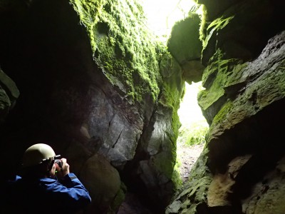
Stout Hall Cave, has an impressive entrance, tall, c.1m wide, entering a lofty chamber. Daylight enters from other higher entrances.
The cave has been modified, there are several shot-holes to be seen. It has also been used regularly, in more recent times, as a dump. Bottles, broken pottery, rusty iron and ash forms a talus in one section.

There is evidence of recent flooding, wooden pallets wedged in narrow fissures, and leaves adhere to the main chamber walls to a height c.2m above floor level.
 Members of the group look at the results of a photogrammetry session in the cave.
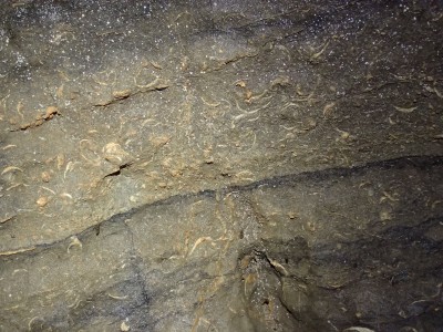
The photography impeded the chance to explore fully but several geologically interesting features were noted, like this death assemblage.
It would be interesting to investigate the sedimentology in the main chamber, and some of the side passages, although the fill is fine, and rather sticky.
In the surrounding woodland there is plenty of scope for further cave development, albeit most likely to be choked.
Later in the morning, went over to investigate the site of a palaeo-lake in an adjoining field. Several potential ‘sink’ features were noted, and I’m not going to get into the argument about whether they are sinks or something else. In the field, medieval field boundaries were clearly visible, these are seen on a LiDAR image of the site distributed with the field notes for the weekend.
Walking back to the car park, I pointed out another feature, a drainage ditch parallel to a stone-built boundary wall has been channelled into a ‘sink’. There were several mature trees growing over the stone wall, and it is possible that some working of the rock outcrop surrounding the ‘sink’ had occurred in the past. Close-by was a depression with some evidence of recent slumping.
That was the end of the action for the weekend. A thoroughly enjoyable field meeting, and a return to the area is planned.